
Fresh front blowing in Monday; 100-degree heat possible next week
It could hit 100 degrees again nearby next week
Go Deeper.
Create an account or log in to save stories.
Like this?
Thanks for liking this story! We have added it to a list of your favorite stories.


A weak summer cool front is blowing fresher air into Minnesota Monday. The air mass behind the front is slightly cooler and less humid.
Check out temperatures across our region Monday afternoon. You can see the persistent heat dome to the south. Temperatures are in the cooler 60s across northern Minnesota.

Winds are gusting to more than 30 mph Monday afternoon across Minnesota. That’s pumping in the noticeably cooler and less humid air mass.
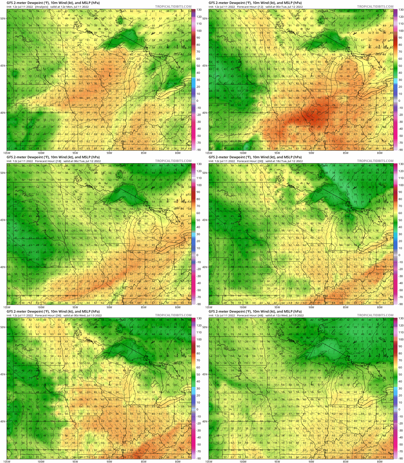
The National Oceanic and Atmospheric Administration’s Global Forecast System model captures the trend of lower dew points pushing into Minnesota into Wednesday.
Turn Up Your Support
MPR News helps you turn down the noise and build shared understanding. Turn up your support for this public resource and keep trusted journalism accessible to all.
Watch how dew points in the 60s get shoved southeastward, and dew points in the comfy 50s cover most of Minnesota this week.
Highs through Wednesday will hover in the low to mid-80s in southern Minnesota, with comfy 70s up north.

Isolated late afternoon thundershowers are possible again Tuesday. Severe weather is unlikely.
Heat builds into next week
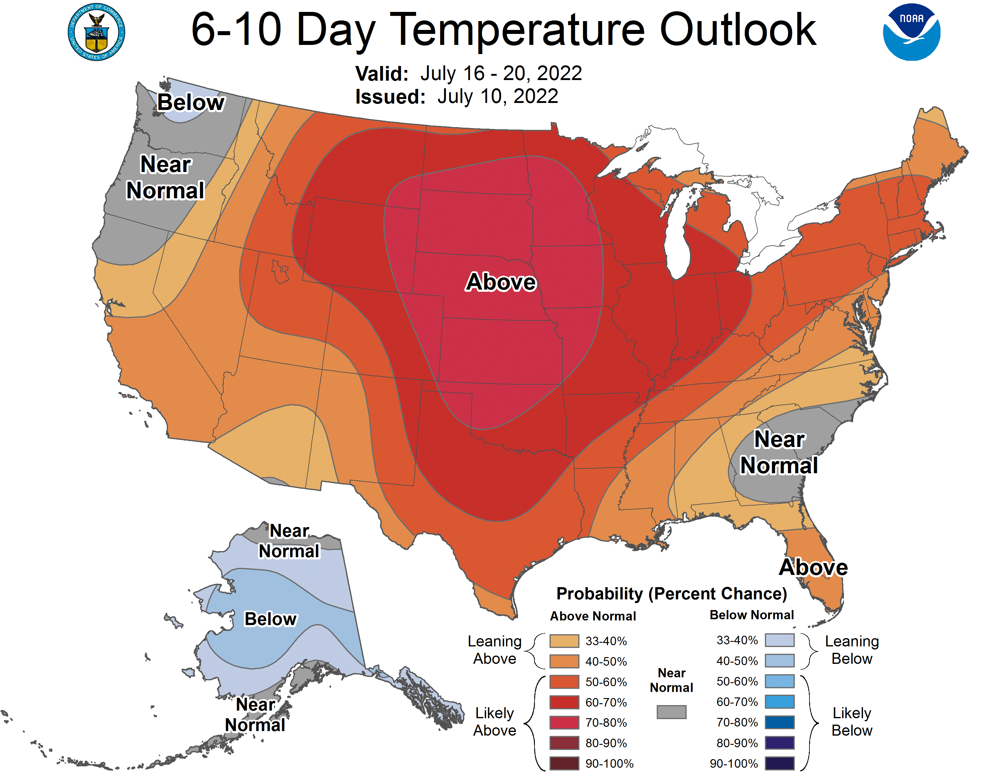
Forecast models still point to signs of excessive heat across the northern plains this weekend into next week. The core of the heat dome looks likely to build into the northern Rockies and the Dakotas.
Minnesota will ride the eastern edge this weekend. But there are still signs the heat could spill eastward into Minnesota next week.
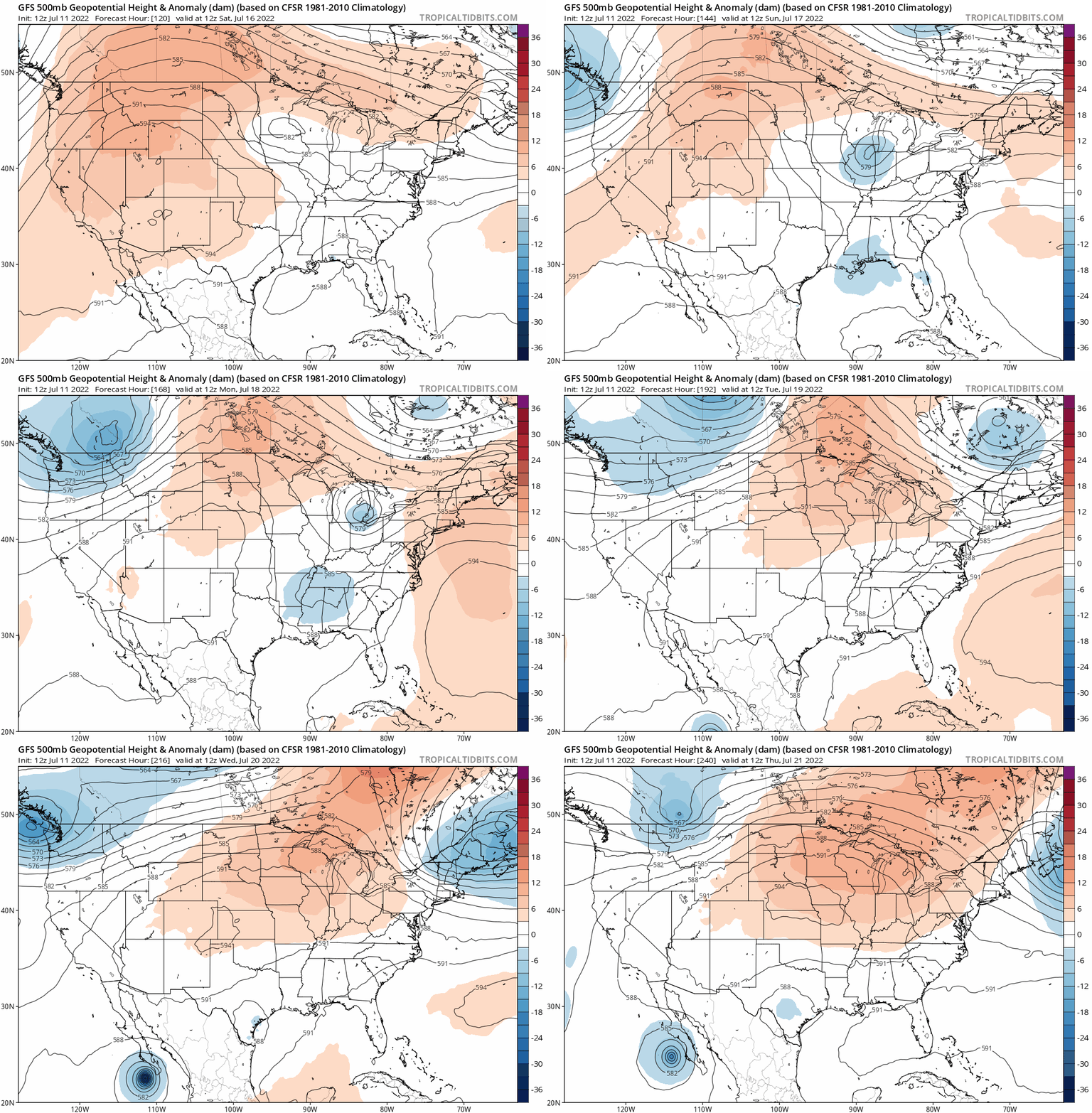
NOAA’s GFS model shows the upper-level heat dome shifting from the Rockies into Minnesota between this Saturday and Thursday of next week.
Highs should reach the 90s again in Minnesota by this weekend.
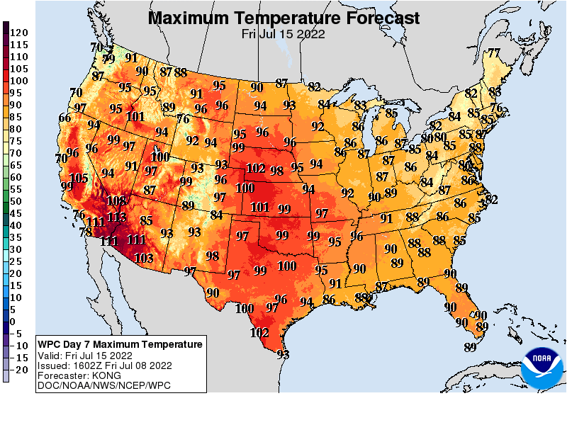
Highs above 100 degrees look likely from Kansas into the Dakotas early next week.
Several forecast models suggest temperatures could reach 100 degrees or higher in Minnesota by Wednesday or Thursday next week.

There is still uncertainty about just how hot it will get in Minnesota next week. But a string of highs in the 90s looks likely, and 100 degrees is looking possible again.
Stay tuned.

