
Hotter days ahead: A string of 90s next week?
Enjoy our lovely temperatures and humidity this week. 90s likely return next week.

Go Deeper.
Create an account or log in to save stories.
Like this?
Thanks for liking this story! We have added it to a list of your favorite stories.


I hope you’re enjoying our lovely and comfortable air mass this week.
Forecast models still suggest a persistent hot spell across much of Minnesota next week. Some forecast models have backed off the magnitude of next week’s potential heat. But models like the usually trusty European model still suggest a string of highs in the 90s looks likely for much of western and southern Minnesota.
Toss in dew points in the upper 60s and 70s and you’ve got a bona fide heat wave.
Check out the heat across the western U.S. Tuesday afternoon. Highs are hovering well into the 90s to around 100 degrees as far north as Idaho. See how Minnesota is an oasis of relief by comparison?
Turn Up Your Support
MPR News helps you turn down the noise and build shared understanding. Turn up your support for this public resource and keep trusted journalism accessible to all.

The Canadian model shows the western heat dome nudging eastward toward Minnesota as we move toward this weekend.

By Sunday and Monday, 100-degree temperatures look increasingly likely in parts of South Dakota, with the 90s pushing into Minnesota.

The heat continues Tuesday.
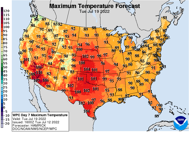
The European model cranks out a string of four consecutive days of 90-degree heat in the twin Cities from Sunday through next Thursday. It peaks with a high of 95 degrees for the Twin Cities next Tuesday, July 19.
So it remains to be seen precisely how hot it will get in Minnesota next week. But a string of four days in the low to mid-90s looks increasingly likely.
Stay tuned.

