
Next rain and thunder chance arrives Thursday night into Friday
Rainfall coverage looks hit or miss. But some lawns and fields could get a soaking.

Go Deeper.
Create an account or log in to save stories.
Like this?
Thanks for liking this story! We have added it to a list of your favorite stories.


Many lawns and crops in Minnesota are just getting by on moisture these days. As in barely getting by.
The multi-sensor rainfall data from the Midwest Regional Climate Center (above) shows a patchwork of rainfall across Minnesota in the past week. Parts of southern Minnesota picked up two to five inches of rain in the past week. But most of Minnesota has logged less than an inch. And a big chunk of central Minnesota has seen little rain in the past week.
Thursday night thunder?
So is there any hope for some much-needed rainfall in the next 48 hours? The short answer is yes.
A few forecast models suggest a cluster of thunderstorms may develop in western Minnesota Thursday evening and move southeast across parts of Minnesota. One of the more aggressive model runs came in Wednesday afternoon. NOAA’s 18Z NAM 3 km resolution forecast model develops a strong storm complex in the Red River Valley Thursday evening. This particular model run suggests a possible squall line blowing through western Minnesota overnight into early Friday morning.
Turn Up Your Support
MPR News helps you turn down the noise and build shared understanding. Turn up your support for this public resource and keep trusted journalism accessible to all.
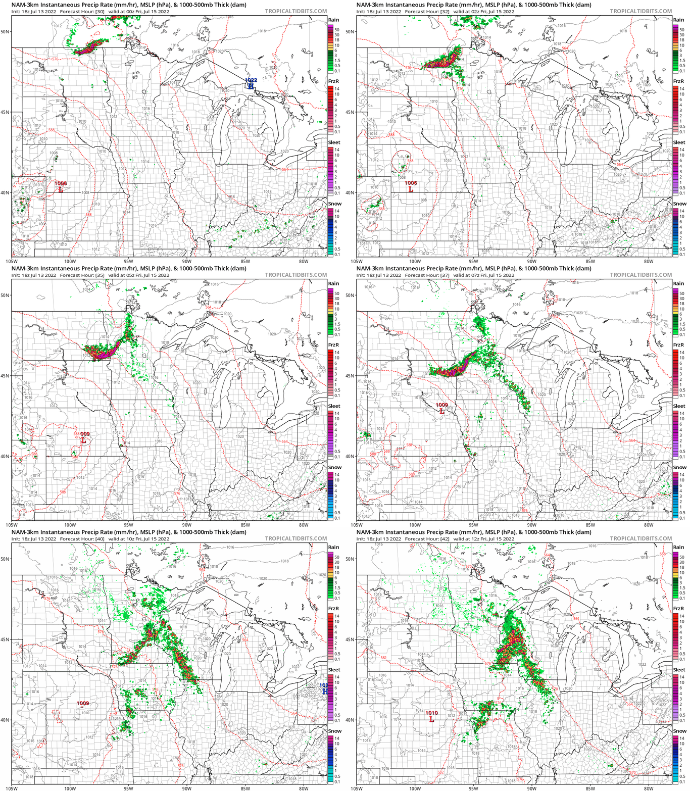
Storm clusters could reach as far east as the Twin Cities in the pre-dawn hours Friday morning. So it’s possible the Twin Cities could get a sunrise surprise soaking Friday.
Both the European and GFS models are cranking out a relatively narrow band of significant rainfall across central Minnesota by Friday morning.
The European model cranks out around an inch of rainfall along the I-94 corridor between Fargo and the Twin Cities.

So it’s possible some of the dry areas in central Minnesota could pick up some much-needed rainfall by daybreak Friday morning.
As always, rainfall from summer thunder cells can be highly localized. Your results may vary.
And there is a marginal severe risk for most of western and central Minnesota Thursday night into early Friday morning.

Stay tuned.

