
Heat advisory: 90s through Tuesday; some relief arrives by Wednesday
Temperatures about 10 degrees cooler for many areas by Wednesday

Go Deeper.
Create an account or log in to save stories.
Like this?
Thanks for liking this story! We have added it to a list of your favorite stories.


Call it a hot front.
The leading edge of an intense hot air dome has finally pushed into Minnesota this Monday. A heat advisory is in effect until 8 pm Monday for much of Minnesota including the Twin Cities.
Isanti-Chisago-Hennepin-Anoka-Ramsey-Washington-Sibley-Carver- Scott-Dakota-Brown-Nicollet-Le Sueur-Rice-Watonwan-Blue Earth- Waseca-
Including the cities of Cambridge, Center City, Minneapolis, Blaine, St Paul, Stillwater, Gaylord, Chanhassen, Chaska, Victoria, Shakopee, Hastings, New Ulm, St Peter, Le Sueur, Faribault, St James, Mankato, and Waseca
131 PM CDT Mon Jul 18 2022 ...
HEAT ADVISORY REMAINS IN EFFECT UNTIL 6 PM CDT TUESDAY...
* WHAT...Heat index values 98 to 102 expected today, lows in the mid 70s tonight, and hot again on Tuesday.
* WHERE...Portions of central, east central and south central Minnesota.
* WHEN...From noon today to 6 PM CDT Tuesday. * IMPACTS...Hot temperatures and high humidity may cause heat illnesses to occur.
Highs temperatures above 100 degrees are common across South Dakota Monday, with temperatures close to 100 in western Minnesota.

The heat continues Tuesday with highs again well into the 90s across much of southern Minnesota.
Turn Up Your Support
MPR News helps you turn down the noise and build shared understanding. Turn up your support for this public resource and keep trusted journalism accessible to all.

It’s interesting to note that this week’s heat is not in record territory for most of Minnesota. Record highs for the Twin Cities range between 101 and 105 degrees this week.
Relief by Wednesday
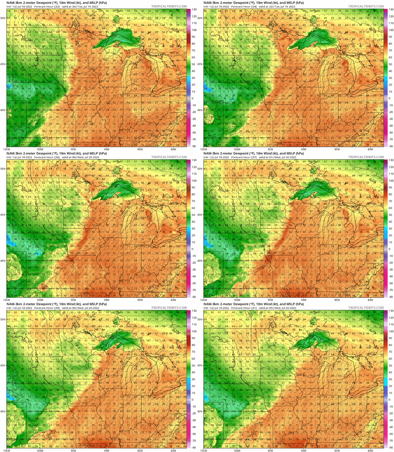
A cold front will blow through Minnesota late Tuesday. The air mass behind the front looks about 10 to 15 degrees cooler, and a lot less humid.
Check out the change in dew points between the two air masses. Dew points in the 70s will be swept away and replaced by a transfusion of dew points in the more comfortable 50s and lower 60s this week!
High temperatures will hover in the upper 80s to around 90 in southern Minnesota from Wednesday through Friday. Highs up north will hover around 80 degrees in many locations.

Cooler by your favorite Great Lake.
Stay tuned.

