
'Enhanced' severe weather risk Saturday includes the Twin Cities area
Scattered severe storms could produce damaging winds, large hail, and possible tornadoes.

Go Deeper.
Create an account or log in to save stories.
Like this?
Thanks for liking this story! We have added it to a list of your favorite stories.


Well at least we need the rain.
Saturday’s storm outlook is looking potentially severe across our region. A cold front will spark scattered storms. The environment looks favorable for a few storms to turn severe, especially Saturday afternoon and evening.
NOAA’s Storm Prediction Center has expanded the enhanced risk area Saturday to include the greater Twin Cities area. (graphic above)
Mainly afternoon storms
Turn Up Your Support
MPR News helps you turn down the noise and build shared understanding. Turn up your support for this public resource and keep trusted journalism accessible to all.
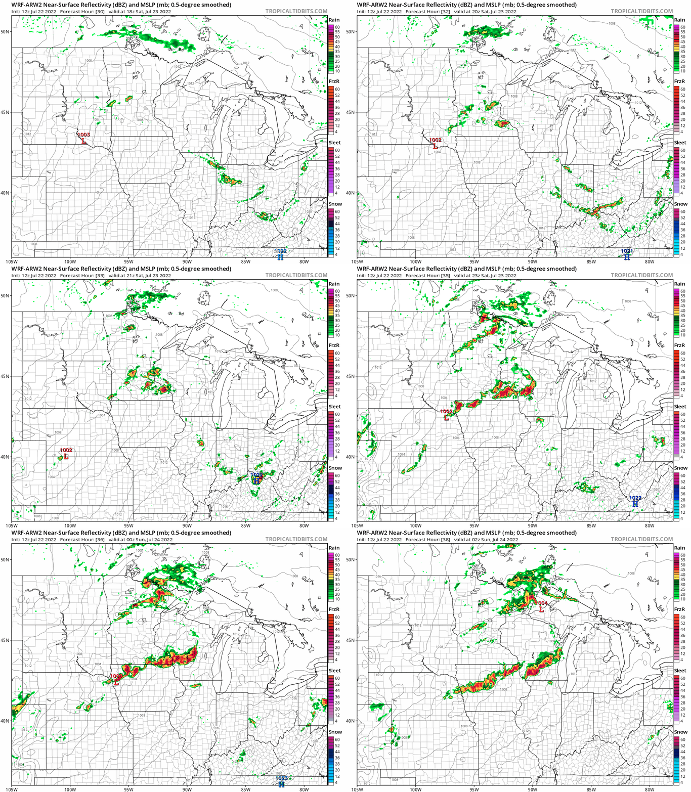
Forecast model storm timing varies by model. Most models suggest scattered strong to severe cells will develop early Saturday afternoon in west-central Minnesota and track southeast toward eastern Minnesota including the Twin Cities. Storm coverage may begin as individual severe cells, then morph into a potential squall-line packing potentially damaging winds and hail. A few tornadoes are also possible Saturday.
NOAA’s WRF model shows scattered cells congealing into a line of storms as it moves through the Twin Cities into southeast Minnesota, Iowa, and Wisconsin.
The biggest storm risks Saturday include large hail and damaging winds. NOAA assesses a 30% risk for severe winds above 57 mph within 25 miles of any location from the Twin Cities east and south Saturday across our region.

And these storms could be hailers. There is the potential for large hail over 2” in diameter across southern Minnesota including the Twin Cities Saturday.

Keep an eye and ear out Saturday for possible severe weather watches and warnings.

