
Two thunderstorm waves likely through Saturday; locally heavy downpours possible.
Scattered storms likely early Saturday morning and late Saturday afternoon and evening.

Go Deeper.
Create an account or log in to save stories.
Like this?
Thanks for liking this story! We have added it to a list of your favorite stories.


Welcome to the last weekend of meteorological summer.
This is the time of year when meteorologists watch fairly weak weather waves track through lingering warm, slightly humid air masses. These waves often spark scattered thunderstorms pockets. This type of weak synoptic weather pattern can be a challenge to forecast.
There are no big wound-up bomb cyclones to track this time of year. The large, well-defined bombs of October and November are in many ways easier to forecast than these finicky, stealthy late summer atmospheric ripples.
So the latest short-range model guidance through Saturday presents some interesting forecast solutions. The overall theme centers around two likely scattered storm waves crossing Minnesota through Sunday morning.
Turn Up Your Support
MPR News helps you turn down the noise and build shared understanding. Turn up your support for this public resource and keep trusted journalism accessible to all.
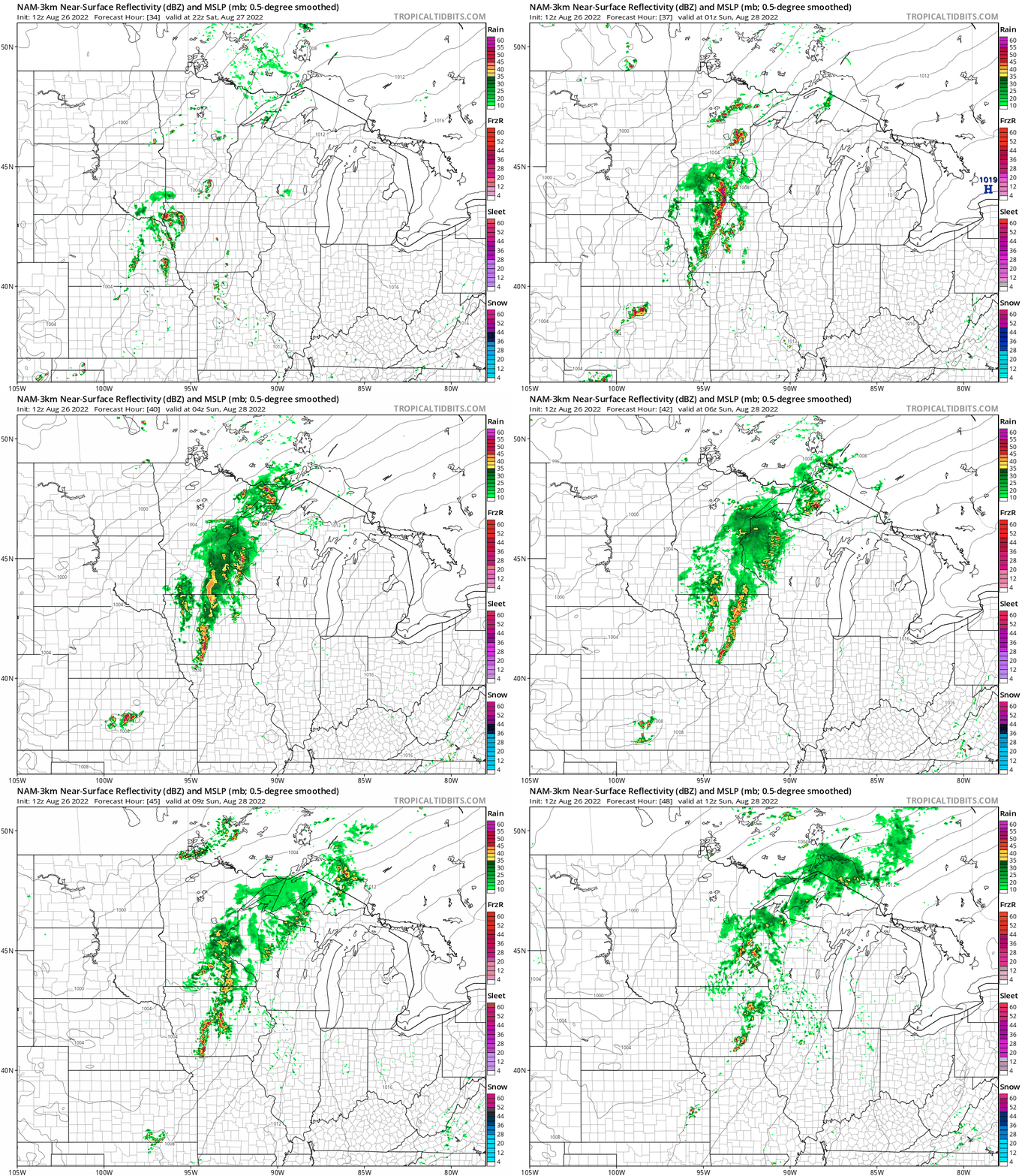
Wave #1 likely develops overnight Friday night into early Saturday morning. After a mostly dry Saturday, wave #2 looks likely to form in central Minnesota late Saturday afternoon and evolve into Saturday night.
I often like the way NOAA’s NAM 3km resolution model handles these systems. The NAM 3k is similar to the WRF models Friday that develop a broken line of rain and thunder cells overnight into early Saturday morning.
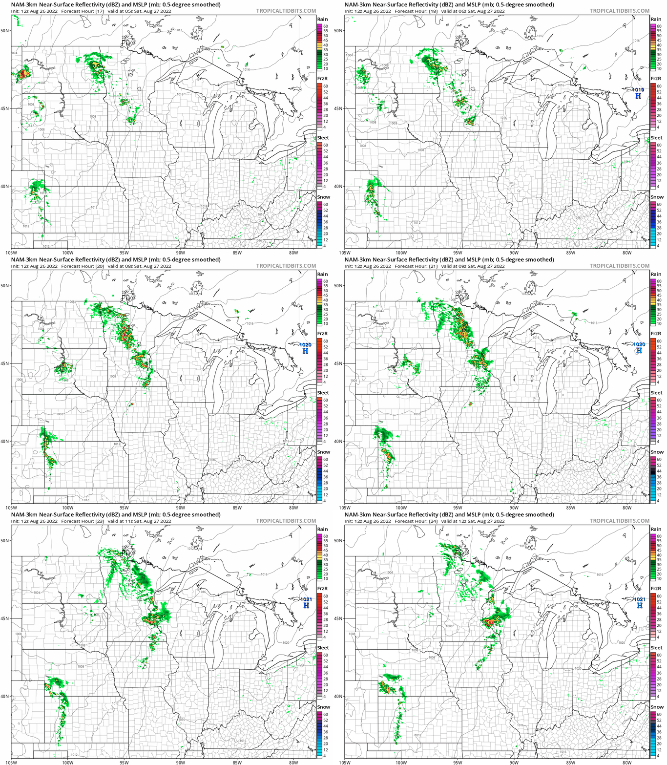
The NAM 3 km model and others keep most of Minnesota dry Saturday morning into the mid to late afternoon hours.
A second wave of scattered rain and thunder cells is likely to develop late Saturday afternoon and expand through Saturday night. Here’s NOAA’s NAM 3 km model’s idea of rainfall coverage between 5 pm Saturday and 7 am Sunday.
Locally heavy rainfall potential?
Pinpointing summer convective rainfall totals can be like playing weather darts. Even the best high-resolution mesoscale forecast models can produce patchwork precipitation forecasts.
Why?
Because individual convective thunderstorms cells are often anywhere from less than a mile to just a few miles in the area. Torrential rain can fall under these localized cells. The next town a few miles away could get little or no rainfall.
Take a look at the NAM 3 km model through Sunday. You can see areas that may get little or no rainfall this weekend. There are also pockets of 1 to more than 2 inches of rainfall in southern Minnesota and around the Twin Cities.

Sunday looks like the steamier day this weekend with highs in the upper 80s to near 90 in southern Minnesota and dew points that could climb into the upper 60s to near 70 degrees.

So enjoy the many dry hours this weekend, and keep an eye out for a possible gully-washer near you.

