Frost advisory for northern Minnesota

Lows in the 30s up north. Coldest night in 4 months for most of Minnesota.

Frost advisory for NE MN
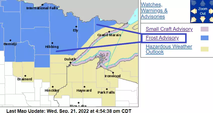
Frost advisory for northeast Minnesota.
NOAA

It’s back!

The season’s strongest cold front so far is prompting a frost advisory for most of northern Minnesota. The frost advisory zone covers most of northern Minnesota, just north of a Fargo to Duluth line.

Frost advisory
Frost advisory.
Grand Forks NWS Office

Here’s the advisory language for the eastern half of northern Minnesota from the Duluth NWS Office.

Including the cities of International Falls, Ely, Isabella, Bigfork, Hibbing, Walker, Grand Rapids, and Hill City

216 PM CDT Wed Sep 21 2022

...FROST ADVISORY IN EFFECT FROM 4 AM TO 10 AM CDT THURSDAY...

* WHAT...Temperatures as low as 32 will result in frost formation.

* WHERE...Koochiching, North St. Louis, Northern Cook and Lake, North Itasca, Central St. Louis, North Cass, South Itasca and Northern Aitkin Counties. This includes the Tribal Lands of the Mille Lacs Band, Big Sandy Lake area and the Bois Forte Band, Deer Creek, Lake Vermilion and, Nett Lake areas.

* WHEN...From 4 AM to 10 AM CDT Thursday. * IMPACTS...Frost could kill sensitive outdoor vegetation if left uncovered.

Forecast low temperatures Thursday morning
Forecast low temperatures Thursday morning.
NOAA

Coldest air mass in 4 months

Create a More Connected Minnesota

MPR News is your trusted resource for the news you need. With your support, MPR News brings accessible, courageous journalism and authentic conversation to everyone - free of paywalls and barriers. Your gift makes a difference.

Our inbound air mass is the coldest in about 4 months for Minnesota. The last time the Twin Cities dropped below 50 degrees was on May 27 when we bottomed out at 45 degrees.

Highs Thursday will barely make the 60s in southern Minnesota, with chilly 50s up north.

Forecast high temperatures Thursday
Forecast high temperatures Thursday.
NOAA

Record long ‘summer’

Monday I wrote about the record streak of 70-degree or higher days we've recorded in the Twin Cities since May 27. It’s interesting to note that temperatures at MSP Airport remained above 70 degrees until after 1 am Wednesday. That means today (September 21) was the 118th straight day with highs at or above 70 in the Twin Cities. The graphic below says 117, but that analysis included days through September 20.

Major hurricane threat next week?

Powerful Hurricane Fiona will threaten Bermuda Thursday.

Both the European and GFS models develop a potentially major hurricane somewhere in the Gulf of Mexico next week.

Hurricane Fiona
Hurricane Fiona.
NOAA/NHC

It’s too early to responsibly post some of the forecast models I’m seeing today. But the threat of a major hurricane strike somewhere between Florida and the Gulf Coast is growing by the middle to end of next week.

Possible hurricane tracks for 98L
Possible hurricane tracks for 98L.
NOAA via tropical tidbits

Stay tuned.