
Above-normal temps this weekend and beyond; quiet weather on Halloween
No drought relief in sight
Go Deeper.
Create an account or log in to save stories.
Like this?
Thanks for liking this story! We have added it to a list of your favorite stories.


Saturday afternoon temps will make it feel more like late September than late October.
Minnesota and western Wisconsin will have highs in the 60s Saturday, with a few 50s in far northern Minnesota. Many spots in the Twin Cities metro area will top out in the upper 60s.
Our average Twin Cities high temperature is just 51 degrees this time of year. Wind gusts of 12 to 18 mph are possible later this afternoon.
Temperature trends
High temps reach the lower 60s in roughly the southern half of Minnesota plus western Wisconsin on Sunday:
Turn Up Your Support
MPR News helps you turn down the noise and build shared understanding. Turn up your support for this public resource and keep trusted journalism accessible to all.

Sunday afternoon wind gusts will be 10 mph or less in most areas:

Forecast wind gusts are in knots, with 7 knots equal to 8 mph.
Above-normal temps will continue through the coming week. Twin Cities metro area highs are projected to reach the lower 60s on Monday, followed by upper 60s Tuesday and Wednesday, then mid 60s Thursday.
It’ll be cooler on Friday, with highs in the upper 50s. That’s still several degrees warmer than our average high temp in early November.
Dry weekend
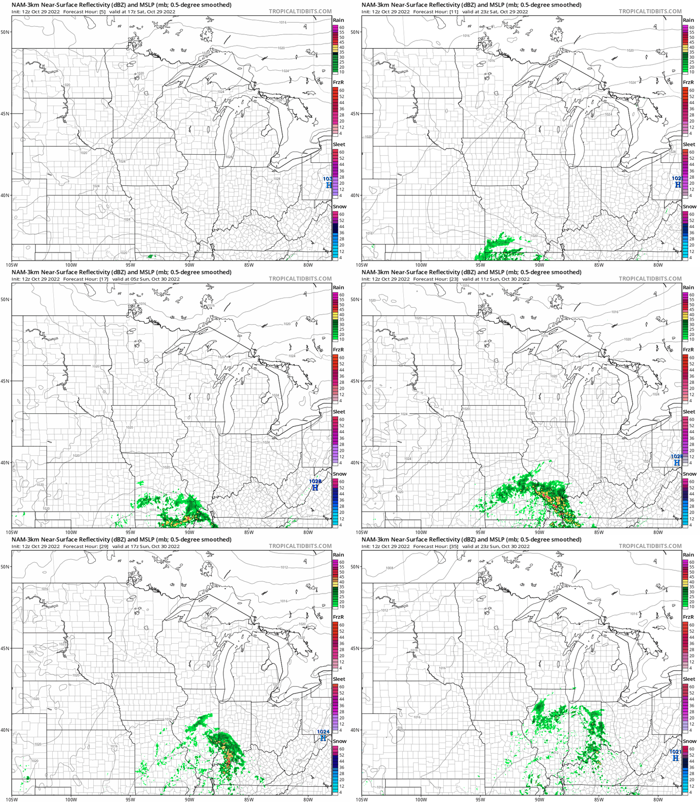
This weekend still looks dry. The National Oceanic and Atmospheric Administration’s North American Mesoscale (NAM) forecast model isn’t showing any weekend rain or snow in Minnesota or western Wisconsin:
We have updated weather information for Minnesota and western Wisconsin on the Minnesota Public Radio News network, and on the MPR News live weather blog.
Drought continues
The latest U.S. Drought Monitor report shows extreme drought conditions (shaded red) from western Ramsey County and northwestern Dakota County through much of Hennepin County and the southwest metro, as well as Sibley County and portions of Lyon and Redwood counties in southwestern Minnesota:

Severe drought covers the remainder of the Twin Cities metro area and much of southwestern Minnesota.
The official Twin Cities precipitation total (rainfall plus the water content of the minor snowfall on Oct. 14) is just 24 one-hundredths (.24) of an inch this October.
That’s 2.15 inches below normal for this point in October. Precipitation at Minneapolis-St. Paul International Airport is 4.93 inches below normal since Sept. 1 and 9.90 inches below normal since Jan. 1.
Halloween weather
Monday and Monday evening look dry in Minnesota and western Wisconsin. Highs on Monday will reach the 60s across most of Minnesota and western Wisconsin, with some 50s in far northern Minnesota. Temps will be mainly in the 50s during trick-or-treating time Monday evening.
Weather nugget
The Twin Cities record high for today is 78 degrees, set in 1922. The coldest Oct. 29 high temp in Twin Cities weather records is 25 degrees, set in 1925.
Programming note
You can hear my live weather updates on MPR News at 7:35 a.m., 9:35 a.m. and 4:39 p.m. Saturday and Sunday.

