
Unusually warm through Thursday; Halloween weather isn't scary this year
Rain chances later in the week
Go Deeper.
Create an account or log in to save stories.
Like this?
Thanks for liking this story! We have added it to a list of your favorite stories.


Our temperatures today were more typical of late September than late October.
The Sunday high temp at Minneapolis-St. Paul International Airport was 66 degrees. Our average Twin Cities high is just 51 this time of year. Much of Minnesota and western Wisconsin had Sunday highs in the 60s, with some 50s in parts of far northern Minnesota and in the far southeast. Our Halloween temps will also be unusually warm.
Halloween weather
Halloween high temps will be in the 60s across most of Minnesota plus western Wisconsin:
Turn Up Your Support
MPR News helps you turn down the noise and build shared understanding. Turn up your support for this public resource and keep trusted journalism accessible to all.

Some spots in the Twin Cities metro area will probably reach the upper 60s, and parts of southwestern Minnesota could top 70 degrees. There will be some upper 50s in parts of far northern Minnesota.
Monday afternoon wind gusts will be highest in the northern third of Minnesota, where they could reach 20 mph at times:

Forecast wind gusts are in knots, with 17 knots equal to 19.6 mph.
During trick-or-treat time Monday evening, Twin Cities temperatures will be in the mid to upper 50s. Temps during that time will be in the 50s across most of Minnesota and western Wisconsin, with some 40s in far northern Minnesota.
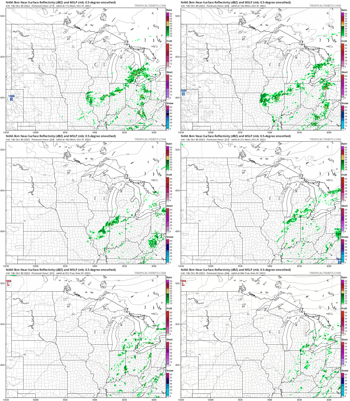
Halloween still looks dry in Minnesota and western Wisconsin. The National Oceanic and Atmospheric Administration’s North American Mesoscale (NAM) forecast model shows rain staying well off to the southeast Monday and Monday evening:
We have updated weather information for Minnesota and western Wisconsin on the Minnesota Public Radio News network, and on the MPR News live weather blog.
Temperature trends
Twin Cities metro area highs are projected to be around 70 on Tuesday, followed by lower 70s Wednesday. Our record high for this Wednesday (Nov. 2) is 72 degrees. Metro area highs retreat slightly to the upper 60s on Thursday, then drop sharply to the lower 50s on Friday.
Rain chances?
Forecast models show that scattered showers will be possible late Thursday, Thursday night and Friday. There is the potential for more meaningful rains next weekend. With much of central and southern Minnesota experiencing drought conditions, it would be great to see some rain.
Halloween Climatology
The Minnesota State Climatology Office has compiled Twin Cities Halloween weather data that goes back to the 1870s.
Their data reveals that rain or snow haven’t affected Twin Cities trick-or-treaters in the past 24 years:
The area has not seen a Halloween washout, with measurable precipitation during the evening, since 1997.
As you can imagine, Halloween temperatures can vary widely. According to the Climatology Office:
High temperatures in the Twin Cities are generally in the 40s and 50s. It is more common for the daily high on Halloween to be in the 60s than in the 30s. 70s tend to be rare, with only eight Halloween high temperatures being 70 degrees or above or about one in eighteen years. The warmest Halloween on record was 83 degrees in 1950, with one of the coldest one year later with a high of 30 in 1951. The coldest Halloween maximum temperature was a bone-chilling 26 degrees back in 1873.
Weather nugget
This will likely be the sixth-driest October in Twin Cities weather records. Last month the Twin Cities had the driest September in Twin Cities weather records. Those weather records go back to the 1870s.
Programming note
You can hear my live weather updates on MPR News at 7:35 a.m., 9:35 a.m. and 4:39 p.m. Saturday and Sunday.

