
Snowfall totals could reach 30 inches near North Shore's Silver Bay
Persistent lake-effect snow bands still dumping locally heavy snowfall on the North Shore
Go Deeper.
Create an account or log in to save stories.
Like this?
Thanks for liking this story! We have added it to a list of your favorite stories.


Lake Superior is the snowy lake-effect gift that keeps on giving to the North Shore.
Snowfall totals have already reached 2 feet near Silver Bay.
Several other locations between Finland and Hovland are over 20 inches of snow as of midday Wednesday.
21 N Grand Marais [Cook Co, MN] PUBLIC reports SNOW of 20.00 INCH at 9:59 AM CST --
7 WSW Hovland [Cook Co, MN] TRAINED SPOTTER reports SNOW of 21.20 INCH at 11:21 AM CST --
3 E Finland [Lake Co, MN] TRAINED SPOTTER reports SNOW of 21.00 INCH at 8:55 AM CST -- 18 INCHES ON THE GROUND.
Now we watch as a small “mesolow” pressure system spins along the North Shore Wednesday and dumps more heavy localized snow along parts of the North Shore.
Turn Up Your Support
MPR News helps you turn down the noise and build shared understanding. Turn up your support for this public resource and keep trusted journalism accessible to all.
The focus of this smaller-scale event appears to favor areas around Silver Bay once again. This feature already helped produce 10 inches of snow at Lax Lake near Silver Bay Wednesday morning.
Winter storm warnings are posted until midnight between about Two Harbors and Silver Bay. The area could see as much as 7 more inches of snowfall through this evening.

Southern Lake- Including the cities of Two Harbors and Silver Bay
1016 AM CST Wed Nov 16 2022
...WINTER STORM WARNING IN EFFECT UNTIL MIDNIGHT CST TONIGHT...
* WHAT...Heavy lake effect snow is ongoing. Additional snow accumulations of 2 to 5 inches, with local accumulations of 5 to 7 inches northeast of Castle Danger.
* WHERE...Southern Lake County.
* WHEN...Until midnight CST tonight.
* IMPACTS...Plan on difficult travel conditions today, with rapid reductions in visibility north of Castle Danger. The hazardous conditions could impact the evening commute.
Check out the National Oceanic and Atmospheric Administration’s NAM 3 km model loop below. The time frame runs between noon Wednesday and midnight Thursday.
See the little bark blue spinny thing in the upper right corner of the map along the North Shore?
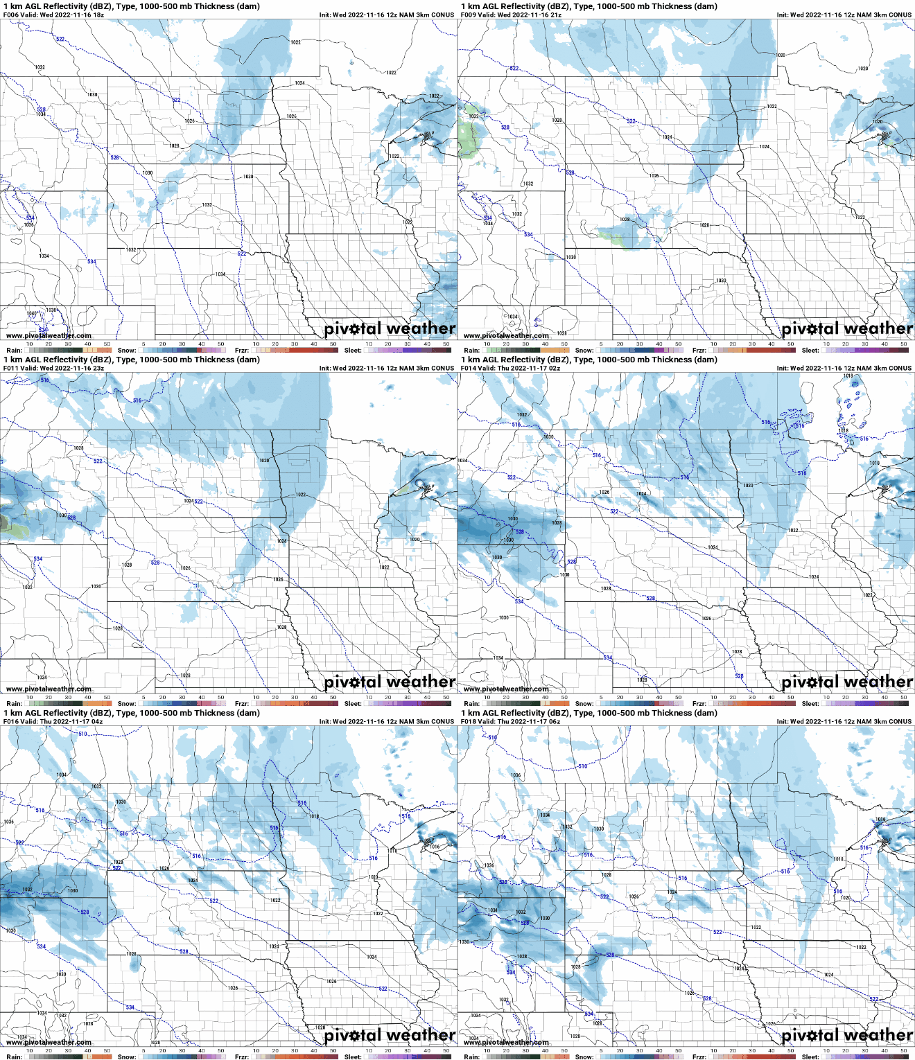
That’s the mesolow pressure system that will pump out additional bands of moderate to heavy snow in the region.
NOAA’s NAM 3 km model 12 hours snowfall output cranks out up to another highly localized 10 inches of snow near the Lake-Cook county line through 6 a.m. Thursday.

With 20 to 24 inches of snow already, another 4 to 7 inches would bring snowfall totals at some locations between 25 and 30 inches by Thursday morning.

