
Colder Sunday, much colder Tuesday through Friday; Periods of snow Monday PM
Midweek winter storm is possible
Go Deeper.
Create an account or log in to save stories.
Like this?
Thanks for liking this story! We have added it to a list of your favorite stories.


The pesky low pressure system that has given us periods of snow for the past five days is finally showing signs of moving away.
Periods of light snow continue into early Saturday evening in eastern Minnesota and deeper into Saturday night in western Wisconsin. Western Minnesota has a chance of flurries Saturday evening.
You can find updated weather information for Minnesota and western Wisconsin on the Minnesota Public Radio News network, and on the MPR News live weather blog.
Temperature trends
Turn Up Your Support
MPR News helps you turn down the noise and build shared understanding. Turn up your support for this public resource and keep trusted journalism accessible to all.
Most of western Minnesota will see below-zero low temps early Sunday morning. Lows in the single digits above zero area expected early Sunday in much of eastern Minnesota and western Wisconsin.
Sunday highs will be in the single digits in western Minnesota, with teens elsewhere in Minnesota and western Wisconsin:

Our average Twin Cities high temp is 28 degrees this time of year, so Sunday metro area highs in the teens are very chilly.
Sunday afternoon wind chills will be below zero in much of Minnesota, but sllghtly above zero in the Twin Cities and southeastern Minnesota:

Back to forecast high temps, Twin Cities metro area highs are projected to be in the upper teens on Monday followed by a highs around 10 degrees Tuesday, then around 5 degrees Wednesday and around 2 above zero on Thursday and Friday.
Strong winds will drop wind chill temps into the 30s and 40s below zero in some locations Thursday and Friday:

Snow opportunities
Some scattered light snow showers could move into western Minnesota Monday morning, then periods of snow are likely to spread over much of Minnesota and western Wisconsin Monday afternoon and evening.
The National Oceanic and Atmospheric Administration’s North American Mesoscale (NAM) forecast model shows the potential snow pattern from 6 a.m. Monday to 11 p.m. Monday:
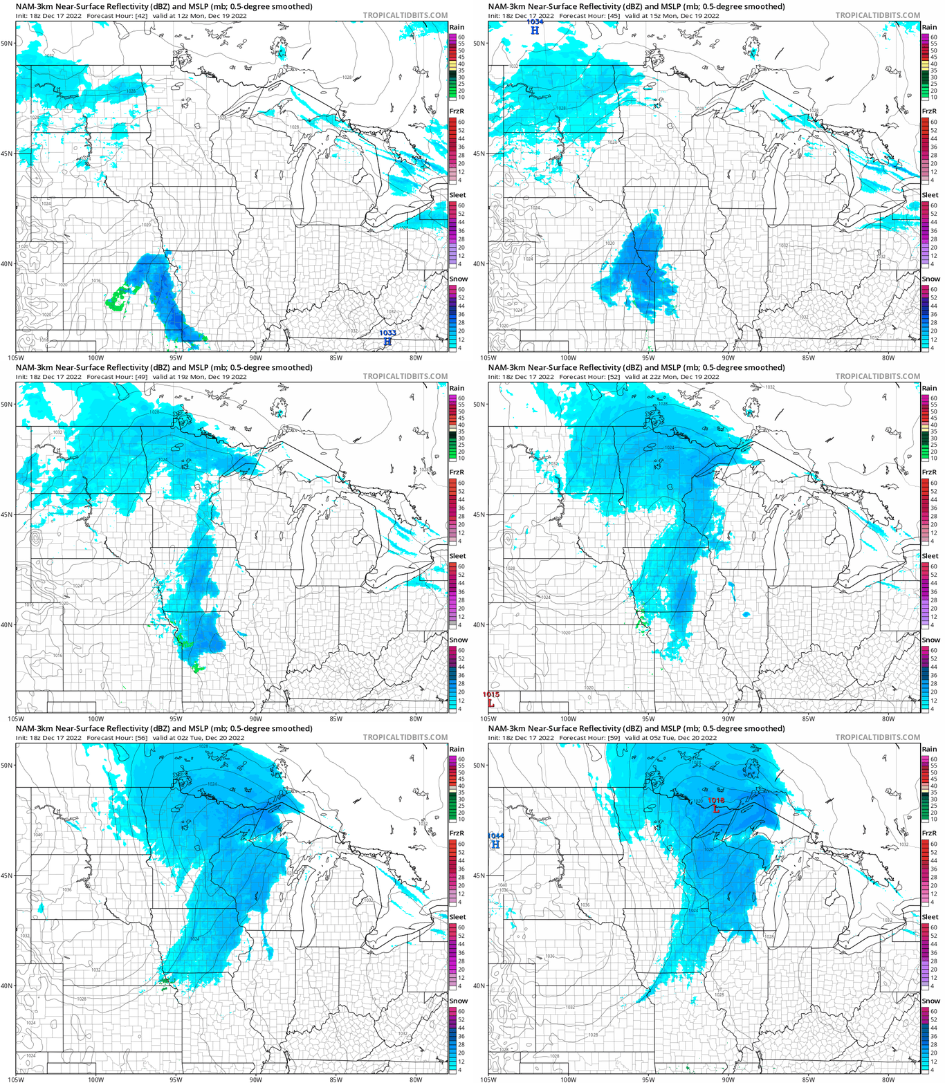
Accumulations are expected to be around one inch in many areas by Monday evening, but northern Minnesota could see some two-inch totals.
There may be a major snowstorm Wednesday and Wednesday night. Some forecast models bring a swath of heavy snow across the upper Midwest, but some models track the system much farther to the south, with the heavy snow missing Minnesota and most of Wisconsin. Check forecast updates as we get closer to Wednesday.
Weather nugget
Those single-digit high temps in the Twin Cities forecast for Thursday Dec. 22 and Friday Dec. 23 will not be the coldest high temps ever recorded on those dates. Here are Twin Cities high temps on those dates in 1983:

Those would be cold low temps, but those are the daily Twin Cities highs for the listed dates.
Programming note
You can hear my live weather updates on MPR News at 7:35 a.m., 9:35 a.m. and 4:39 p.m. Saturday and Sunday.

