Blizzard conditions, bitter cold up next as snowfall eases

Plowable snow ends early Thursday morning

Winter storm messaging
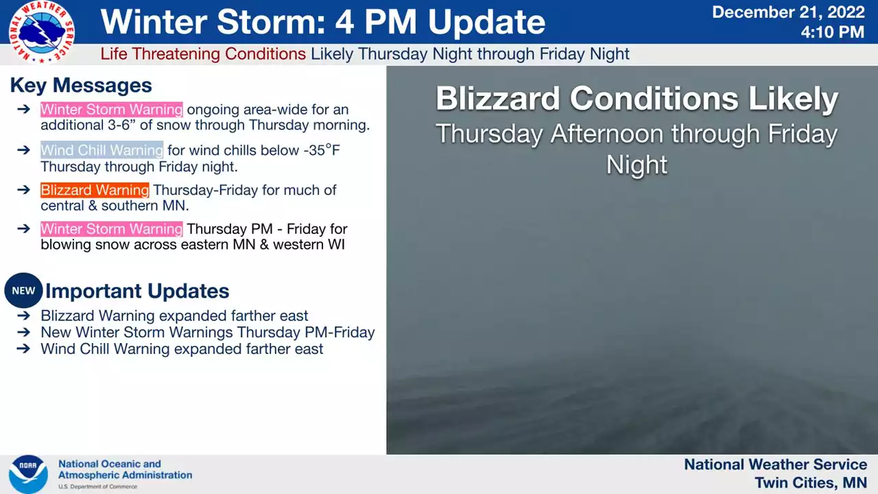
Winter storm messaging.
Twin Cities National Weather Service office

Snowfall has been intermittent during the first part of the storm that rolled in Wednesday, leading to slightly lower snowfall totals in some areas. Expect about 4 to 7 inches total for the Twin Cities region, where the snow will end between 2 a.m. and 4 a.m. Thursday.

Here’s the latest additional snowfall update from the Twin Cities National Weather Service office:

Snowfall totals
Additional snowfall
Twin Cities National Weather Service office

Here’s the latest Minnesota snowfall map from the National Oceanic and Atmospheric Administration:

Snowfall projection for Minnesota 4
Snowfall projection for Minnesota
NOAA

The second part of the storm is still on track to deliver high winds, blowing snow, blizzard conditions and dangerous wind chills Thursday into Saturday morning.

Blizzard warnings have been expanded into several more counties across southern Minnesota late Wednesday, and they still include the western and southern Twin Cities counties.

Winter storm watches and advisories
Winter storm and blizzard warnings
Twin Cities National Weather Service office

Carver-Scott-Rice- Including the cities of Chanhassen, Chaska, Victoria, Shakopee, and Faribault

1134 AM CST Wed Dec 21 2022

...WINTER STORM WARNING REMAINS IN EFFECT UNTIL 3 AM CST THURSDAY... ...BLIZZARD WARNING IN EFFECT FROM 6 PM THURSDAY TO 6 AM CST SATURDAY... ...WIND CHILL WARNING IN EFFECT FROM 6 PM THURSDAY TO NOON CST SATURDAY...

* WHAT...For the Winter Storm Warning, heavy snow. Total snow accumulations of 5 to 8 inches. For the Blizzard Warning, blizzard conditions expected. Winds gusting as high as 50 mph. For the Wind Chill Warning, dangerously cold wind chills expected. Wind chills as low as 40 below zero.

* WHERE...Carver, Scott and Rice Counties.

* WHEN...For the Winter Storm Warning, until 3 AM CST Thursday. For the Blizzard Warning, from 6 PM Thursday to 6 AM CST Saturday. For the Wind Chill Warning, from 6 PM Thursday to noon CST Saturday.

* IMPACTS...Travel could be very difficult or impossible. Widespread blowing snow could significantly reduce visibility. Gusty winds could bring down tree branches. The dangerously cold wind chills could cause frostbite on exposed skin in as little as 10 minutes.

* ADDITIONAL DETAILS...This could be a life-threatening situation if you get stranded traveling late this week. Consider adjusting any travel plans now.

PRECAUTIONARY/PREPAREDNESS ACTIONS... Travel should be restricted to emergencies only. If you must travel, have a winter survival kit with you. If you get stranded, stay with your vehicle. The latest road conditions for the state you are calling from can be obtained by calling 5 1 1. Road conditions can also be found at 511mn.org for Minnesota or 511wi.gov for Wisconsin.

With wind gusts greater than 40 mph, wind chills will dip into the dangerous minus 30s and minus 40s across Minnesota later Thursday through Saturday morning.

Wind chill forecast
Wind chill forecast
Twin Cities National Weather Service

Stay safe out there Minnesota.

Create a More Connected Minnesota

MPR News is your trusted resource for the news you need. With your support, MPR News brings accessible, courageous journalism and authentic conversation to everyone - free of paywalls and barriers. Your gift makes a difference.