
Areas of light snow Thursday evening, cooler Friday; mainly dry this weekend
Plowable snow possible Monday into Tuesday
Go Deeper.
Create an account or log in to save stories.
Like this?
Thanks for liking this story! We have added it to a list of your favorite stories.


The Thursday high temp at Minneapolis-St. Paul International Airport was 37 degrees. That’s relatively mild; our average Twin Cities high temp is 25 degrees this time of year.
Cooler air has already moved into western Minnesota. That cooler air will arrive in eastern Minnesota and western Wisconsin overnight Thursday night, then linger through Friday.
Snow or wintry mix Thursday evening
A swath of precipitation will continue into Thursday evening from southwestern Minnesota into central and northeastern Minnesota and parts of western Wisconsin. It will be snow in many locations, with a wintry mix of snow, sleet and patchy light freezing rain in other areas. A winter weather advisory continues until 9 p.m. this Thursday for several counties in southwestern Minnesota:
Turn Up Your Support
MPR News helps you turn down the noise and build shared understanding. Turn up your support for this public resource and keep trusted journalism accessible to all.

Here are details of the winter weather advisory:
URGENT - WINTER WEATHER MESSAGE National Weather Service Sioux Falls SD 226 PM CST Thu Dec 29 2022 IAZ001>003-013-MNZ080-081-089-090-098-300300- /O.CON.KFSD.WW.Y.0021.000000T0000Z-221230T0300Z/ Lyon-Osceola-Dickinson-O`Brien-Murray-Cottonwood-Nobles-Jackson- Rock- 226 PM CST Thu Dec 29 2022 ...WINTER WEATHER ADVISORY REMAINS IN EFFECT UNTIL 9 PM CST THIS EVENING... * WHAT...Mixed precipitation. Snow and sleet accumulations of up to two inches and ice accumulations of a light glaze. * WHERE...Portions of northwest Iowa and southwest Minnesota. * WHEN...Until 9 PM CST this evening. * IMPACTS...Plan on slippery road conditions. The hazardous conditions could impact the evening commute. PRECAUTIONARY/PREPAREDNESS ACTIONS... Slow down and use caution while traveling. The latest road conditions for the state you are calling from can be obtained by calling 5 1 1.
In addition to the 1 to 2 inch snow totals in southwestern Minnesota, parts of central and northeastern Minnesota could see up to one inch of snow Thursday evening, with a wintry mix at times.
A coating of light snow is possible in the Twin Cities metro area Thursday evening, with a wintry mix also possible at times. Parts of the west metro could see up to one inch of snow.
You can find updated weather information for Minnesota and western Wisconsin on the Minnesota Public Radio News network, and on the MPR News live weather blog.
Minnesota road conditions can be found here.
Weekend snow chance?
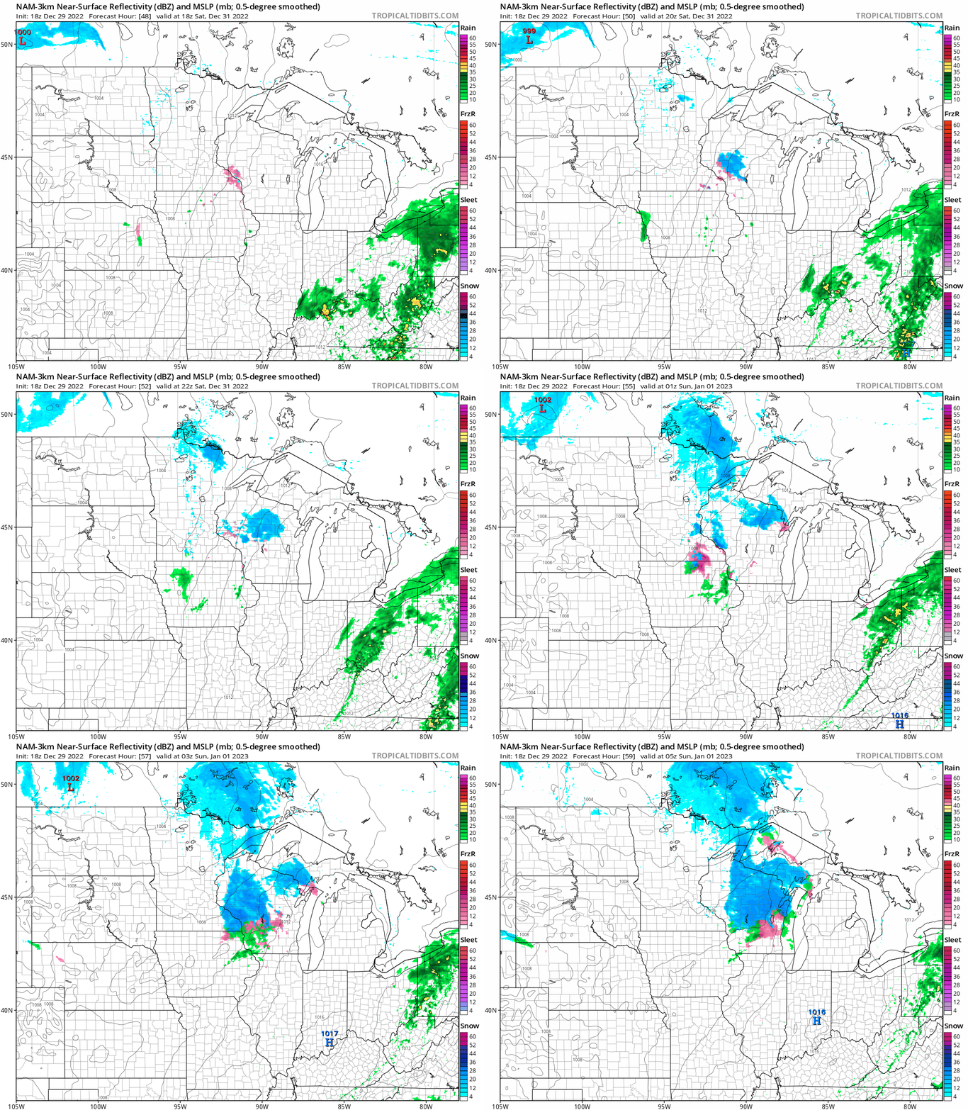
Friday and most of the weekend are expected to be dry. Some areas of light snow could develop in eastern Minnesota and western Wisconsin Saturday afternoon into Saturday evening.
The National Oceanic and Atmospheric Administration’s North American Mesoscale (NAM) forecast model shows the potential snow pattern from noon Saturday to 11 p.m. Saturday:
Monday/Tuesday snow
Forecast models show precipitation spreading across much of Minnesota and Wisconsin on Monday, then lingering Monday night and Tuesday. One forecast model gives eastern Minnesota and western Wisconsin rain to start, then a rain/snow mix followed by snow. That same model shows all snow in western and northern Minnesota Monday into Tuesday. Another model brings plowable snow to most areas Monday afternoon into Tuesday. Check forecast updates for updated info on the Monday/Tuesday snow potential.
Temperature trends
Some spots in the metro area and southeastern Minnesota could see their Friday highs at 1 or 2 in the morning. Highs during the daylight hours of Friday will be mainly in the teens in northern Minnesota, with 20s elsewhere:

A few spots in southwestern Minnesota could top 30.
Saturday highs will be in the 20s in the northern third of Minnesota, with 30s elsewhere:

Sunday highs will range from upper teens in far northwestern Minnesota to 30s in the southeast:

Monday highs will also range from upper teens in the far northwest to 30s in the southeast:

Programming note
You can hear my live weather updates on MPR News at 7:35 a.m., 9:35 a.m. and 4:39 p.m. Saturday and Sunday.

