
Snowfall boom: A foot of snow now in much of the Twin Cities
Expect another 1 to 3 inches by tomorrow morning in most areas.

Go Deeper.
Create an account or log in to save stories.
Like this?
Thanks for liking this story! We have added it to a list of your favorite stories.


Talk about a snowfall bonanza.
Our 2-part slow-moving storm system is still spinning across southern Minnesota today. You can see the center vortex of the storm on radar loops spinning along I-35 near Faribault around midday.
Our icy rain last evening changed to all snow overnight. Several hours of steadier snowfall have added up to a snowfall boom from southwest Minnesota right into the greater Twin Cities.
Snowfall totals are still pouring in. Many locations around the Twin Cities have now recorded around a foot of snow.
Turn Up Your Support
MPR News helps you turn down the noise and build shared understanding. Turn up your support for this public resource and keep trusted journalism accessible to all.
Here are some updated snowfall totals as of midday Wednesday.
Edgerton 14” (Pipestone County)
Woodbury 13.5”
Eagan 13.2”
Bloomington 13.1”
Farmington 13”
MSP Airport 12.2”
Northfield 12”
Chanhassen 11.3”
Hopkins 11.2”
Lakeville, Fridley, Falcon Heights 11”
Moose Lake 7”
Duluth 4”
Snow continues
Expect more periods of snowfall of varying intensity through tonight. The snow may stop at times but fall moderately at other times. NOAA’s NAM 3 km model shows this slow-moving system producing snow showers into early Thursday morning.
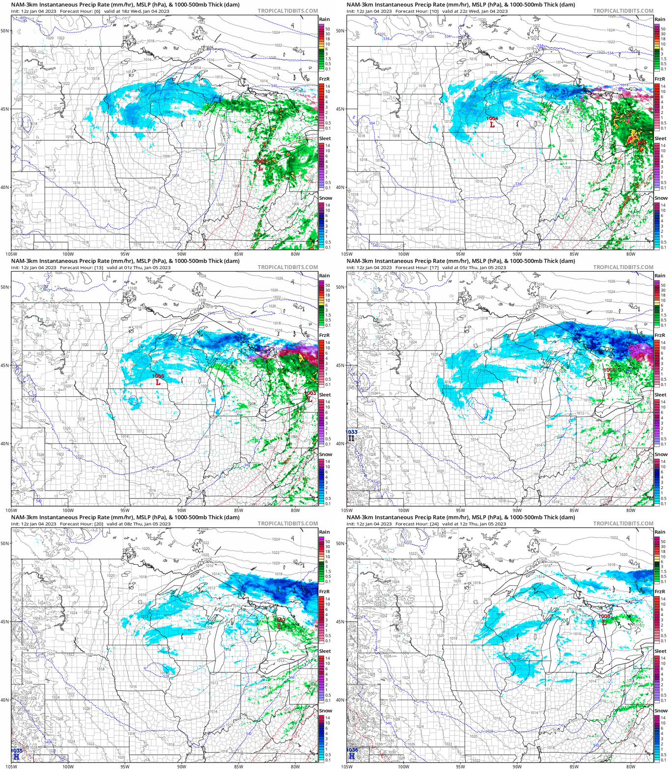
Most areas of central and southern Minnesota will see another 1” to 3” by Thursday morning.

