
Pesky system will bring light ice, snow Tuesday night and Wednesday
Most of the precipitation will fall from the Twin Cities northward
Go Deeper.
Create an account or log in to save stories.
Like this?
Thanks for liking this story! We have added it to a list of your favorite stories.


Welcome to a kinder, gentler January week, Minnesota.
Major winter storms slammed Minnesota three of the past four weeks. Thankfully, I don’t see any monster storms lurking on the weather maps this week.
There is a little system that’s breaking off the parade of California's atmospheric river events that will produce some pesky snow and ice accumulations Tuesday night and Wednesday.
Icy Tuesday night?
We’ve been getting our share of foggy icy mornings the past several days. We may awake to more of the same Tuesday. The air quality alert runs until noon Tuesday. Icy smog layers will hang in the stagnant atmosphere overnight.
Turn Up Your Support
MPR News helps you turn down the noise and build shared understanding. Turn up your support for this public resource and keep trusted journalism accessible to all.

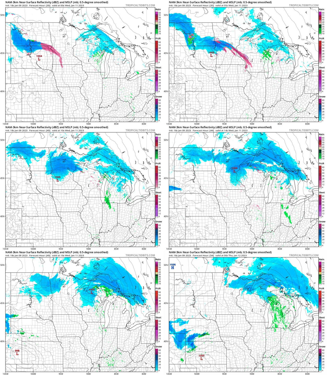
Then the next low-pressure wave will drive a thin layer of icy precipitation across the Twin Cities and central Minnesota Tuesday evening. Further north, it will be mostly light snow.
The National Oceanic and Atmospheric Administration’s NAM 3 km model (above) tracks the icy ribbon (pink) and snow shield (blue) across central and northern Minnesota between 6 p.m. Tuesday and 6 p.m. Wednesday.
The system will produce very light ice and snow accumulations around the greater Twin Cities. Accumulating snow will fall north of the metro area.

Most of central and northern Minnesota will likely end up with 1 to 3 inches of snow by Thursday. We could see some local 4-inch totals along and near the North Shore.

Temperature roller coaster this week
Our brutal December brought arctic air and colder-than-average monthly temperatures. The Twin Cities finished Dec. 4 degrees colder than average.
Fast forward to January and temperatures are relatively balmy by comparison. So far, the Twin Cities is running 4.4 degrees warmer than average this month.
Tuesday brings another relatively mild day. The average high and low for the Twin Cities are now 24 and 9 degrees.

Colder air pours south later this week. Right now, Friday looks like the coldest day.

Another thaw looks likely starting Sunday. A couple of forecast models suggest southern Minnesota will hit 40 degrees by Sunday and Monday.

Stay tuned.

