
Southeasterly breezes and mild Sunday temps
Low pressure system edges closer Sunday night
Go Deeper.
Create an account or log in to save stories.
Like this?
Thanks for liking this story! We have added it to a list of your favorite stories.


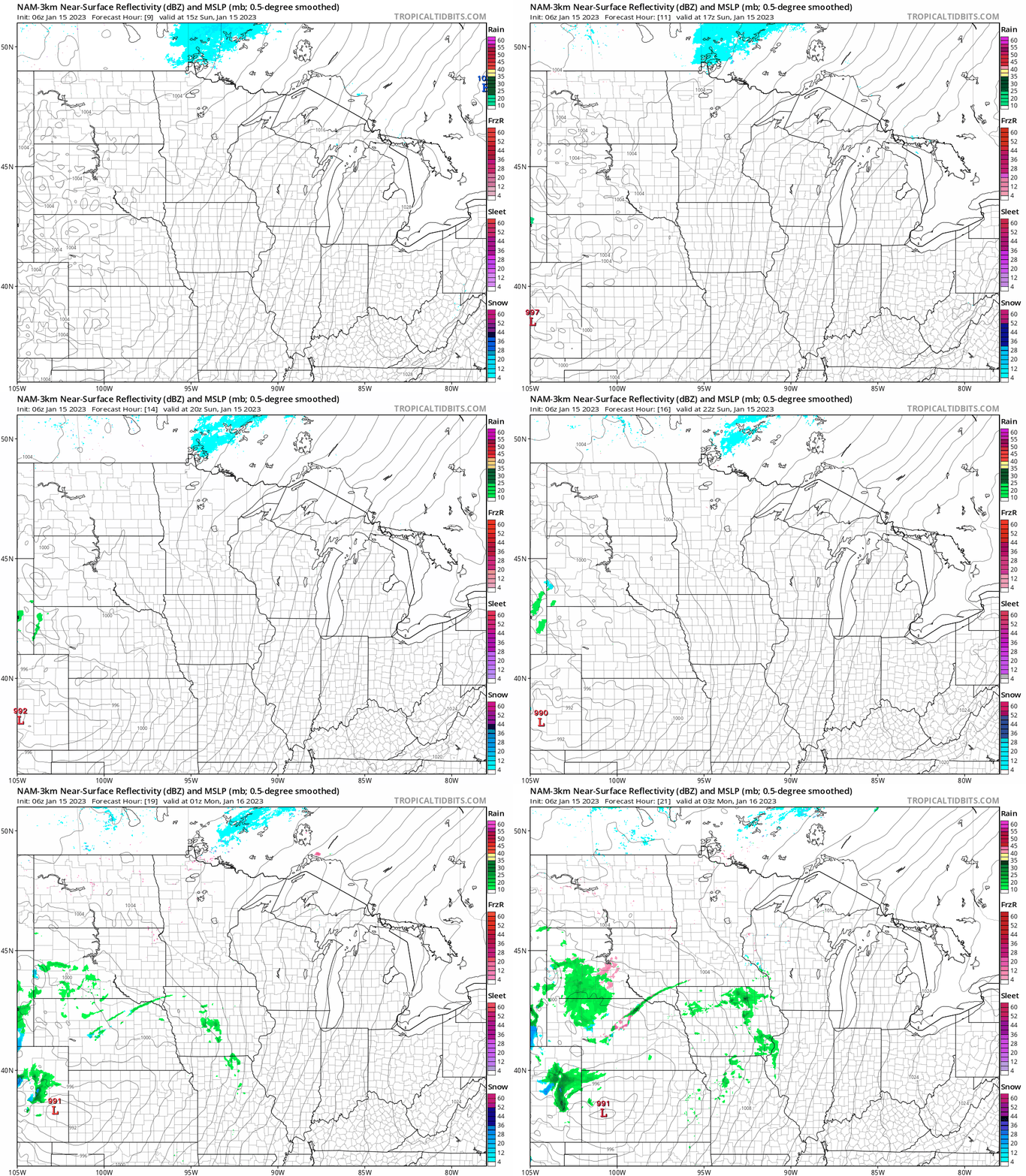
We’ll have a high-pressure system to our southeast and a low-pressure system to the west today. That combo will give us south-southeasterly breezes and mild temps.
The daylight hours today look dry in most of Minnesota and western Wisconsin. The National Oceanic and Atmospheric Administration’s North American Mesoscale (NAM) forecast model shows the pressure pattern and the potential precipitation pattern from 9 a.m. Sunday through 9 p.m. Sunday:
You can find updated weather information for Minnesota and western Wisconsin on the Minnesota Public Radio News network and on the MPR News live weather blog.
Sunday temps and wind chills
Our average Twin Cities high temperature is coldest from Jan. 10 through Jan. 24, at 23 degrees. Metro area highs will reach the upper 30s this Sunday. Highs in the 30s are on tap for most of Minnesota and western Wisconsin today:
Turn Up Your Support
MPR News helps you turn down the noise and build shared understanding. Turn up your support for this public resource and keep trusted journalism accessible to all.

Sunday afternoon wind chill temps will be mainly in the 20s:

Great conditions for fun in the snow
If sledding, snowboarding or cross-country skiing are in your Sunday plans, you’ll be happy to know that there’s plenty of snow on the ground across most of Minnesota:

The official Twin Cities snow depth is 12 inches right now, but some spots in the metro area have snow depths of 15 inches or higher.
The snow cover may have gone down slightly since the map was created on Thursday, but the purple areas on the snow depth map indicate 18 inches or more of snow cover from northern Isanti County and northern Chisago County up through northeastern Minnesota.
The light purple areas in Pine County and portions of northeastern Minnesota have 24 inches or more of snow on the ground.
Some spots in far southeastern Minnesota have 2 inches or less of snow cover.
Update
A new Updraft will be posted around 10:30 a.m. today. It will include a look at the week ahead, including our rain and snow potential on Monday and Tuesday.
Programming note
You can hear my live weather updates on MPR News at 7:35 a.m., 9:35 a.m. and 4:39 p.m. Saturday and Sunday.

