
Deep freeze weekend: Seriously subzero lows set to drop across Minnesota
Coldest air mass in 6 weeks arrives this weekend, may stick around

Go Deeper.
Create an account or log in to save stories.
Like this?
Thanks for liking this story! We have added it to a list of your favorite stories.


Our balmy Minnesota January is about to come crashing down next weekend.
Check out how far above average temperatures are running so far this month:
Twin Cities +7.8 degrees
Duluth +10.9 degrees
International Falls +13.3 degrees
This week brings quiet and relatively seasonal weather with only a couple of chances of snow showers. An arctic front will blow through Minnesota Friday. It brings some light fluff, and then the coldest temperatures in six weeks.
A few forecast models suggest the inbound air mass may be the coldest air of the winter season, and it could linger into early February.
Turn Up Your Support
MPR News helps you turn down the noise and build shared understanding. Turn up your support for this public resource and keep trusted journalism accessible to all.
Quiet for now
The average high and low for the Twin Cities this week is about 24 and 8 degrees. Highs this week will run in the 20s across most of Minnesota with a few highs in the teens up north.

Light snow chances
There may be a few light snow showers at times this week but the best chance for any accumulating snow arrives Friday. An Alberta clipper looks likely to spread snow into the Red River Valley Thursday night, then race southeast across Minnesota Friday.
I like the looks of the Canadian model, which lays out a pretty wide snow zone pulsing southeast across our region Thursday night through Friday.
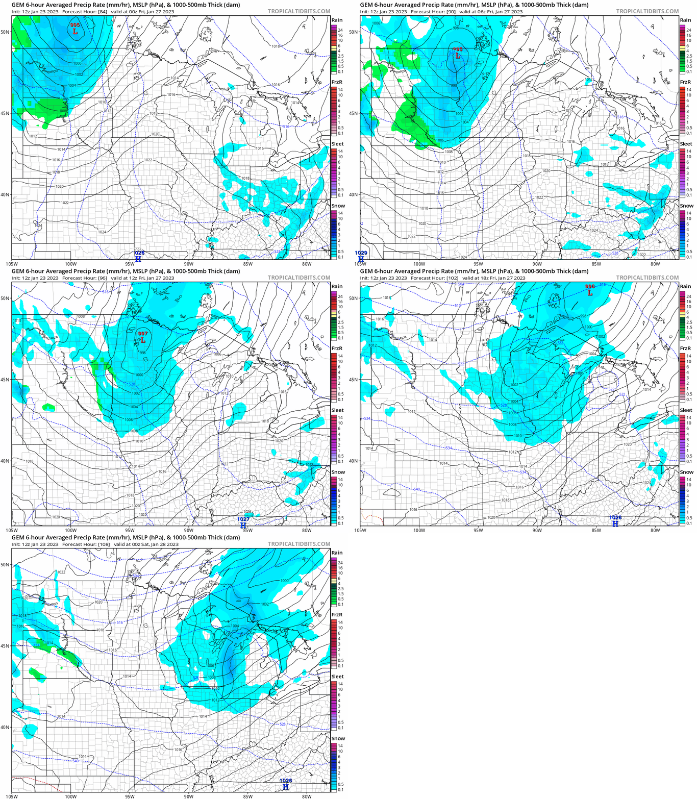
Most forecast models suggest a few inches of light fluffy snow Friday will pave the way for the arctic invasion.
Long-duration subzero cold?
It’s still early, but some forecast models suggest the coming subzero streak could last several days and linger well into next week.
The National Oceanic and Atmospheric Administration’s Global Forecast System model is cranking out lows in the minus 10s and possibly minus 20s for the Twin Cities and southern Minnesota, with minus 30s up north.
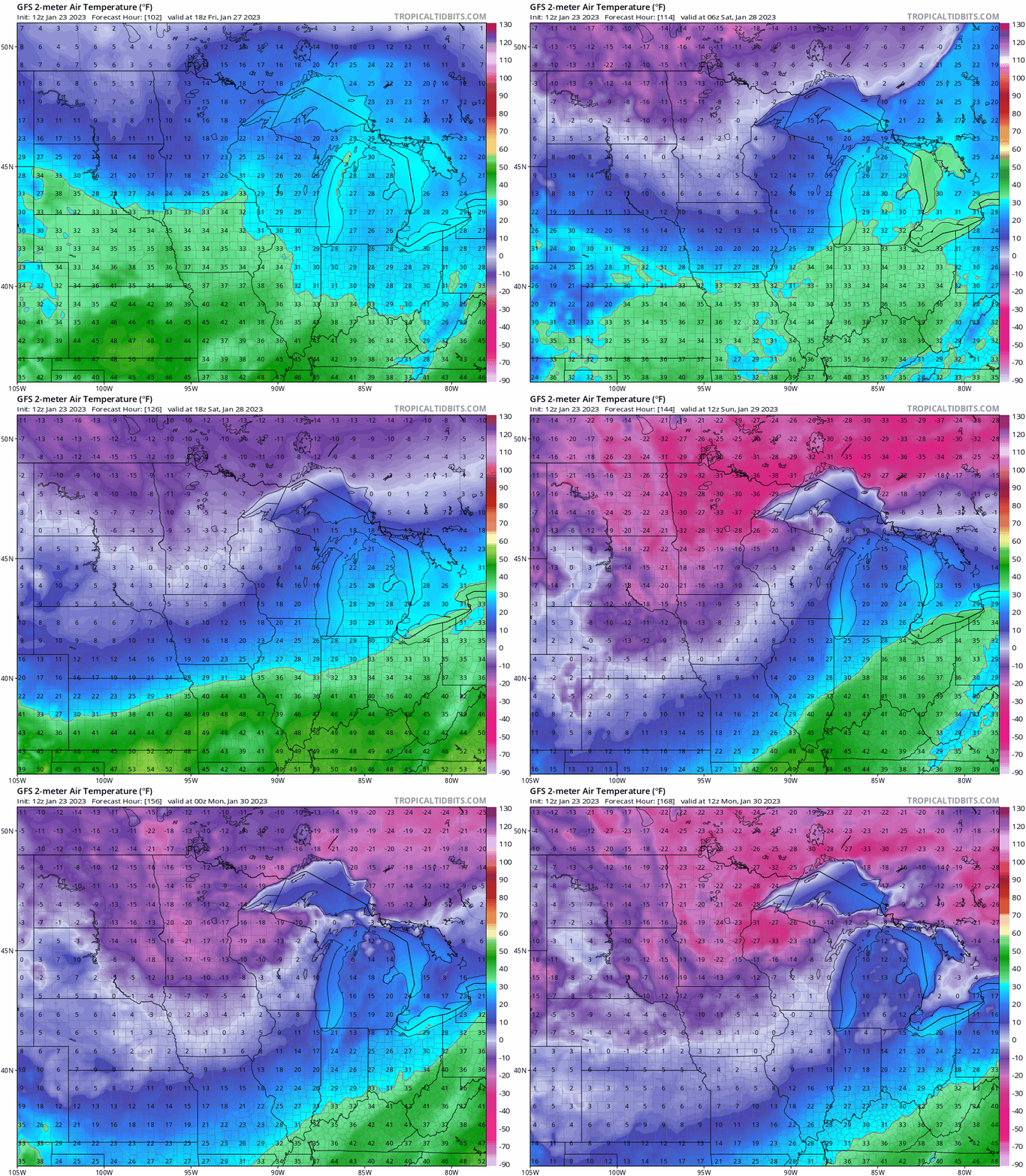
The coldest temperature so far this winter in the Twin Cities is minus 12 degrees on Dec. 23. There are early signs next week’s air mass will be colder.
Get out and enjoy our seasonal temperatures and abundant snow cover this week. Let’s see how the magnitude and duration of the coming cold wave evolve this week.
Stay tuned.

