
Light snow chances ahead; subzero air arrives this weekend
This could challenge the coldest air of winter for the Twin Cities so far
Go Deeper.
Create an account or log in to save stories.
Like this?
Thanks for liking this story! We have added it to a list of your favorite stories.


Our balmy January is about to turn significantly frigid.
So far, temperatures this month are running 7.7 degrees warmer than average this month in the Twin Cities. It’s been closer to 12 degrees above average in northeastern Minnesota. Western Minnesota has been a little less warm compared to average.

Light snow chances
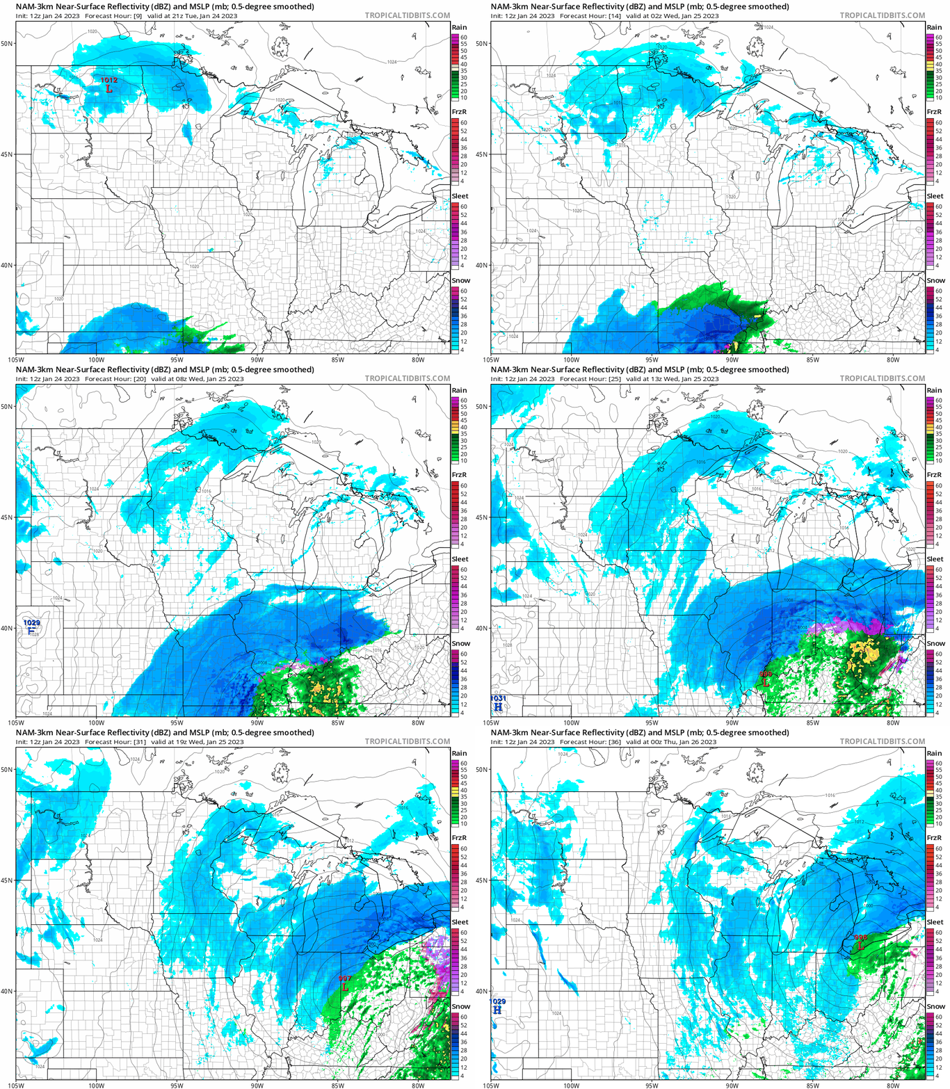
A couple of chances for light snow will drift through Minnesota this week. A weak low-pressure system drifting south across Minnesota is producing light snow today through Wednesday.
The National Oceanic and Atmospheric Administration’s NAM 3 km model paints the light snow zones through Wednesday. Note the bigger snowfall event pushing along and north of the Ohio River Valley to our south.
Turn Up Your Support
MPR News helps you turn down the noise and build shared understanding. Turn up your support for this public resource and keep trusted journalism accessible to all.
The loop below runs between 3 p.m. Tuesday and 6 p.m. Wednesday. Most locations will pick up an inch of snow or so through Wednesday with some local 2-inch totals favoring northern Minnesota.
Friday brings another shot of snow in advance of our weekend arctic outbreak. Snow will spread rapidly from the Red River Valley Thursday night, across Minnesota overnight. The Canadian model loop below runs between 6 p.m. Thursday and noon Friday.
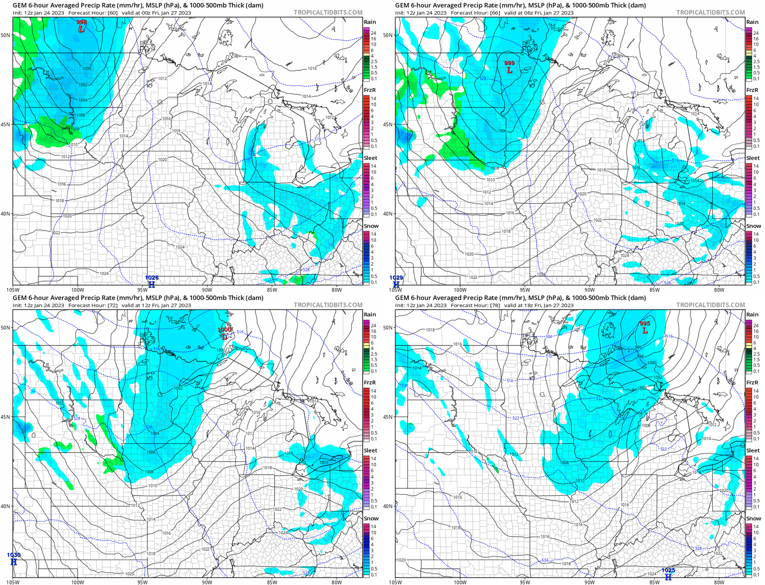
Most forecast models lay out a total of between 2 and 5 inches of snow combined from both systems through Friday night in northern Minnesota. It looks more likely we’ll accumulate 1 to 3 inches combined this week across southern Minnesota, including the Twin Cities.

Subzero weekend ahead
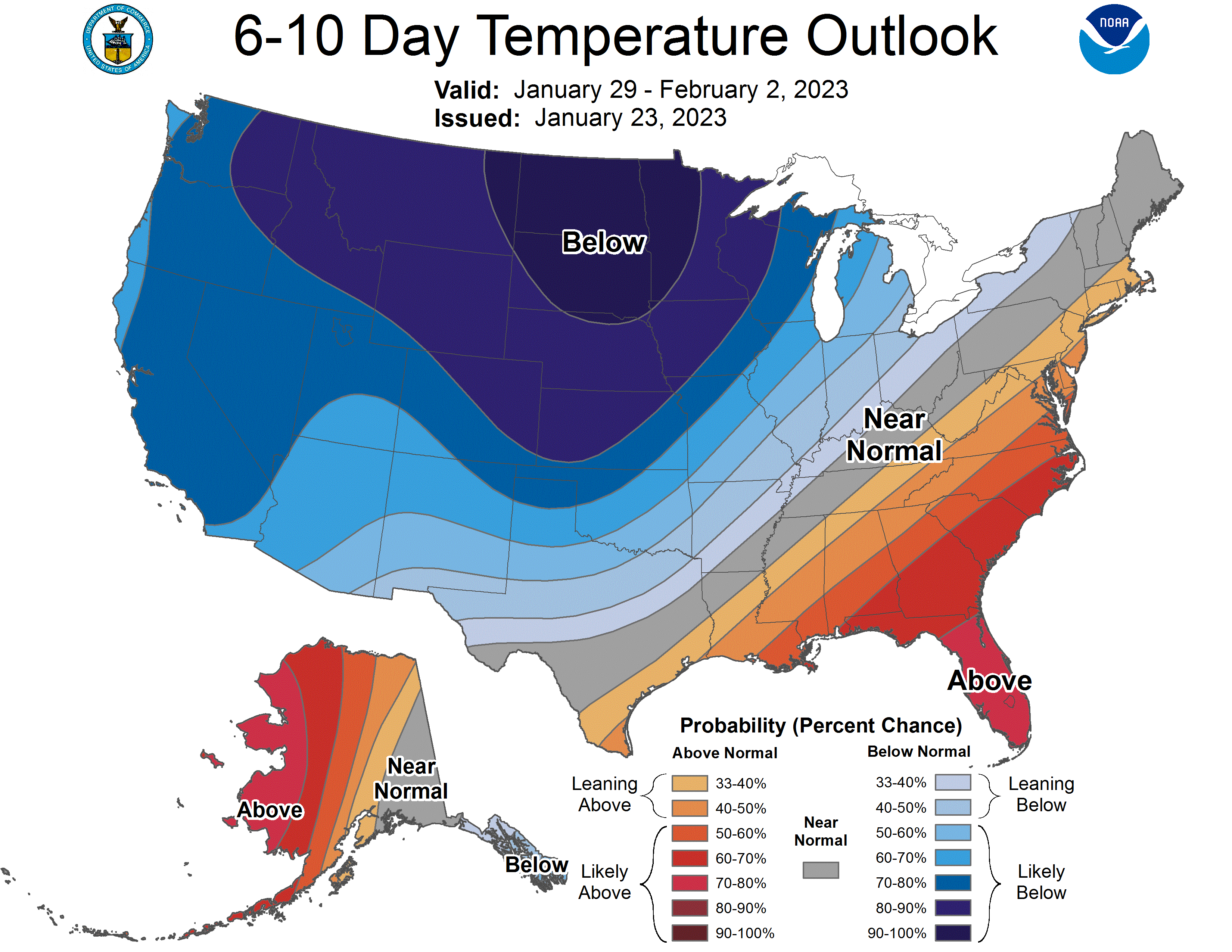
It’s still a little early to gauge the precise magnitude and duration of the upcoming weekend arctic outbreak. But several nights of subzero air look likely starting this weekend into next week.
Most forecast models suggest the Twin Cities and southern Minnesota will see teens below zero, with minus 20 and minus 30 across northern Minnesota into early next week.
Here’s the European Centre for Medium-Range Weather Forecasts model temperature output for next Monday at 6 a.m.:

The coldest temperature so far this winter in the Twin Cities is minus 12 degrees on Dec. 23. We have a shot to go lower by next Monday morning.
Stay tuned.

