
Pacific breeze: Extended February thaw this week
Highs above freezing most days into next week?

Go Deeper.
Create an account or log in to save stories.
Like this?
Thanks for liking this story! We have added it to a list of your favorite stories.


Welcome to the prolonged February thaw of 2023.
We’re in for a string of significantly milder-than-average days ahead. A persistent flow of Pacific air will persist across Minnesota for most of the next week.
We get thaw days in February, but it’s pretty unusual to get a prolonged February thaw like this. Keep in mind our average high and low temperatures in the Twin Cities this week are 26 and 10 degrees.
Pacific flow
Upper air flow patterns control large-scale temperature trends in Minnesota. This is especially true in winter. The upper winds over Minnesota blow from the northwest for most of the winter season. Occasionally we get a Pacific flow that pumps in milder air.
Turn Up Your Support
MPR News helps you turn down the noise and build shared understanding. Turn up your support for this public resource and keep trusted journalism accessible to all.
But check out the upper air (500 millibars) flow around 18,000 feet above the ground for the next week. See how the warm color tones keep pumping into Minnesota from the northern Pacific Ocean?
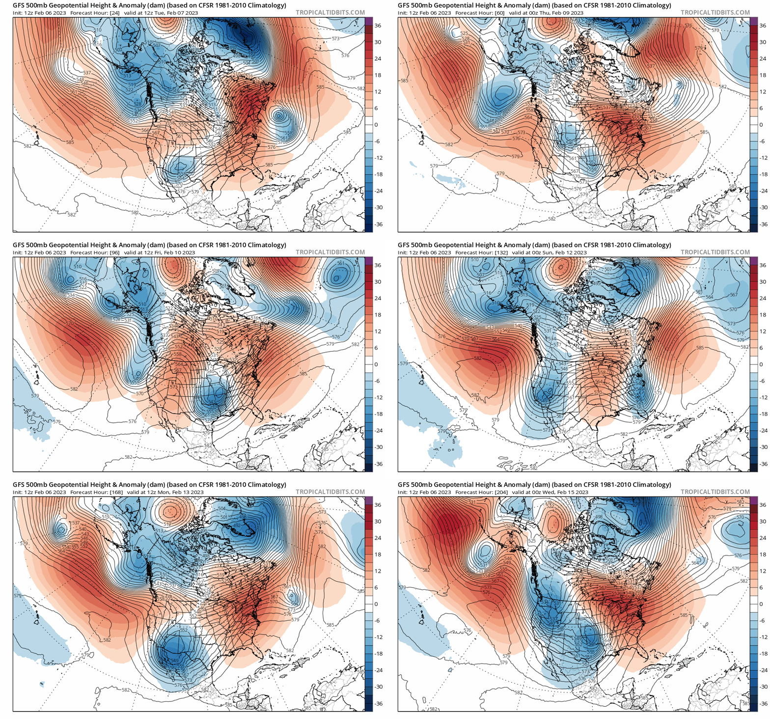
That means our milder-than-average temperatures in the 30s will persist most days.
Right now, the warmest days look like Wednesday and next Sunday. Highs in the upper 30s look likely for much of Minnesota. If we get enough sun Wednesday, I think we’ll see some 40-degree temperatures around the Twin Cities and parts of Minnesota Wednesday afternoon.

A weak cold front will knock temperatures back a bit into the 20s Friday. But I think we’ll see a quick rebound back into the upper 30s to around 40 degrees by Sunday afternoon.
The National Oceanic and Atmospheric Administration’s six to 10-day outlook continues the mild bias into next week:
More rain and snow?
One of the areas of weather forecasting I love best is the one to two-week outlooks. We’ve made a lot of progress with higher skills in forecasting temperature trends a week or two out. It’s much tougher to predict day-to-day precipitation events after a week out.
And this is a dicey time of winter to be making longer-range outlooks. Keep in mind we still average about 20 inches of snowfall for the Twin Cities through the rest of the winter season. We can and usually do still see a shot or two of subzero temperatures in late February and the first week of March in Minnesota.
But the current forecast pattern seems to favor above-average temperatures through February. If this pattern persists into March, I have a hunch we could see a quicker start to spring this year.
We’re still likely to get a couple of significant or big snow events in the next six weeks. But springtime warmth has been early and persistent in the Central Plains this month.

So it’s conceivable we could get a couple of early-season warm spells in March this spring in between snowfalls.
It’s going to be really interesting to see how the next six to eight weeks unfold this year.
Stay tuned.

