
Mild weekend temps; chilly Thursday, Friday next week
Plenty of snow cover across much of Minnesota
Go Deeper.
Create an account or log in to save stories.
Like this?
Thanks for liking this story! We have added it to a list of your favorite stories.


The Friday high temperature at Minneapolis-St. Paul International Airport was 29 degrees. That’s 2 degrees warmer than the average high temperature in the Twin Cities on Feb. 10.
Warmer temps are in the forecast this weekend.
Temperature trends
Saturday highs will be well into the 30s in most areas. Some spots in northwestern and north-central Minnesota could reach the lower 40s:

A few locations in the Twin Cities metro area and southeastern Minnesota might briefly touch 40 degrees Saturday afternoon. Most of us will enjoy plenty of sunshine on Saturday.
Turn Up Your Support
MPR News helps you turn down the noise and build shared understanding. Turn up your support for this public resource and keep trusted journalism accessible to all.
Sunday highs will be in the 30s in most locations:

Sunday will feature clouds and some peeks of sun.
Looking ahead to next week, Twin Cities metro area highs are projected to reach the upper 30s on Monday, then around 40 degrees on Tuesday, followed by upper 30s Wednesday. Metro area highs may only reach the lower 20s on Thursday and around 20 degrees on Friday.
The Twin Cities metro area will probably see some periods of rain Tuesday afternoon into Tuesday night, with a changeover to a rain-snow mix on Wednesday. Check forecast updates.
Dry weekend in most areas
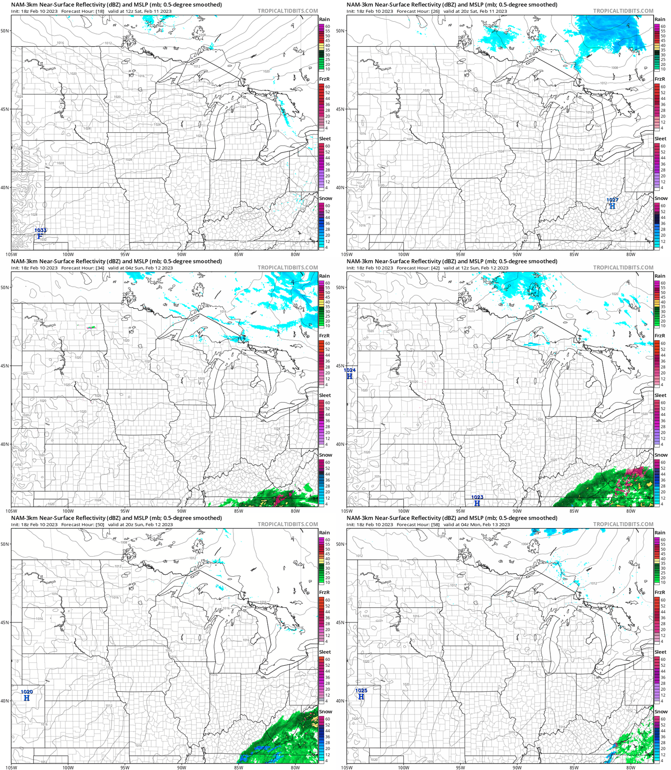
The weekend weather will be drama-free for most of us. It’ll be a bit breezy on Saturday as a low-pressure system moves across southern Canada, then the winds will ease up on Sunday.
Parts of far northern Minnesota could see a few scattered sprinkles or flurries late Saturday night and early Sunday morning. The National Oceanic and Atmospheric Administration’s North American Mesoscale (NAM) forecast model shows the surface pressure pattern and the precipitation pattern from 6 a.m. Saturday to 10 p.m. Sunday:
You can find updated weather information for Minnesota and western Wisconsin on the Minnesota Public Radio News network, and on the MPR News live weather blog.
Plenty of snow cover for winter fun
If your weekend plans include sledding, cross-country skiing or snowboarding, the weekly snow depth map from the Minnesota Department of Natural Resources shows plenty of snow on the ground across much of Minnesota:

The current official Twin Cities snow depth, measured at Minneapolis-St. Paul International Airport, is 8 inches. Some spots in the far north metro have snow depths of 12 inches or more.
The purple-shaded areas from northern Pine County through northeastern Minnesota have snow depths of 18 inches or more. The light-purple shaded areas in northeastern Minnesota have 24 to 30 inches of snow cover.
Weather nugget
The average Twin Cities high temperature rises from 27 degrees on Feb. 10 to 39 degrees by March 10. On April 10, the average Twin Cities high temperature is 55 degrees.
Programming note
You can hear my live weather updates on MPR News at 7:35 a.m., 9:35 a.m. and 4:39 p.m. Saturday and Sunday.

