
Temps set to rebound Friday afternoon; weekend highs in the 30s
Snowstorm raking Iowa, southern Wisconsin, northern Illinois
Go Deeper.
Create an account or log in to save stories.
Like this?
Thanks for liking this story! We have added it to a list of your favorite stories.


Northern and central Minnesota are enjoying a lot of sunshine Thursday morning. Much of southern Minnesota is covered with clouds that are rotating around a low-pressure system centered over southeastern Missouri. The Twin Cities metro area will be riding the northern edge of the clouds into the afternoon.
Snowstorm update
The Missouri low-pressure system will track northeastward Thursday afternoon and evening, delivering several inches of snow to much of southern and eastern Iowa plus parts of southern Wisconsin and northern Illinois.
The National Oceanic and Atmospheric Administration’s North American Mesoscale (NAM) forecast model shows the potential precipitation pattern from 10 a.m. to 10 p.m. Thursday:
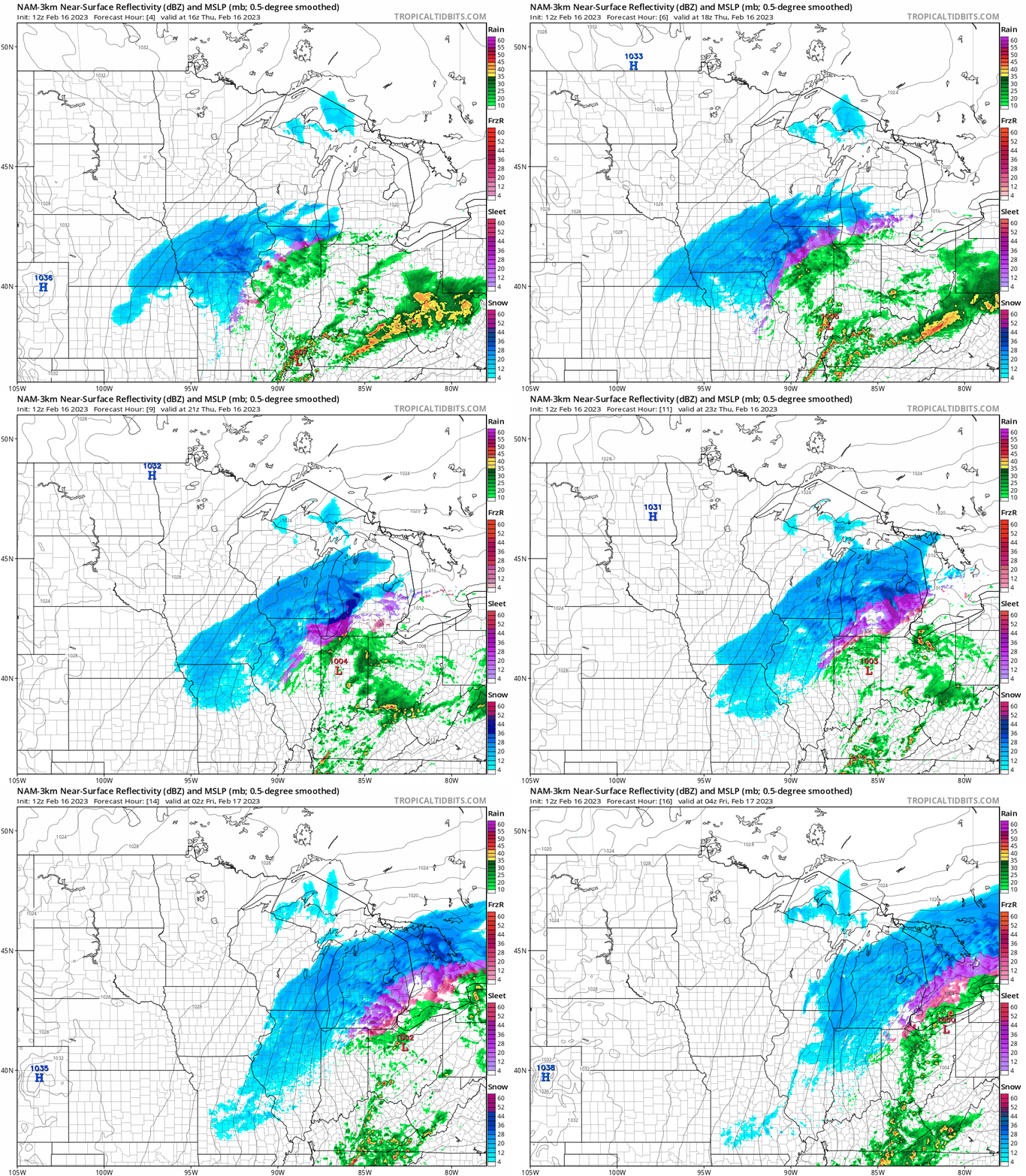
Winter storm warnings extend from southeastern Nebraska through northwest Missouri, southern and eastern Iowa and into southern Wisconsin and far northern Illinois:
Turn Up Your Support
MPR News helps you turn down the noise and build shared understanding. Turn up your support for this public resource and keep trusted journalism accessible to all.

Here are winter storm details for Iowa:

Here are winter storm details for Wisconsin:

Forecast snow totals are highest in southeastern Wisconsin:

Our Minnesota weather is very quiet Thursday. Far southeastern Minnesota could see a light snow shower.
You can find updated weather information for Minnesota and western Wisconsin on the Minnesota Public Radio News network, and on the MPR News live weather blog.
Temps rebound Friday afternoon
Much of Minnesota will have Thursday highs in the teens. Some spots in far northwestern Minnesota will see single-digit highs. Southeastern Minnesota and parts of western Wisconsin will reach the lower 20s.
Some spots in the Twin Cities metro area could top 20 degrees. The average Feb. 16 Twin Cities high temp is 29 degrees. Low temps early Friday will be below zero in many areas:

Friday afternoon highs will be well into the 20s in most locations, with some lower 30s in northwestern Minnesota:

Winds will ramp up Friday afternoon, with gusts over 30 mph in western and northern Minnesota:

Forecast gusts are in knots, with 27 knots equal to 31.1 mph.
Winds will diminish a bit this weekend, and many areas will have weekend highs in the 30s.
Programming note
You can hear my live weather updates on MPR News at 7:35 a.m., 9:35 a.m. and 4:39 p.m. Saturday and Sunday.

