
Mild Sunday temps in most areas; Periods of snow on Monday
Heavy snow is possible midweek
Go Deeper.
Create an account or log in to save stories.
Like this?
Thanks for liking this story! We have added it to a list of your favorite stories.


The Saturday high temp at Minneapolis St. Paul international Airport was 36 degrees. That’s well above the average Feb. 18 Twin Cities high of 30 degrees. I noticed that Blaine in the north metro touched 39 degrees.
Much of Minnesota and western Wisconsin had Saturday highs in the 30s. Some areas will have two more days with mild temps.
Temperature trends
Sunday highs will reach the 30s in most of eastern and southern Minnesota plus western Wisconsin. There’ll be a lot of 20s in west-central and northwestern Minnesota, with some teens in far northwestern Minnesota:

Monday highs will be in the 30s in southern and central Minnesota, with 20s in the north:
Turn Up Your Support
MPR News helps you turn down the noise and build shared understanding. Turn up your support for this public resource and keep trusted journalism accessible to all.

Twin Cities metro area highs are projected to retreat to the lower 20s for Tuesday and Wednesday, followed by upper teens on Thursday and Friday.
Snow chances
A low pressure system tracking across southern Canada will give far northern Minnesota periods of light snow Saturday night into Sunday morning. Snow amounts are generally expected to be one inch or less, but some spots close to the Canadian border could see around two inches of snow by Sunday morning.
A clipper system will bring a shot of snow to much Minnesota and western Wisconsin Sunday night into Monday. The National Oceanic and Atmospheric Administration’s North American Mesoscale (NAM) forecast model shows the potential precipitation pattern from 5 p.m. Sunday to 11 p.m. Monday:
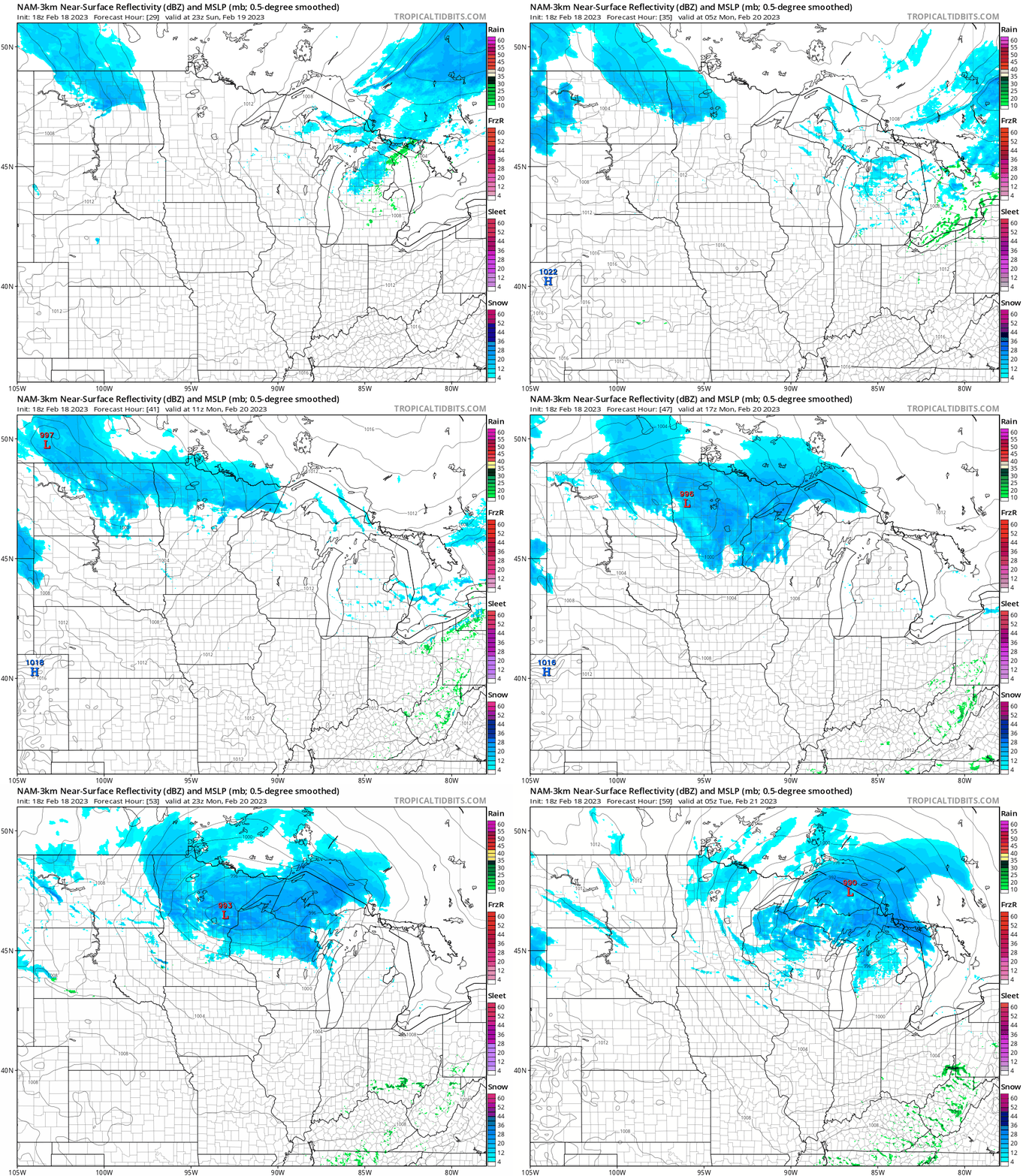
Less than one inch of snow is expected in Twin Cities metro area on Monday, but parts of northern Minnesota will see several inches of snow Monday into Monday evening:

Far northwestern Wisconsin could tally 2 to 3 inches of snow Monday/Monday night.
You can find updated weather information for Minnesota and western Wisconsin on the Minnesota Public Radio News network, and on the MPR News live weather blog.
Snowstorm potential Tuesday night into Thursday
A slow-moving low pressure system is expected to bring significant snow and strong winds to portions of the upper Midwest from Tuesday night through Wednesday and into Thursday. Parts of South Dakota, Minnesota and Wisconsin could see double-digit snowfall totals from the storm.
The storm may deliver two episodes of heavy snow. The first arrives Tuesday night and lingers into Wednesday morning. Another batch of heavier snow may arrive Wednesday night and linger into Thursday.
The timing and position of the heaviest snow bands will become clearer as we get closer to Tuesday night/Wednesday.
Here’s the NWS summary of the winter storm potential:

Programming note
You can hear my live weather updates on MPR News at 7:35 a.m., 9:35 a.m. and 4:39 p.m. Saturday and Sunday.

