
Light snow Tuesday night; slippery roads likely into Wednesday
1-3 inches expected in Twin Cities
Go Deeper.
Create an account or log in to save stories.
Like this?
Thanks for liking this story! We have added it to a list of your favorite stories.


It’s been a weird weather February in Minnesota.
Bouts of rain and ice have fallen in a month that typically brings precipitation in the form of snow.
Monday brought record precipitable water values to the atmosphere above Minnesota.
We felt the coldest morning of winter on Feb. 3 at minus 13 in the Twin Cities. Then the warmest afternoon with 45 degrees just five days later on Feb. 8.
Turn Up Your Support
MPR News helps you turn down the noise and build shared understanding. Turn up your support for this public resource and keep trusted journalism accessible to all.
The entire month’s snowfall of 15.5 inches fell last week between Monday and Friday. That’s about 7 inches more than average for the month. Last week’s storm dumped 17 to 20 inches in the southern Twin Cities.
Now we watch as the next weak to moderate weather system glides into Minnesota Tuesday night.
The system
This is a weak to moderate low-pressure system that moved off the northern Pacific Ocean along the Washington coast Sunday into Monday.
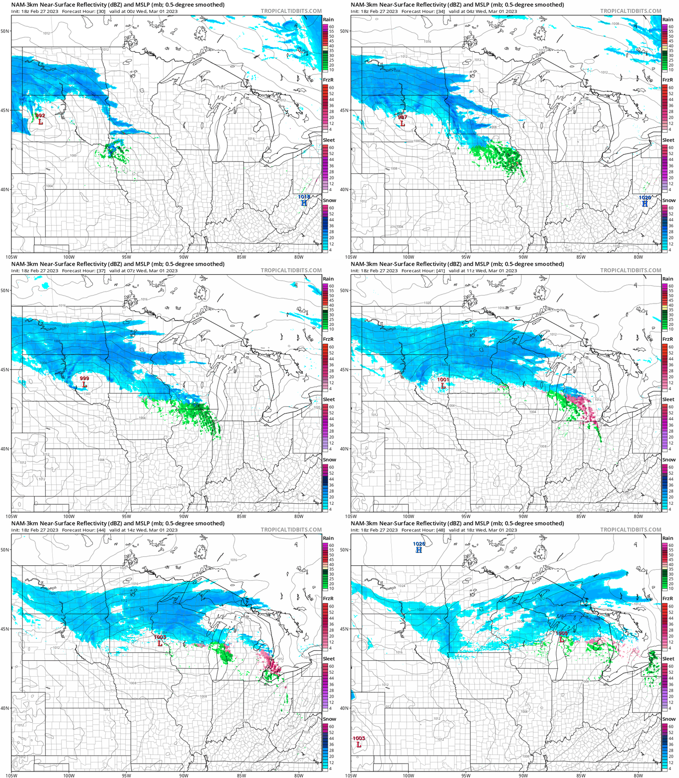
The National Oceanic and Atmospheric Administration’s NAM 3 km model tracks waves of light to moderate snowfall across central and southern Minnesota Tuesday evening through midday Wednesday.
The loop runs between 6 p.m. Tuesday and noon Wednesday:
Snowfall timing and totals
Snowfall likely begins in southwestern Minnesota early Tuesday evening. The snow will spread east Tuesday evening. Most models suggest it will arrive in the Twin Cities after about 8 to 9 p.m.
The more moderate bands of snow favor areas between the northern Twin Cities along and south of a line from Fargo, N.D., to Duluth. Most forecast models are in close agreement with a general zone of 1 to 3 inches with this system through Wednesday for the greater Twin Cities area.

The heaviest snowfall zone is likely to set up in west-central Minnesota where 2 to 5 inches looks most likely.

Temperatures with this snowfall will hover in the 20s across central and southern Minnesota with teens north. That means it will be cold enough for slippery roads Tuesday night through Wednesday morning.

Stay tuned.

