Next rain-snow chance lurks Thursday into Saturday

Forecast models still grappling with storm track

Wintry weather outlook
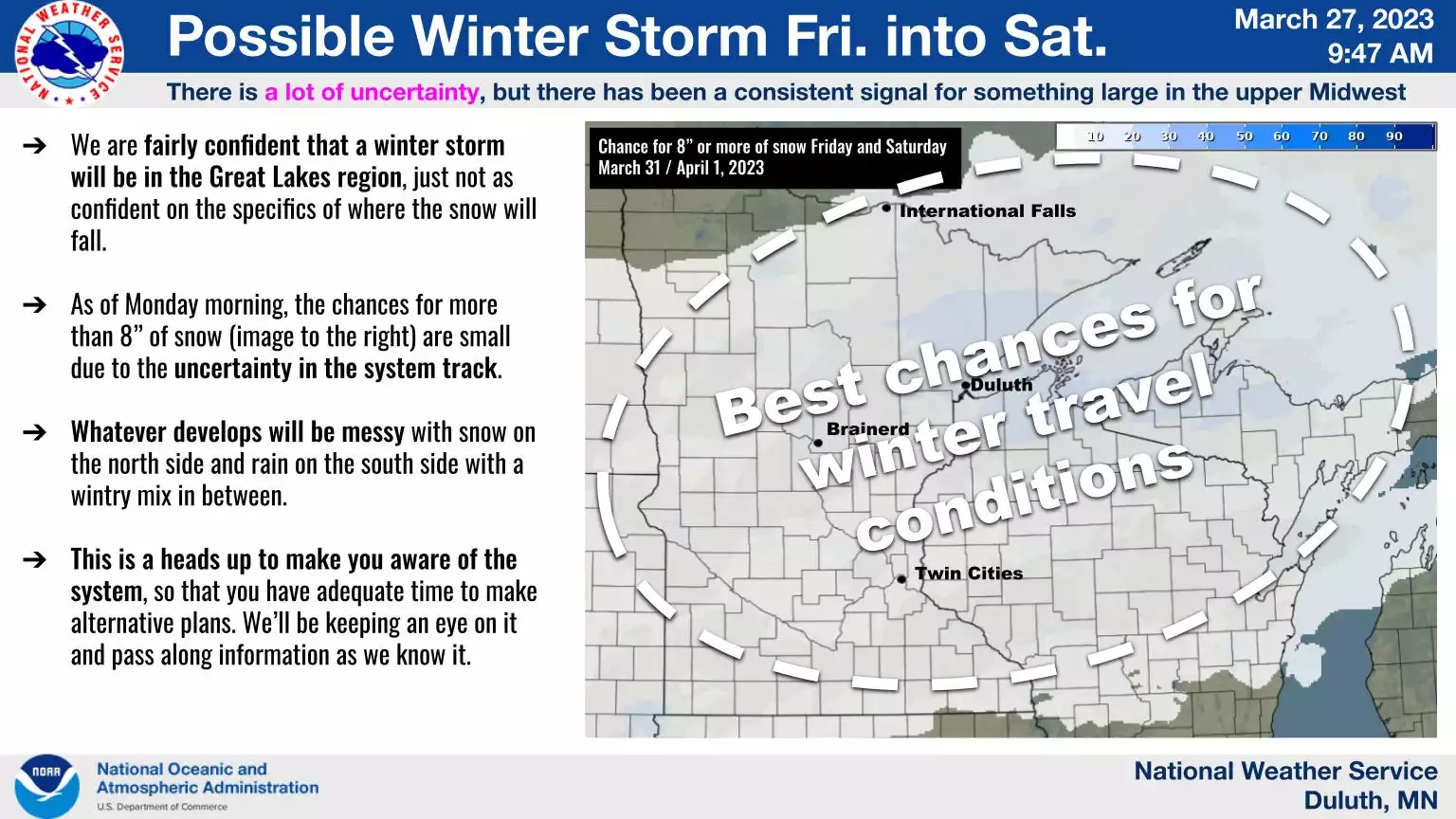
Wintry weather outlook Friday and Saturday.
Duluth National Weather Service office

And the wintry weather hits just keep on coming.

Temperatures are running about 3 degrees colder than average so far this month in the Twin Cities. Across Minnesota, temperatures are running from near average in the southeast, to as much as 10 degrees colder than average in the Red River Valley.

So it’s no big surprise that another colder than average week is on tap to close out March 2023. Another chance of rain or snow is showing up in the forecast models Thursday and Friday.

Chilled sunshine for now

Monday through Wednesday brings plenty of sunshine to Minnesota, but the price is another shot of colder-than-average air. High temperatures Tuesday will run from the teens northwest to the 30s southeast.

Create a More Connected Minnesota

MPR News is your trusted resource for the news you need. With your support, MPR News brings accessible, courageous journalism and authentic conversation to everyone - free of paywalls and barriers. Your gift makes a difference.

Forecast high temperatures Tuesday
NOAA

Tuesday night will be the coldest night of the week. Check out the ridiculous subzero temperatures to the northwest in the last week of March:

Forecast low temperatures Wednesday
NOAA

Wednesday brings highs mostly in the 20s.

Rain, snow chances Thursday and Friday

Our next weather system blows into the Upper Midwest Thursday and Friday. The forecast models are still working out storm track and temperature profiles with this system.

So far, most forecast models suggest mostly rain from the Twin Cities southward from Thursday into Friday. Many then suggest a rain-to-snow scenario later Friday night into early Saturday.

The Canadian model solution below is similar to the European model. The loop below runs between 7 p.m. Thursday and 7 a.m. Saturday.

Canadian model
Canadian model between 7 p.m. Thursday and 7 a.m. Saturday
Environment Canada, via Tropical Tidbits

The National Oceanic and Atmospheric Administration’s often less reliable Global Forecast System model suggests the Twin Cities would be in the heavier snow zone late Friday into Saturday.

We’ll see how the models react Tuesday.

The bottom line is we’re going to close out March much colder than average across Minnesota, and one more rain-snow system arrives Thursday and Friday.

So it looks like we’ll book the first March in 22 years without a 50-degree temperature in the Twin Cities.

A few forecast models suggest temperatures could approach 50 degrees again from the Twin Cities southward by Sunday afternoon.

Stay tuned.