
Rain, thunder, snow for swaths of Minnesota Wednesday through Friday
Most of the snow should stay north of the Twin Cities this time
Go Deeper.
Create an account or log in to save stories.
Like this?
Thanks for liking this story! We have added it to a list of your favorite stories.


It was a nice Tuesday across our region! We topped out in the mid-50s in the Twin Cities Tuesday. Our average high and low are now 58 and 39 degrees.
But here comes the next weather system.
Rain early Wednesday
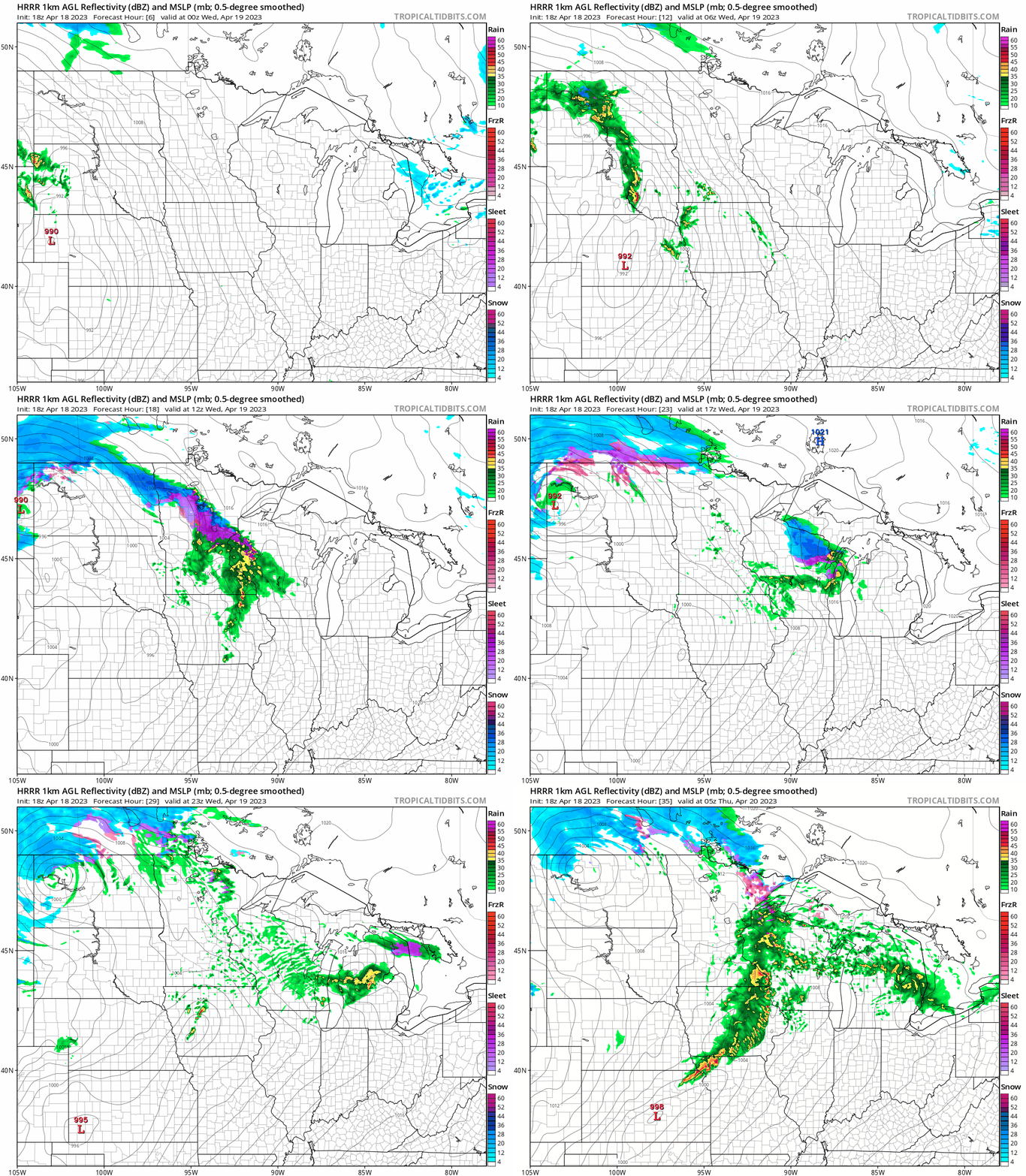
Rain and thunderstorms will blossom overnight across southwestern Minnesota, with the first wave rolling around midnight. Rain and embedded thunder likely arrive in the greater Twin Cities area from around 4 a.m. through 8 a.m. Wednesday.
The National Oceanic and Atmospheric Administration’s High-Resolution Rapid Refresh model shows the initial wave of rain and thunder moving from southwestern Minnesota around midnight into the Twin Cities early Wednesday morning.
Turn Up Your Support
MPR News helps you turn down the noise and build shared understanding. Turn up your support for this public resource and keep trusted journalism accessible to all.
Note the mixed ice and snow band moving through central Minnesota early Wednesday.
A second wave of rain and thunder likely develops from about the Twin Cities southward late Wednesday afternoon and evening. The High-Resolution Rapid Refresh loop below runs between 1 a.m. Wednesday and midnight Thursday.
Another soaker
Several rivers are in major flood stage around our region. We don’t need another shot of heavy precipitation, but that looks like what we’ll see. Another inch or two of precipitation is likely across most of Minnesota this week.
Here’s the European Centre for Medium-Range Weather Forecasts model precipitation output through 1 p.m. Friday:

Snow up north
This next system looks warm enough for mostly rain in the Twin Cities and southern Minnesota. But it will be cold enough for snow again up north.
Don’t take these totals literally yet, but the Canadian model below gives you the idea of another plowable snowfall event up north Thursday and Friday.

Highs Wednesday and Thursday will make the lower 50s across southern Minnesota. It will be noticeably colder up north.

Hang in there.

