
Rain, thunder, ice, snow through Thursday
Expect weekend temps in the 30s north, 40s south

Go Deeper.
Create an account or log in to save stories.
Like this?
Thanks for liking this story! We have added it to a list of your favorite stories.


We’re getting weather frequent flyer miles this year in Minnesota.
The main body of our next inbound storm arrives overnight into Thursday. This will bring a variety of precipitation types to different parts of Minnesota.
Let’s start with rain and thunder. Precipitation will be mostly rain in the southern third of Minnesota including the greater Twin Cities. Thunderstorms are already booming in southwestern Minnesota as I write this post. Additional waves will roll north from Iowa Wednesday night.
Tornado watches are up for much of western Iowa. A severe thunderstorm watch for northwestern Iowa includes Nobles and Jackson counties in southwestern Minnesota until 11 p.m. Wednesday night.
Turn Up Your Support
MPR News helps you turn down the noise and build shared understanding. Turn up your support for this public resource and keep trusted journalism accessible to all.
Additional watches and severe weather warnings are possible across southern Minnesota overnight into Thursday. There is a marginal to slight risk of severe storms with hail and high winds for southern Minnesota. We may hear non-severe thunder across much of Minnesota overnight.

Another soaker
This system brings another soaking. The European Centre for Medium-Range Weather Forecasts and other forecast models suggest another inch or two of precipitation with this system.
Here’s the latest European model precipitation output through Friday:

Snow and ice up north
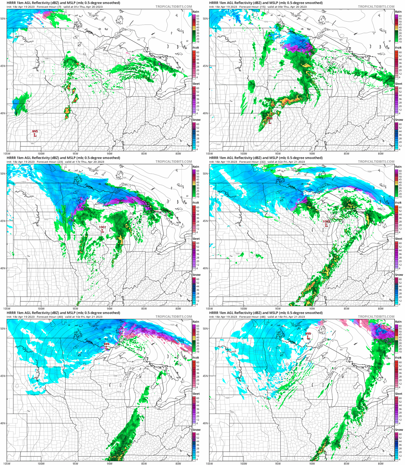
Temperatures will hover around the freezing mark across most of northern Minnesota with this system. That means another shot of ice and snow.
The National Oceanic and Atmospheric Administration’s High-Resolution Rapid Refresh model shows multiple waves of rain and thunder in the south, with ice and snow coverage increasing across northern Minnesota into Friday morning.
The loop below runs between 7 p.m. Wednesday and 7 a.m. Friday.
Ice and snowfall totals
As you can see at the top of this post, significant plowable snow is likely for northern Minnesota. There will also be a lighter icy glaze, especially in northeastern Minnesota.

Temperatures will continue to hover in the 30s north and 40s south into this weekend.

I’m still searching for a more consistent spring weather signal on the forecast maps.
Stay tuned.

