
Sunny and a bit milder weather through Wednesday
Less wind, potent late April sun will make it feel better

Go Deeper.
Create an account or log in to save stories.
Like this?
Thanks for liking this story! We have added it to a list of your favorite stories.


Let’s face it. This has been one of the most challenging winter-into-spring periods we can remember in Minnesota, so it pays to savor the silver weather linings these days.
Tuesday and Wednesday look like a couple of really nice early spring days.
Our pesky cloud cover shows a clearing trend overnight. That will set us up for increased sunshine Tuesday and Wednesday as a bubble of high pressure builds in over the Great Lakes.
Our elevating sun is now as powerful and high in the sky as it is on Aug. 16. Combine that with lighter winds Tuesday and Wednesday and temperatures rising through the 50s in the afternoon will feel surprisingly good.
Turn Up Your Support
MPR News helps you turn down the noise and build shared understanding. Turn up your support for this public resource and keep trusted journalism accessible to all.

Highs Tuesday will make the lower 50s across much of southern and central Minnesota. By Wednesday afternoon thermometers will edge up into the upper 50s in the south.
And by Thursday, highs will reach the lower 60s south with 50s north.

Next rain in sight
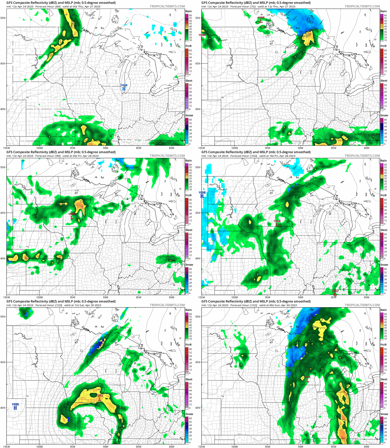
Yet another (unwelcome?) Thursday-Friday weather system will edge into Minnesota this week. Showers will be spotty at first. But the inbound low-pressure system appears likely to stall over Lake Michigan this weekend. That could keep spotty rain in the forecast well into the weekend.
The National Oceanic and Atmospheric Administration’s Global Forecast System model tracks bands of rain (and some snow) across the Upper Midwest between 7 p.m. Wednesday and 7 p.m. Saturday.
Enjoy the next couple of days!

