
Scattered rains now; 60s and 70s ahead
Weather maps finally trending milder
Go Deeper.
Create an account or log in to save stories.
Like this?
Thanks for liking this story! We have added it to a list of your favorite stories.


We finally made it to average. That’s been a tough task lately. The temperature topped out at 62 degrees Thursday afternoon at Minneapolis-St. Paul International Airport. That’s the warmest day in nearly two weeks. We hit 83 degrees on April 14.
The next low-pressure system delivers occasional scattered rain the next few days. The good news? The weather maps are trending milder again next week, and potentially much warmer for the second week of May.
Scattered rainfall
Our latest weather system is delivering more scattered rainfall to the Twin Cities and southern Minnesota. But the rain is steadier north and west of the Twin Cities.
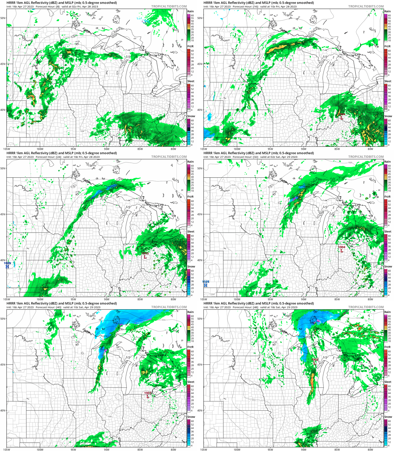
The National Oceanic and Atmospheric Administration’s High-Resolution Rapid Refresh model does a pretty good job of depicting the scattered and occasional nature of the rain — and a few snow showers — across Minnesota between 9 p.m. Thursday and 1 p.m. Saturday.
Turn Up Your Support
MPR News helps you turn down the noise and build shared understanding. Turn up your support for this public resource and keep trusted journalism accessible to all.
Precipitation totals
Overall rainfall totals for the next few days look light in the Twin Cities and southern Minnesota, but areas to the north may pick up soaking rains over the next few days.
NOAA’s North American Mesoscale 3 km model is typical of many that show less rain in the Twin Cities, with bands of one-half inch to 1 inch-plus across parts of central and northern Minnesota.

Milder next week
Highs will hover in the 50s for most of Minnesota into the weekend, with colder air up north.

Next week’s weather pattern looks generally sunnier, drier, and milder. Highs should reach the 60s more frequently by the middle of next week.

NOAA’s longer-range Global Forecast System model output is starting to show more consistent 70s again by the second week of May. That’s a long way off, but keep in mind these models are usually much better with temperature trends than precipitation events in the one to two-week range.

Still not super high confidence yet, but we’ll see how this pans out.
Stay tuned.

