
Consistently warmer next week
Expect a string of days well into the 70s
Go Deeper.
Create an account or log in to save stories.
Like this?
Thanks for liking this story! We have added it to a list of your favorite stories.


We’re taking baby steps into spring this year in Minnesota. Pleasantly mild air has wafted into the state. As of this post, we’ve topped at 77 degrees in the Twin Cities Thursday.
Temperatures will ease back slightly Friday and Saturday. Highs will generally be in the 60s across most of Minnesota Friday and Saturday.

Shower chances
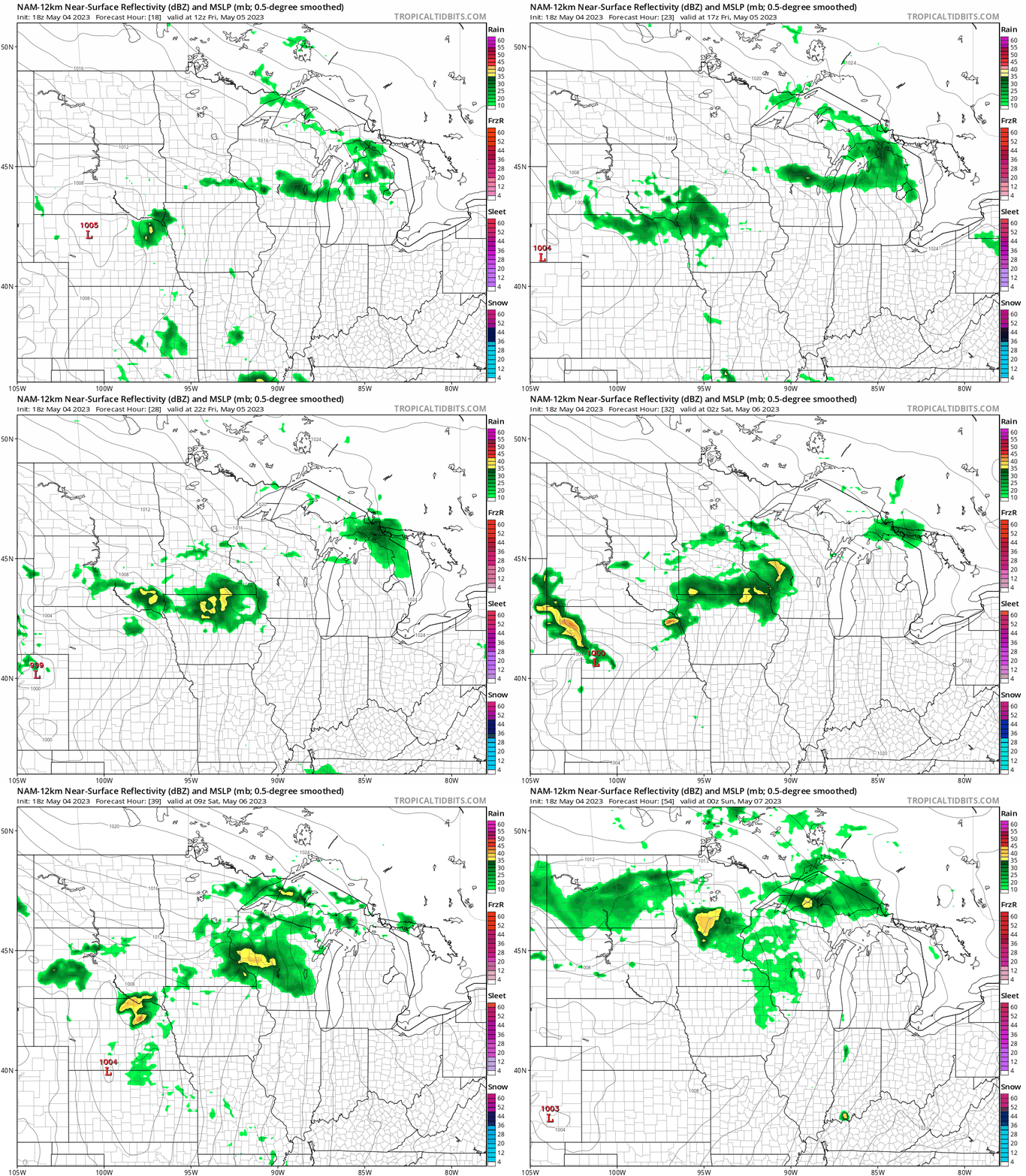
A weak weather system brings more clouds and some scattered rain showers Friday and Saturday. The National Oceanic and Atmospheric Administration’s North American Mesoscale model is typical of those that show scattered, occasional showers Friday into Saturday.
The forecast model loop below runs between 1 p.m. Friday and 7 p.m. Saturday.
Turn Up Your Support
MPR News helps you turn down the noise and build shared understanding. Turn up your support for this public resource and keep trusted journalism accessible to all.
Warmer next week
The overall jet stream pattern shows a change to a more persistently warm, upper-air flow aloft over Minnesota next week.

That will translate into a string of days well into the 70s next week.

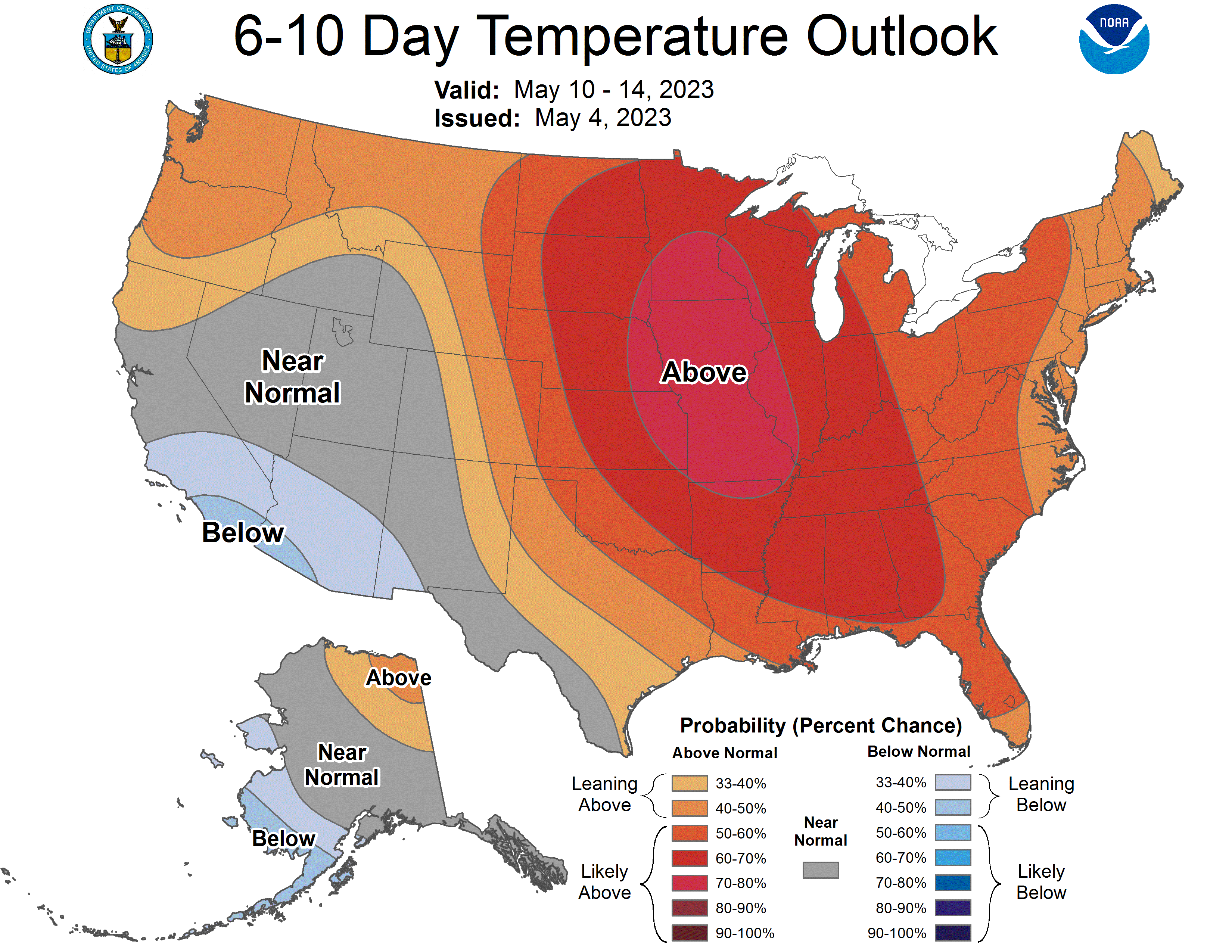
NOAA’s six to 10-day outlook at the top of this post strongly favors warmer-than-average temperatures next week.
We’ve earned it!

