
Scattered showers, smoke Thursday; 80s return next week
Summery air mass for Minnesota next week
Go Deeper.
Create an account or log in to save stories.
Like this?
Thanks for liking this story! We have added it to a list of your favorite stories.


It’s not often we write about cold fronts with smoky skies and scattered showers, but that’s precisely what’s in the forecast for Minnesota Thursday.
I posted earlier about the air quality alert issued for much of northern Minnesota. The cold front driving that wildfire smoke earthward will also spark a few spotty showers and thunderstorms as it sweeps across Minnesota Thursday.
The National Oceanic and Atmospheric Administration’s FV3 model tracks the broken line of showers and thunderstorms along the frontal zone as it sweeps through Minnesota. The forecast model loop below runs between midnight and 4 p.m. Thursday.
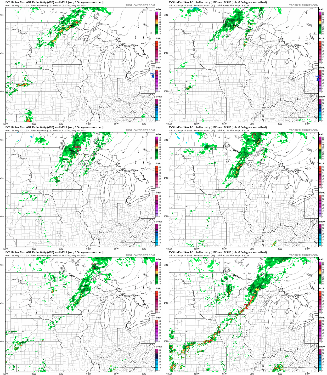
There is a marginal risk for severe storms in southeast Minnesota and into Wisconsin Thursday.
Turn Up Your Support
MPR News helps you turn down the noise and build shared understanding. Turn up your support for this public resource and keep trusted journalism accessible to all.
Rainfall looks spotty and light across most of southern Minnesota. We may see a few smoky raindrop residues on our cars with this one. More significant rainfall is likely in northern Minnesota. Between one-half and 1 inch of rain is possible Thursday in northeastern Minnesota.

Friday brings a blustery colder day. Highs will hover in the lower 60s Friday in much of Minnesota with a northwest breeze at 10 to 20 mph.

Sunshine and milder weather return for the weekend. Highs will run in the 70s this weekend across most of Minnesota.

Taste of summer next week
Forecast models are pretty consistent with a significant warming trend next week. Highs well into the 80s look likely starting on Tuesday and lasting for most of next week.


