
Chance of showers & thunderstorms Saturday; dry Sunday and Monday
Drought conditions in some areas
Go Deeper.
Create an account or log in to save stories.
Like this?
Thanks for liking this story! We have added it to a list of your favorite stories.


It’s been really dry in many areas over the past few weeks and many parts of Minnesota could use some rain.
This week’s U.S. Drought Monitor report shows moderate drought (beige) in 12.4 percent of Minnesota, including roughly the northern half of the Twin Cities metro area:

Almost 60 percent of Minnesota (yellow) is abnormally dry but not yet in drought.
Saturday rain chances
Parts of Minnesota saw scattered showers Saturday morning. Rain chances increase in many areas Saturday afternoon.
Turn Up Your Support
MPR News helps you turn down the noise and build shared understanding. Turn up your support for this public resource and keep trusted journalism accessible to all.
A weak cold front will sag southward today and it’s expected to develop additional areas of showers and thunderstorms in Minnesota and western Wisconsin Saturday afternoon into Saturday evening. Not every area will see meaningful rain today, but some areas could see downpours for awhile, due to slow thunderstorm movement.
You can find updated weather information for Minnesota and western Wisconsin on the MPR News network. Find the latest radar here.
You can also check these National Weather Service sites for updated weather info: Twin Cities, Duluth, La Crosse, Wis., Sioux Falls, S.D., Grand Forks, N.D.
Dry Sunday
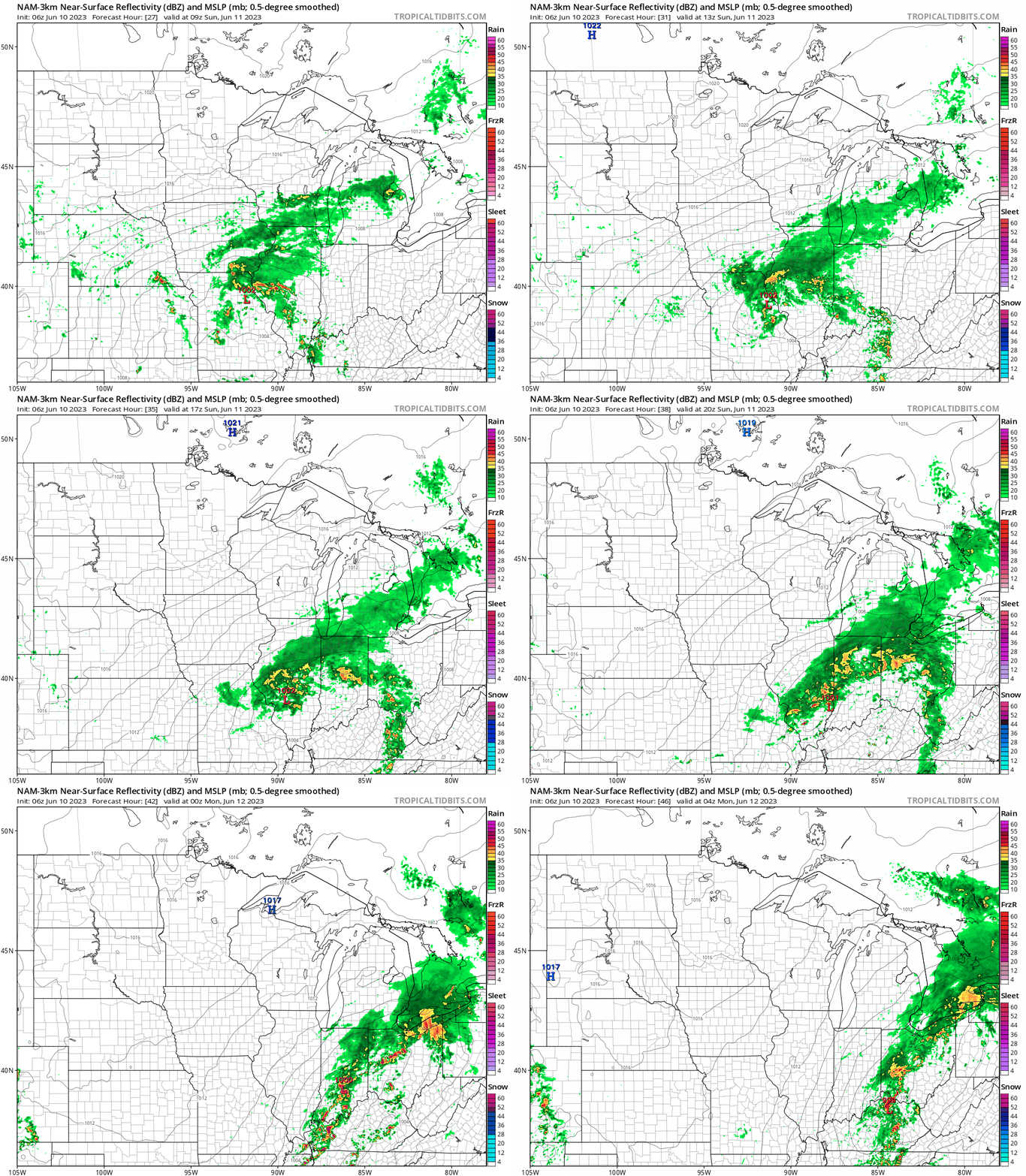
A high pressure system will sprawl across Minnesota on Sunday, bringing us dry weather and slightly cooler temperatures.
NOAA’s North American Mesoscale forecast model shows the surface pressure pattern and the potential rain pattern from 4 a.m. Sunday to 11 p.m. Sunday:
Monday is also looking dry across Minnesota.
Temperature trends
The average Twin Cities high temperature is 78 degrees on June 10. Some spots in the metro area could reach the lower 80s today.
Much of central and southern Minnesota will have Saturday highs in the upper 70s, but a few lower 80s are possible in southeastern Minnesota and in parts of west-central Wisconsin. There will be some 60s near Lake Superior.
Sunday highs will be mainly in the lower 70s, with some mid to upper 70s in the far northwest::

60s are expected near Lake Superior and in much of northwestern Wisconsin. Sunday afternoon dew points will be mainly in the very comfortable 40s.
Twin Cities metro area high temps are projected to be around 80 degrees on Monday, followed by mid 80s Tuesday then upper 80s Wednesday and lower 80s Thursday and Friday.
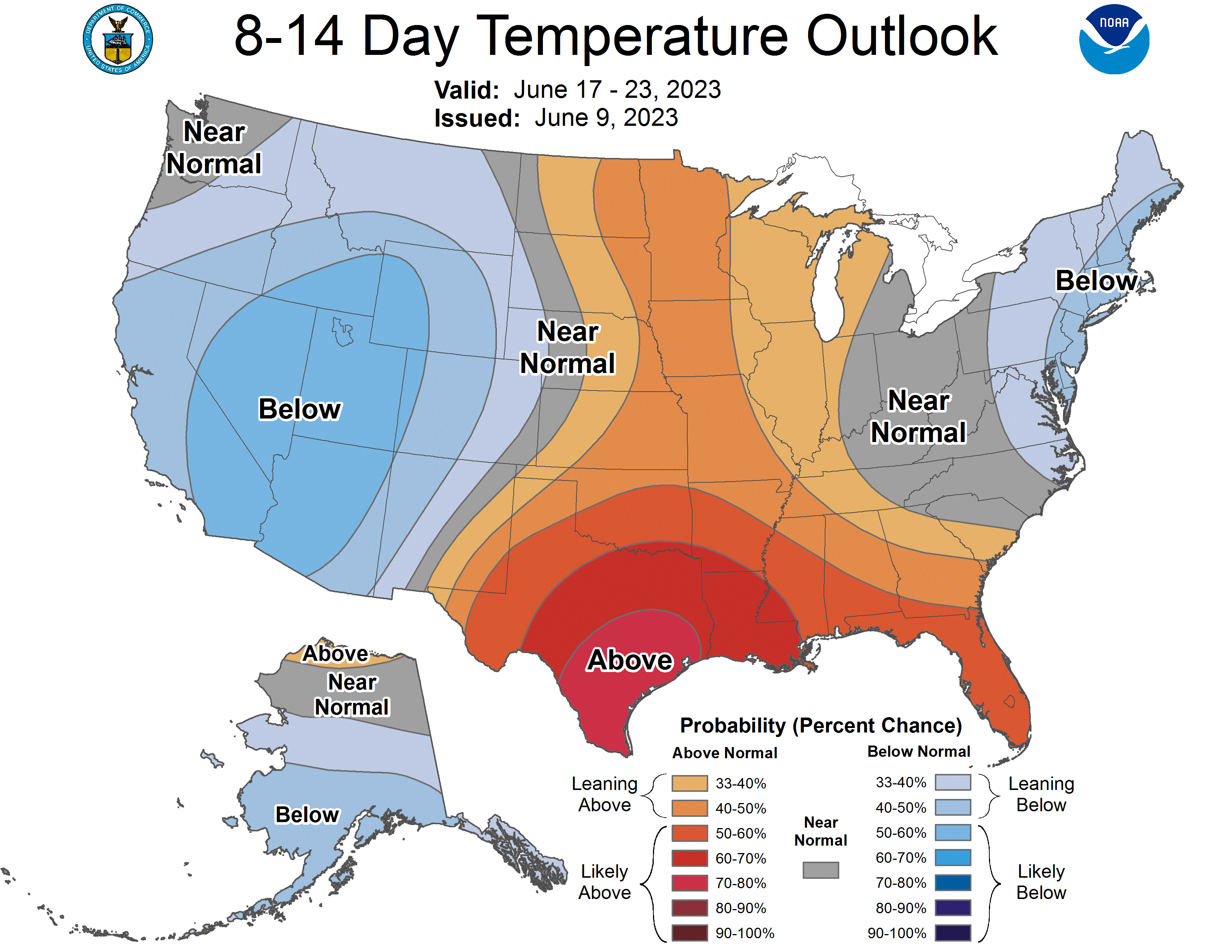
There isn’t an extended cool stretch of weather in sight. The NWS Climate Prediction Center shows a tendency for above-normal temps in Minnesota and Wisconsin next weekend and into the start of the following week.
Weather nugget
The official rainfall total at Minneapolis-St. Paul International Airport was just three-hundredths of an inch during the first nine days of June. That’s 1.24 inches below normal for that stretch of June. The May rainfall total at Minneapolis-St. Paul International Airport was 2.29 inches below normal.
Programming note
You can hear live weather chats with a MPR meteorologist on MPR News at 7:35 a.m., 9:35 a.m. and 4:39 p.m. each Saturday and Sunday.

