
Quiet weather for most on Monday; scattered thunderstorm chances midweek
Near-normal temps return
Go Deeper.
Create an account or log in to save stories.
Like this?
Thanks for liking this story! We have added it to a list of your favorite stories.


Many spots in Minnesota and western Wisconsin saw some much-needed rain Saturday and Saturday night. Scattered showers lingered on Sunday, but we had many dry hours too.
A chance of scattered showers continues in Minnesota and western Wisconsin Sunday evening, with an isolated thunderstorm also possible.
Passing shower possible Monday
Many spots will have a dry Monday, but parts of eastern Minnesota and western Wisconsin could see a passing shower or an isolated afternoon or evening thunderstorm.
The National Oceanic and Atmospheric Administration’s North American Mesoscale (NAM) forecast model shows the potential rain pattern from 6 a.m. Monday to 9 p.m. Monday:
Turn Up Your Support
MPR News helps you turn down the noise and build shared understanding. Turn up your support for this public resource and keep trusted journalism accessible to all.
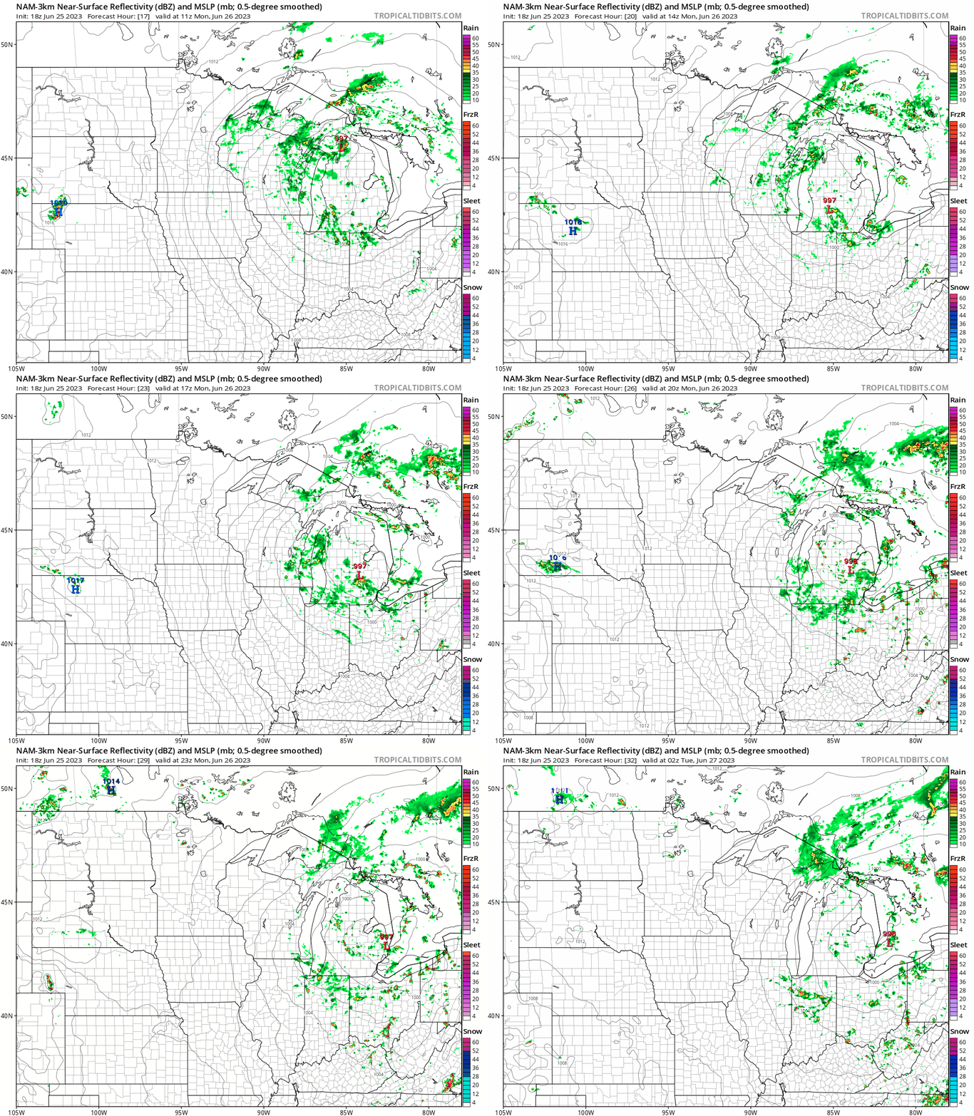
Pay more attention to the very scattered nature of the rain than the exact location of the rain at any point in time. It may also rain in some locations that look dry in the loop.
You can hear updated weather information for Minnesota and western Wisconsin on the MPR News network. You can find the latest radar here.
You can also check these National Weather Service sites for updated weather info: Twin Cities, Duluth, La Crosse, Wis., Sioux Falls, S.D., Grand Forks, N.D.
Tuesday looks dry in central and southern Minnesota, with scattered showers and thunderstorms possible to the north.
Scattered showers and thunderstorms are possible anywhere in Minnesota and western Wisconsin on Wednesday. Check forecast updates.
Saturday tornado update
The National Weather Service is surveying the damage from the tornadoes that hit parts of northwestern Minnesota on Saturday:
Their report wasn’t available Sunday afternoon, but it is likely to appear on their website or social media.
Here’s a listing of Saturday tornado reports:

Times listed are in Universal Time, which is five hours ahead of Central Daylight Time. For instance, a time stamp of 2105 is 4:05 p.m. CDT. There can be multiple reports of the same tornado.
Here’s a picture of a Saturday afternoon tornado in Norman County in northwestern Minnesota:
Temperature trends
The Sunday high temp at Minneapolis-St. Paul International Airport was 75 degrees. That was 7 degrees shy of the average Twin Cities high temp on June 25.
Metro area highs will be in the upper 70s to around 80 on Monday. Western Minnesota will see some lower 80s, with mainly 70s elsewhere:

Many locations will see highs in the 80s on Tuesday, with 70s in parts of northeastern Minnesota:

Twin Cities metro area highs are projected to reach the mid-80s on Tuesday, followed by lower 80s Wednesday, Thursday and Friday.
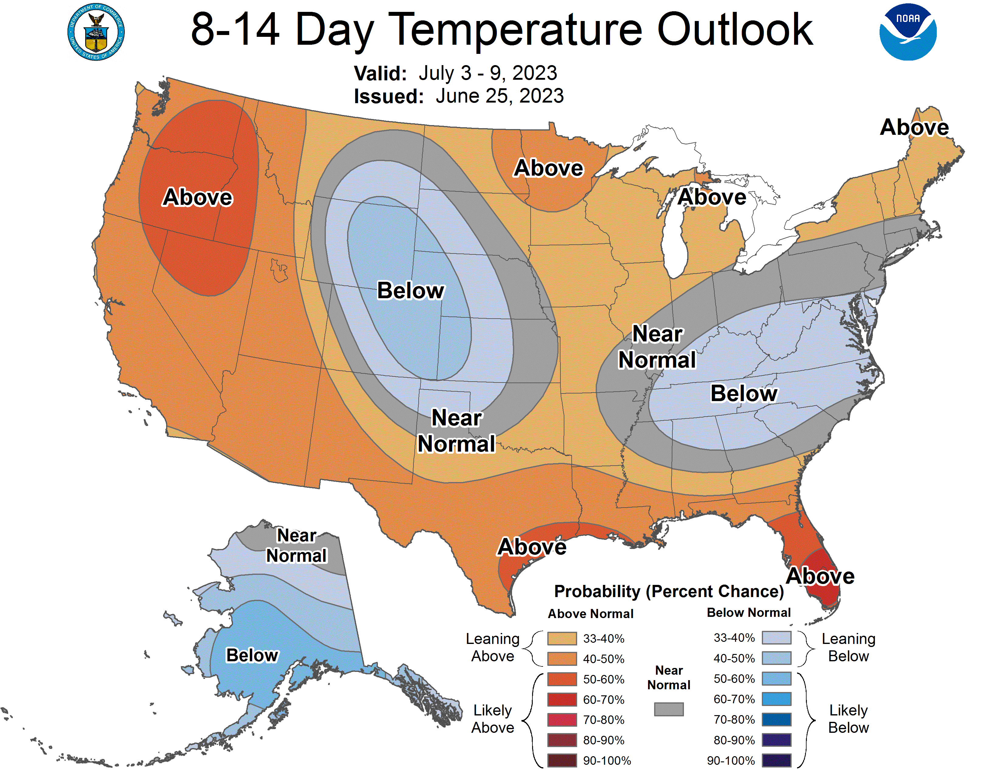
We could see Twin Cities metro area highs in the lower 80s next weekend. The following week may feature above-normal temperatures, according to the July 3 through July 9 temperature outlook from the National Weather Service Climate Prediction Center:
Programming note
You can hear my live weather updates on MPR News at 7:35 a.m., 9:35 a.m. and 4:39 p.m. each Saturday and Sunday.

