
Dry, warm weekend; rain chance on July Fourth
EF-2 tornado hit Mahnomen County on June 24
Go Deeper.
Create an account or log in to save stories.
Like this?
Thanks for liking this story! We have added it to a list of your favorite stories.


Many people will make this a four-day weekend, ending on the Fourth of July. We’ll have summery temps for the next several days.
Temperature trends
The average Twin Cities high temperature is 83 degrees on July 1. Metro area highs are expected to reach the upper 80s this Saturday.
Most of Minnesota and western Wisconsin will have Saturday highs in the 80s:

There could be some upper 70s from around Tofte to Grand Marais along Minnesota’s North Shore.
Turn Up Your Support
MPR News helps you turn down the noise and build shared understanding. Turn up your support for this public resource and keep trusted journalism accessible to all.
Sunday highs will be in the 80s in many areas, but some spots in the southern half of Minnesota could touch 90 degrees:

Monday will be very warm, with highs in low to mid-90s in the southern half of Minnesota and mainly 80s to the north:

Fourth of July highs range from around 80 in far northwestern Minnesota to lower 90s in the far southeast:

Twin Cities metro area highs are projected to be around 90 degrees on July Fourth, followed by 80 on Wednesday then upper 70s Thursday and lower 80s on Friday.
Weekend, holiday rain chances
Parts of far southern Minnesota could see a passing shower this Friday evening.
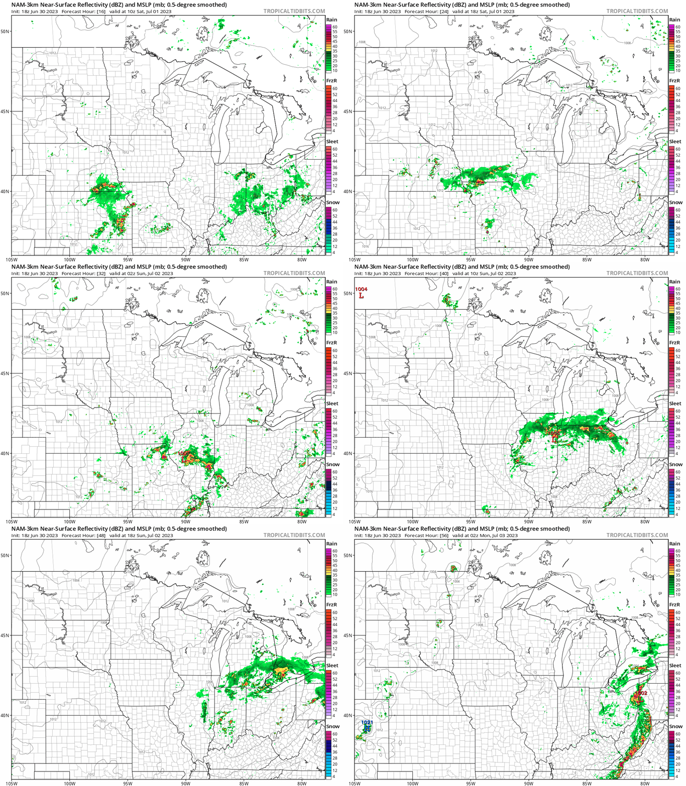
The weekend looks dry in most of Minnesota and western Wisconsin, but a few scattered showers and thunderstorms will be possible in northwestern Minnesota Sunday and Sunday evening.
The National Oceanic and Atmospheric Administration’s North American Mesoscale forecast model shows potential rain pattern from 6 a.m. Saturday to 9 p.m. Sunday:
There will be a chance of scattered showers and thunderstorms in northern and western Minnesota Monday afternoon and evening.
That chance expands to include all of Minnesota and western Wisconsin on the Fourth of July. Some spots won’t see any rain on the holiday but some spots could see strong thunderstorms at times.
You can hear updated weather information for Minnesota and western Wisconsin on the MPR News network. You can find the latest radar here.
You can also check these National Weather Service sites for updated weather info: Twin Cities, Duluth, La Crosse, Wis., Sioux Falls, S.D., Grand Forks, N.D.
EF2 tornado hit NW Minnesota June 24
The Grand Forks, N.D., office of the National Weather Service has posted details on the tornadoes that hit portions of northwestern Minnesota on Saturday, June 24.
Here’s the NWS overview:
Surface low pressure system tracked across the North Dakota/South Dakota border creating and environment supporting the threat for low top supercells in Southeastern North Dakota into adjacent West Central Minnesota. Several low top supercells developed and tracked along portions of Minnesota Red River Valley. Portions of Norman, Polk, Becker, and Mahnomen counties saw multiple tornadoes. Several uprooted or snapped trees, house/garage/barn, and 2 wooden power were damaged where an EF2 tornado tracked through Mahnomen county along and then just east of Hwy 59. Several other tornadoes tracked through Norman, Becker and western Polk county, but luckily stayed in fields and did little to no damage. Large hail and damaging winds accompanied some of the storms, with quarter size hail being reported in Clearwater, Hubbard, and Wadena counties. Heavy rainfall and training thunderstorms generated flash flooding in Clearwater and Pembina counties during the evening and overnight periods.
Tornadoes were reported in several northwestern Minnesota counties that day, but just one tornado was given a rating by the NWS storm survey team:

Here are the details of the Mahnomen County tornado of June 24, as posted by the NWS:
The strongest and longest tracked tornado of the day did structural damage to 3 farmsteads and 2 power poles as the intermittent and occasional multi-vortex tornado tracked along Hwy 59 south of Mahnomen and then east of Mahnomen across Hwy 200. The highest wind speeds are estimated to be around 125 mph with a track length of approximately 7 miles and a maximum width of approximately 250 yards.
Programming note
You can hear my live weather updates on MPR News at 7:35 a.m., 9:35 a.m. and 4:39 p.m. each Saturday and Sunday.

