
Nice start to the weekend; Thunderstorm chance on July Fourth
June was the second-driest in Twin Cities weather records
Go Deeper.
Create an account or log in to save stories.
Like this?
Thanks for liking this story! We have added it to a list of your favorite stories.


How hot and dry was June? Let’s take a look at how we did on temperatures and rainfall for the month.
The average Twin Cities temperature (average of the daily high temps and low temps) was 75 degrees in June, which is 5.3 degrees warmer than normal. There were 9 days in June with a high temperature of 90 degrees or warmer at Minneapolis-St. Paul International Airport.
June rainfall at Minneapolis-St. Paul International Airport was just 93 one-hundredths (.93) of an inch. That was 3.65 inches below normal.
June 2023 was the second-driest and the third-warmest June in Twin Cities weather records:
Turn Up Your Support
MPR News helps you turn down the noise and build shared understanding. Turn up your support for this public resource and keep trusted journalism accessible to all.

Of course rainfall can vary widely over different parts of the metro area and the state. I had 1.62 inches of rain on June 10 in St. Paul, while MSP airport reported just 6 one-hundreths (.06) of an inch that day.
The east metro had some much needed rain on June 10; here are some 24-hour rainfall totals from early on June 10 to early on June 11:

Most of the rain occured on June 10.
Drought update
The rain that we saw last weekend didn’t change the drought picture very much, according to the latest U.S. Drought Monitor report:

The report shows that 4.92 percent of Minnesota (shaded orange) is in severe drought, with 39.25 percent (shaded beige) in moderate drought. The yellow-shaded areas are abnormally dry but not yet in drought.
Only 7.68 percent of Minnesota isn’t either abnormally dry or in drought right now.
Dry Saturday and Sunday in many areas
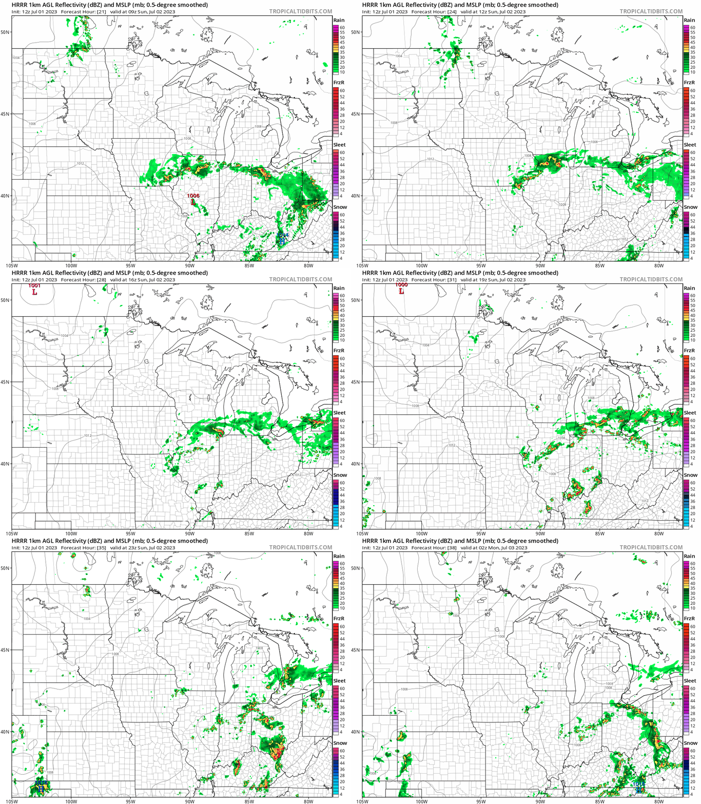
Much of Minnesota and western Wisconsin will have a dry Saturday and Sunday.
Far southern Minnesota could see an isolated shower Saturday afternoon and evening. Parts of northeastern Minnesota could see a few scattered showers or an isolated thunderstorm later Saturday afternoon and Saturday evening.
Northwestern Minnesota will have a chance of scattered showers and thunderstorms Sunday afternoon and evening.
The National Oceanic and Atmospheric Administration’s High-Resolution Rapid Refresh model shows the potential rain pattern from 4 a.m. Sunday to 9 p.m. Sunday:
Unsettled weather Monday and Tuesday
There will be a chance of scattered showers and thunderstorms in northern and western Minnesota Monday afternoon and evening. Some models also show a rain chance in central Minnesota.
That shower/t-storm chance expands to include all of Minnesota and western Wisconsin on the Fourth of July. Some spots won’t see any rain on the holiday but some spots could see strong thunderstorms at times.
You can hear updated weather information for Minnesota and western Wisconsin on the MPR News network. You can find the latest radar here.
You can also check these National Weather Service sites for updated weather info: Twin Cities, Duluth, La Crosse, Wis., Sioux Falls, S.D., Grand Forks, N.D.
Temperature trends
The average Twin Cities high temperature is 83 degrees on July 1. Metro area highs are expected to reach the upper 80s this Saturday.
Most of Minnesota and western Wisconsin will have Saturday highs in the 80s, but there could be some 70s up along portions of the North Shore of Lake Superior.
Sunday highs reach 90 or higher in roughly the southern Half of Minnesota, with 80s elsewhere:

Monday highs will be in the lower to middle 90s in the southern half of Minnesota plus parts of western Wisconsin, with 80s in northern Minnesota:

Tuesday highs range from upper 70s in northwestern Minnesota to lower 90s in the southeast:

Twin Cities metro area highs will be near 90 degrees on July 4th, then around 80 on Wednesday followed by upper 70s Thursday and lower 80s on Friday.
Programming note
You can hear my live weather updates on MPR News at 7:35 a.m., 9:35 a.m. and 4:39 p.m. each Saturday and Sunday.

