
Searching for rain: Spotty rain chances through next week
Some hope late next week for more widespread rain

Go Deeper.
Create an account or log in to save stories.
Like this?
Thanks for liking this story! We have added it to a list of your favorite stories.


When in a drought, don’t forecast rain.
That sage advice has bounced around weather circles for the past 50 years. It’s hard enough to get widespread rainfall in summer.
Most summer rainfall systems are convective in nature. That means they develop vertically like bubbles in boiling water. They tend to dump heavy rains in one area and leave the next town, farm field, or lawn dry.
Case in point? Check out the map below detailing the beneficial rainfall that came down in the eastern Twin Cities into western Wisconsin this week.
Turn Up Your Support
MPR News helps you turn down the noise and build shared understanding. Turn up your support for this public resource and keep trusted journalism accessible to all.

Some areas in the east metro and western Wisconsin recorded 1 to 4 inches earlier this week. Minneapolis-St. Paul International Airport picked up just 57 one-hundredths (.57) of an inch. I got only 34 one-hundredths (.34) of an inch in the rain gauge here at the Weather Lab in Victoria.
Friday brings another example of summer hit-or-miss rainfall. The two rainfall zones across northern and southern Minnesota will bypass the core of the central Minnesota-Twin Cities drought zone. Congratulations to those of you getting rain Friday.
Monday thunderstorm chance?
Most of the weekend looks dry across most of Minnesota. A cold front will sag southward Monday afternoon into an increasingly steamy air mass over southern Minnesota.
The front may trigger some scattered storms Monday afternoon near the Twin Cities as it drifts south. The National Oceanic and Atmospheric Administration’s North American Mesoscale model picks up on the potential of developing rain and a thunderstorm Monday afternoon and evening:
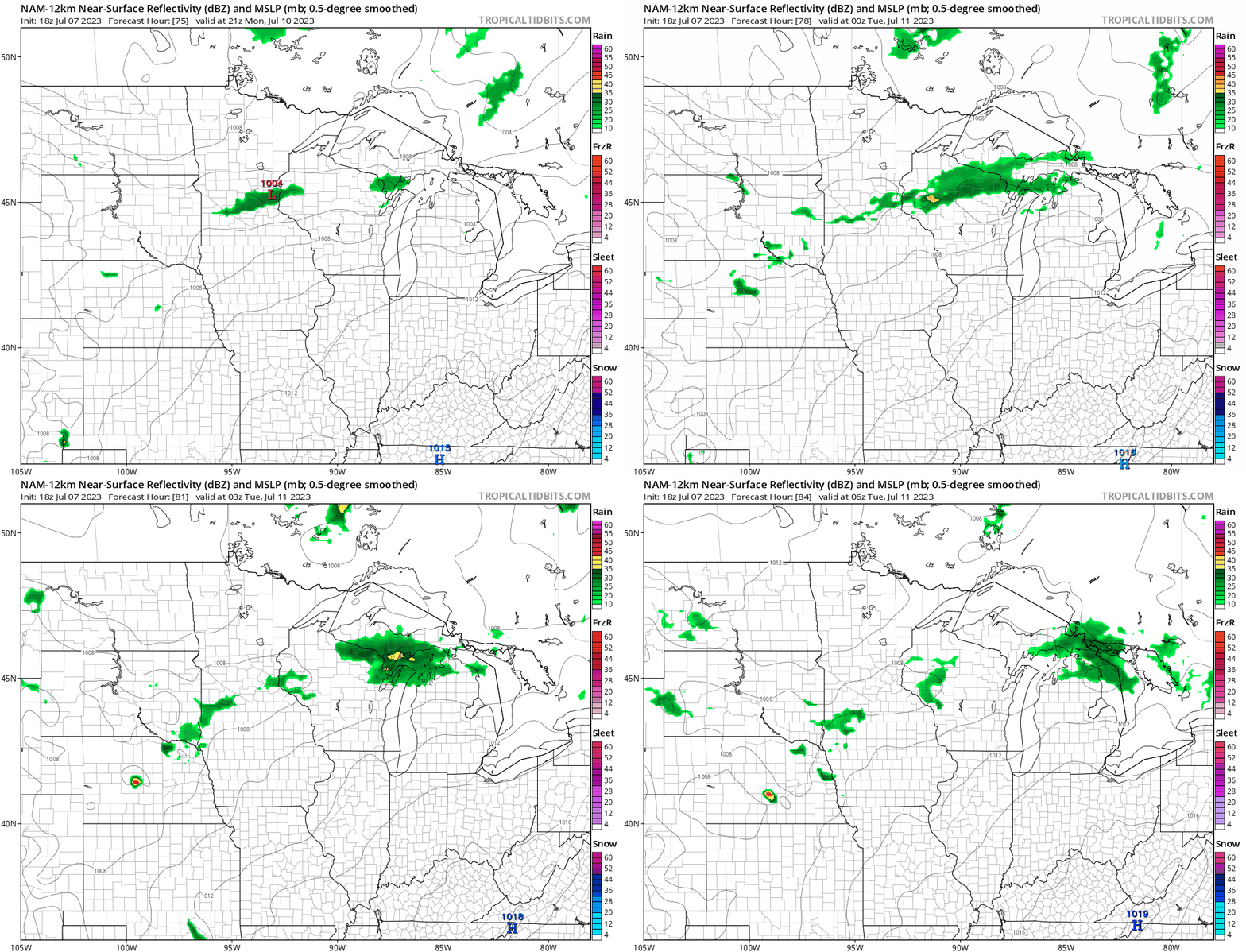
We’ll see if the front is strong enough to pop some local downpours late Monday.
A follow-on disturbance could produce a few scattered rains across southern Minnesota Tuesday. While it’s still a long way off, multiple forecast models suggest a more widespread rain system could evolve late next week.
Overall, rainfall forecasts for the next 10 days seem to favor an inch to 3 inches of rain across parts of Minnesota. Here’s the European Centre for Medium-Range Weather Forecasts model rainfall output through Sunday, July 16.

And here’s NOAA’s Global Forecast System model:

So at least we have a few systems to keep an eye on next week for some much-needed rainfall potential.
Stay tuned.

