
Storms possible Wednesday; 90s again next week?
Pleasant temperatures continue this week.

Go Deeper.
Create an account or log in to save stories.
Like this?
Thanks for liking this story! We have added it to a list of your favorite stories.


We’re on rainfall watch again this week here in the weather lab.
This is our third straight summer of flash drought in Minnesota. The first thing I do every week in this weather pattern is scan the forecast models for possible rain. The next chance for scattered storms that could drop some meaningful downpours arrives Tuesday night into Wednesday.
NOAA’s Storm Prediction Center paints a marginal risk for severe storms in the Twin Cities and most of central Minnesota Wednesday. (map above)
And in the post below, you’ll see that next week could bring more 90s to Minnesota once again.
Turn Up Your Support
MPR News helps you turn down the noise and build shared understanding. Turn up your support for this public resource and keep trusted journalism accessible to all.
Rain chances
A weak low-pressure wave and cool front will be the focus for some scattered thunderstorms Tuesday night and Wednesday. NOAA’s NAM 3 km model picks up on the possible storm waves Tuesday night through Wednesday. The loop below runs between 1 a.m. and 7 p.m. Wednesday.
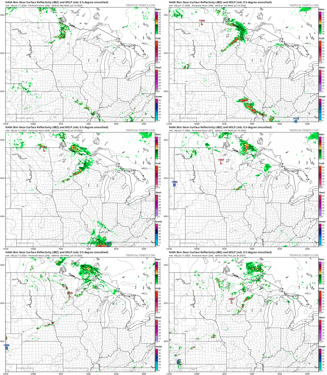
The best chances for scattered storms in the Twin Cities favor early morning and late afternoon Wednesday.
Spotty rainfall
Rainfall coverage will be typically spotty once again this week. NOAA’s GFS model paints the picture of scattered rains. Most of Minnesota will see less than .25” of rain this week. But a few lucky spots may pick up .50” to more than an inch.

Heat wave next week?
The medium-range forecast maps for next week have my attention for a potential heat wave. The massive heat dome across the Southwest shows signs of lifting northward into the Upper Midwest and northern U.S. next week.
NOAA’s GFS model upper air loop below shows the ridge taking shape,. The loop below runs between Sunday, July 23, and Saturday, July 29.
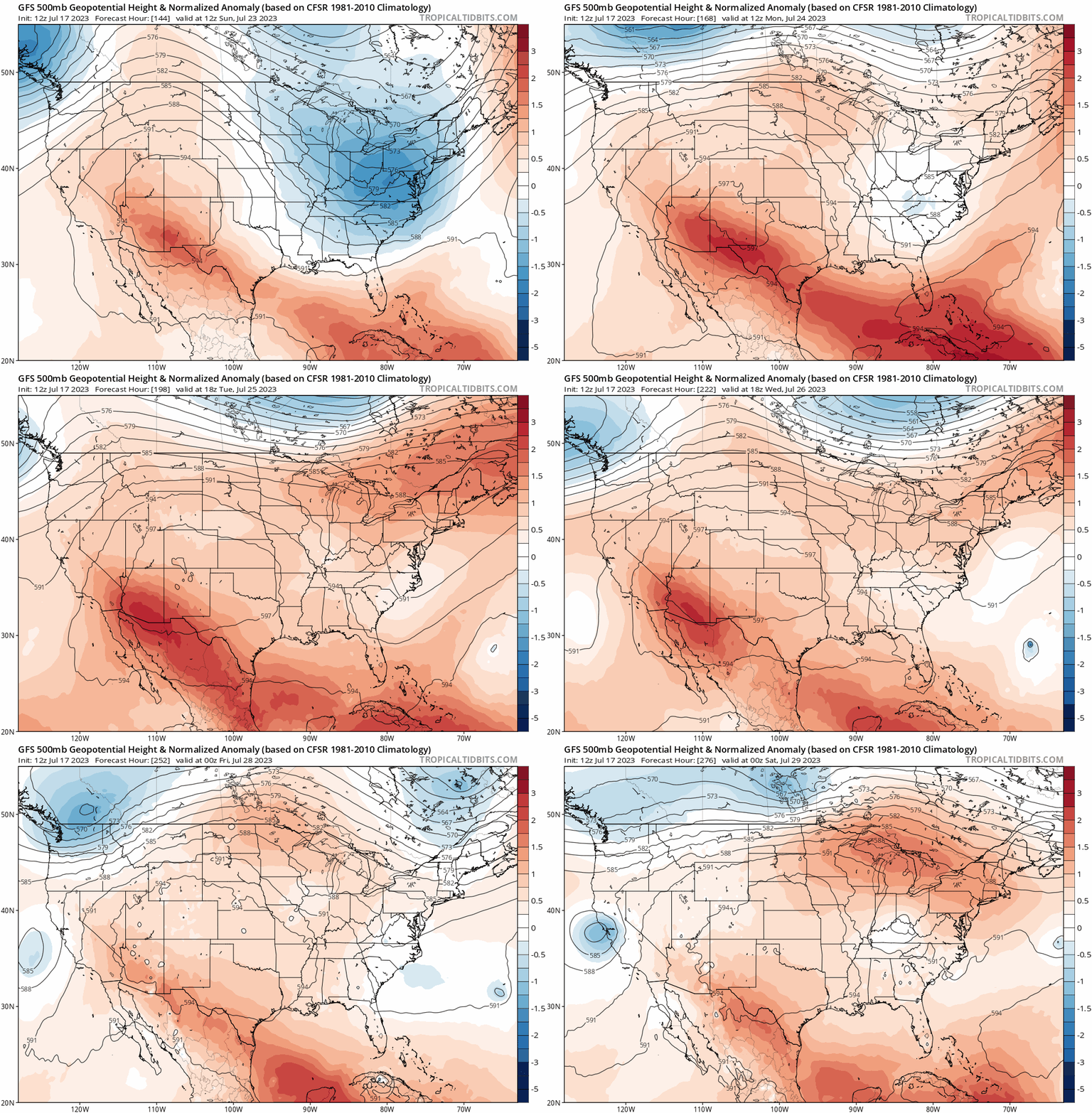
Both the European and American GFS models are cranking out highs in the 90s for next week. It’s still too early for high confidence, but right now the European model cranks out a high of 96 degrees for the Twin Cities on Wednesday, July 26.
So it remains to be seen just how hot it could get next week. But a string of days with highs in the 90s is looking more likely by the day.
Dog Days. Stay tuned.

