Thunderstorms rumble up north; 90s return this week
Severe weather risk for northern Minnesota

Go Deeper.
Create an account or log in to save stories.
Like this?
Thanks for liking this story! We have added it to a list of your favorite stories.


Welcome to August, Minnesota! How did that happen anyway?
August opens on thundery notes in northern and central Minnesota. A weak low-pressure system near the Canadian border is causing a few scattered thunderstorms Tuesday.
A few isolated storms are possible Wednesday. As of this post time, scattered thunderstorms are drifting south north of Little Falls to Hinckley. Another batch is approaching the Grand Rapids and Iron Range areas.
There is a slight risk (level 2 of 5) for severe storms across northwest Minnesota Tuesday with a lower marginal risk (level 1 of 5) into central Minnesota. (map above)
Turn Up Your Support
MPR News helps you turn down the noise and build shared understanding. Turn up your support for this public resource and keep trusted journalism accessible to all.
The atmosphere across the Twin Cities and southern Minnesota is a bit more stable this week. Storms will tend to dissipate as they drift southward across Minnesota.
Heat returns
August brings another shot of 90-degree temperatures to parts of Minnesota. Highs Wednesday should top 90 degrees across most of western and southern Minnesota, including the Twin Cities.

Thursday looks like the warmest day this week. I think the forecast map below could be a bit conservative. Highs could reach the mid-90s from the Twin Cities through western Minnesota.

We’ve recorded 20 days of 90-degree or hotter temperatures in the Twin Cities so far this year. It looks like we’ll be at least 22 by the end of this week. The long-term annual average is about 13 days.
Cooler days ahead
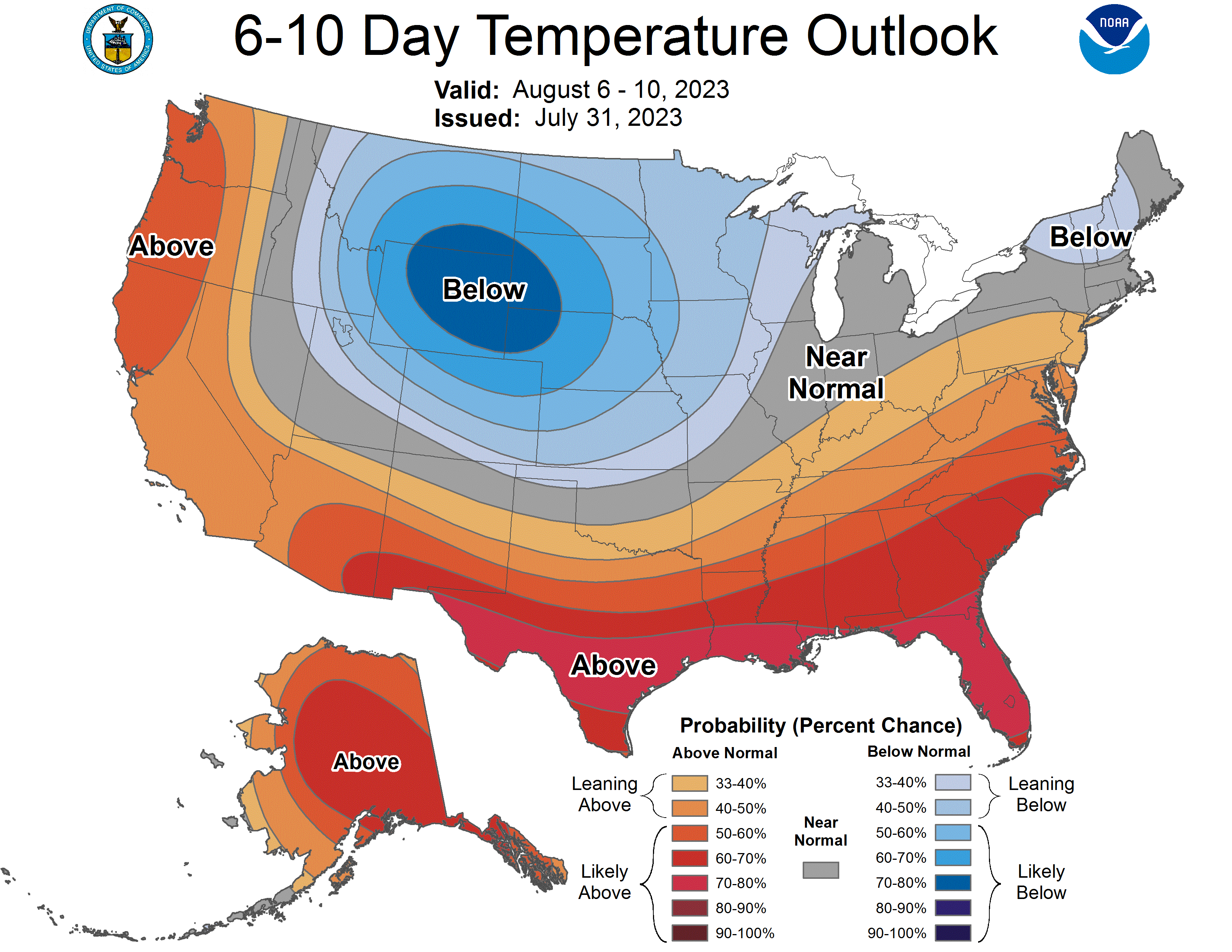
Next week looks cooler around Minnesota. Highs will be in the 70s across most of the state by Sunday.

The National Oceanic and Atmospheric Administration’s six to 10-day outlook favors cooler-than-average temperatures next week: