
Tracking storm potential through Friday
Slight severe risk for southwest Minnesota Thursday.

Go Deeper.
Create an account or log in to save stories.
Like this?
Thanks for liking this story! We have added it to a list of your favorite stories.


We’re tracking a couple more chances for scattered strong to severe storms across Minnesota through Friday. A slight risk for severe storms covers southwest Minnesota Thursday, with a marginal risk zone extending into much of central Minnesota.
The first wave looks likely to cross into western Minnesota Thursday evening.
Several forecast models depict a broken line of strong to potentially severe storms moving eastward toward eastern Minnesota including the greater Twin Cities area by around midnight Thursday night.
NOAA’s FV3 model shows the likely storm progression. The forecast model loop below runs between 7 p.m. Thursday and 1 a.m. Friday.

Friday storm potential
A second wave of storms looks likely to form Friday afternoon ahead of a weak low-pressure wave. NOAA’s FV3 model shows scattered storm clusters developing Friday afternoon across southern and central Minnesota.
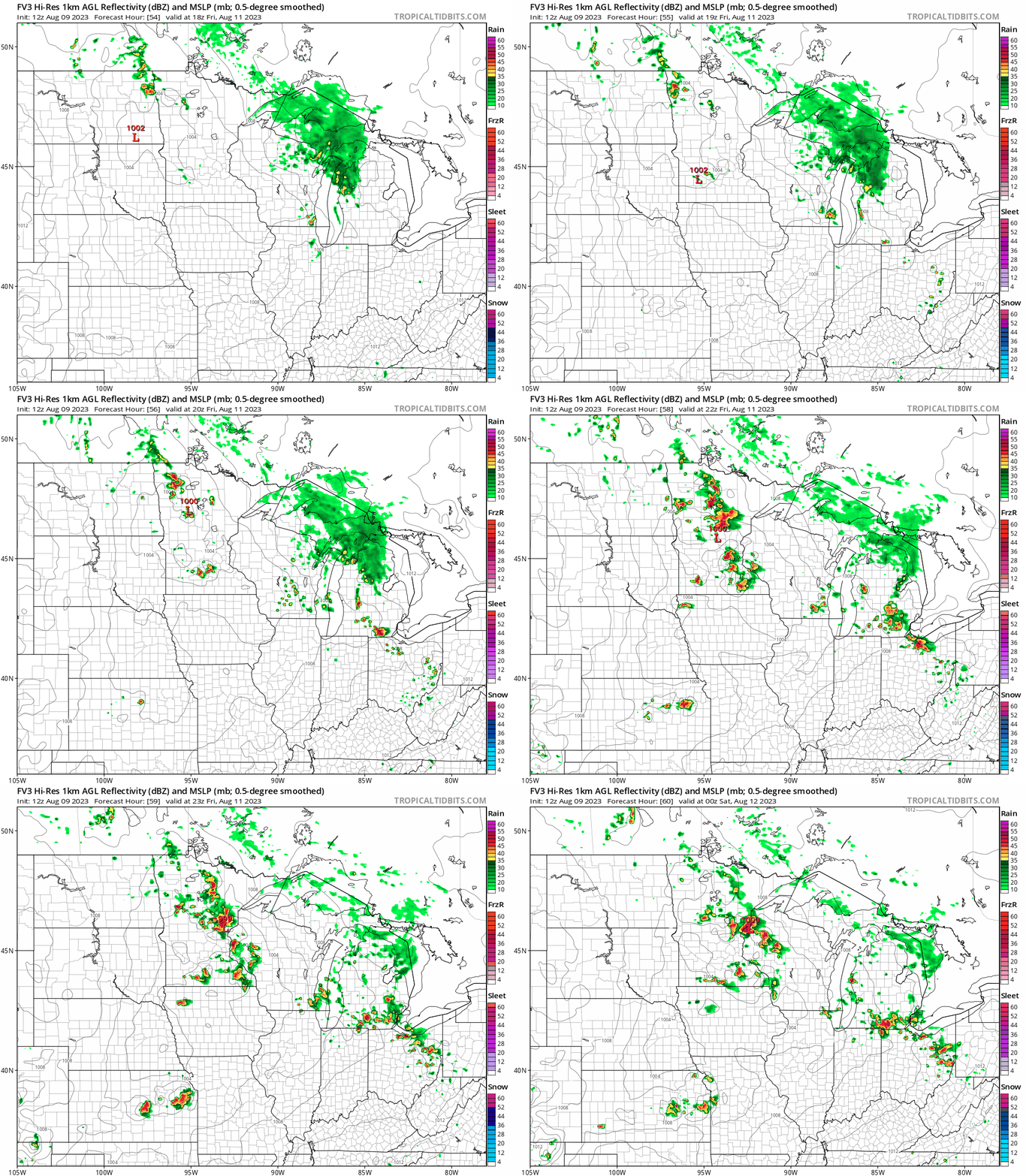
Both storm waves are likely to be scattered in coverage. A few cells could produce large hail and potentially damaging wind gusts. Keep an eye out for possible severe weather watches and warnings Thursday night and Friday.
Highs Thursday will hover in the 70s north and 80s south across Minnesota.

Turn Up Your Support
MPR News helps you turn down the noise and build shared understanding. Turn up your support for this public resource and keep trusted journalism accessible to all.

