
Friday hail recap; Saturday sunshine, then Sunday rain
Warmest weekend temps will be today
Go Deeper.
Create an account or log in to save stories.
Like this?
Thanks for liking this story! We have added it to a list of your favorite stories.


The weather was wild late Friday afternoon into Friday evening. Many of us saw sheets of rain and strong wind gusts, along with hail.
Some spots in eastern Minnesota and west-central Wisconsin had very large hail late Friday afternoon into Friday evening.
Between about 5:20 and 5: 50 p.m. Friday, Minneapolis had numerous reports of 2 inch to 2.5 inch diameter hail.
The largest hail report I saw from Friday was at 4:48 p.m., when a 3 inch diameter hailstone was reported 6 miles south of Dassel in Meeker County…that report also mentioned a 3.75 inch diameter hail stone (softball size) near Highway 15.
Turn Up Your Support
MPR News helps you turn down the noise and build shared understanding. Turn up your support for this public resource and keep trusted journalism accessible to all.
There was a report of 3 inch diameter hail in Rockford (Wright County) at 4:46 p.m. Friday. At 4:28 p.m. Friday there was a report of 2.75 inch diameter hail (baseball size) five miles northeast of Buffalo Lake in Renville County.
I saw a report of 1.25 inch diameter hail in St. Paul and 1.75 inch diameter hail near Mendota Heights.
Here’s a map of Friday’s hail tracks, issued Friday evening by the National Weather Service:
You can find a listing of Friday hail reports and other severe weather here. The NWS Storm Prediction Center has posted Friday hail reports and other severe weather here….times listed are in Universal Time, which is 5 hours ahead of CDT. For example 2200 on the SPC listing would be 5 p.m. CDT.
A beautiful Saturday, rain Sunday
Saturday will be the best day for outdoor activities this weekend. Most of Minnesota and western Wisconsin will have a dry Saturday. Far northern Minnesota and far northwestern Wisconsin could see a few scattered showers at times.
A low pressure system will bring periods of rain to much of Minnesota and western Wisconsin on Sunday. There could also be some embedded thunderstorms at times. The National Oceanic and Atmospheric Administration’s North American Mesoscale (NAM) forecast model shows the potential rain pattern from 4 a.m. Sunday to 11 p.m. Sunday:
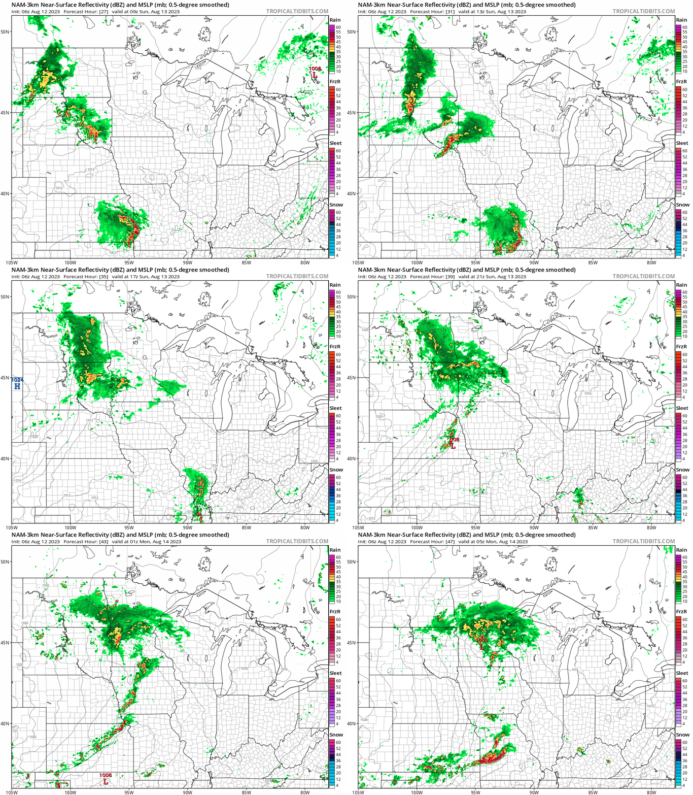
You can hear updated weather information for Minnesota and western Wisconsin on the MPR News network. Also check out the MPR News display of National Weather Service radar.
Weekend temps
The average Twin Cities high temperature is 81 degrees on Aug. 12. Metro area highs are forecast to reach the lower 80s this Saturday.
Saturday high temps will be in the 80s across roughly the southern half of Minnesota, with mainly 70s to the north:

Sunday highs will be mainly in the 60s, with some lower 70s from the Twin Cities metro area into southeastern Minnesota and west-central Wisconsin:

Programming note
You can hear my live weather updates on MPR News at 7:35 a.m., 9:35 a.m. and 4:39 p.m. each Saturday and Sunday.

