
Shower chances Saturday; cooler, mainly dry Sunday
Taste of October next week?
Go Deeper.
Create an account or log in to save stories.
Like this?
Thanks for liking this story! We have added it to a list of your favorite stories.


The second weekend of September brings a few shower chances. Most of the hours this weekend will be dry, but it will be a pick-your-spot forecast for outdoor activities this weekend.
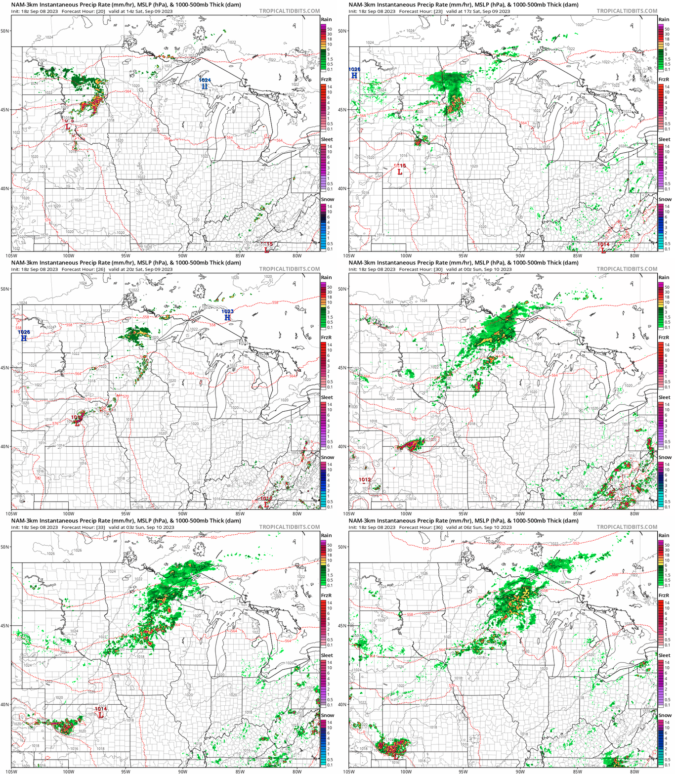
A cold front crossing Minnesota Saturday brings scattered showers and a few thundershowers. The National Oceanic and Atmospheric Administration’s latest NAM 3 km model shows showers favoring western Minnesota in the morning hours on Saturday.
Cells may grow in coverage Saturday afternoon into the evening across eastern Minnesota including the Twin Cities area. The forecast model loop at the top of this post runs between 9 a.m. Saturday and 1 a.m. Sunday.
Overall rainfall totals look patchy and light on Saturday.
Turn Up Your Support
MPR News helps you turn down the noise and build shared understanding. Turn up your support for this public resource and keep trusted journalism accessible to all.
The map below shows the European Centre for Medium-Range Weather Forecasts model rainfall output. It favors a few tenths of an inch in most locations, with a few pockets of locally heavier rainfall.

Sunday looks mainly dry across Minnesota.
Temperatures peak near 80 degrees across southern Minnesota Saturday before the frontal passage. Highs will hover in the 60s and 70s north on Saturday.

Sunday brings a cooler day with highs in the 60s north to 70s south.

Taste of October next week?
A cooler air mass oozes south into Minnesota from Canada early next week. Highs by Tuesday will hover in the 60s across most of Minnesota.

Overnight lows in the 40s will be common on Monday and Tuesday nights.

We could see some 30s once again in northeast Minnesota next week. Ely already dropped to a chilly 37 degrees Thursday morning.
Meteorological fall is here, Minnesota.

