
Hard freeze up north; warmer days ahead
Highs in the 80s return Thursday

Go Deeper.
Create an account or log in to save stories.
Like this?
Thanks for liking this story! We have added it to a list of your favorite stories.


There was plenty of frost on the pumpkins up north Wednesday morning. Temperatures dipped well below freezing in much of northeastern Minnesota.
Low temperatures reached the upper 20s across much of the Iron Range and surrounding areas. The coldest reading I’ve seen reported so far is 27 degrees in Hibbing, but as you can see from the image at the top of this post many locations dipped below freezing Wednesday morning.
The temperature at Minneapolis-St. Paul International Airport bottomed out at 47 degrees Wednesday morning. That’s the coldest morning in almost four months since 44 degrees on May 20.
Around the Twin Cities area, I saw 37 degrees in Lakeville and Blaine on Wednesday morning, and a crisp 36 degrees in Lake Elmo.
Turn Up Your Support
MPR News helps you turn down the noise and build shared understanding. Turn up your support for this public resource and keep trusted journalism accessible to all.
Frost in northern Minnesota is common in September. The average date for the first 32-degree temperature in fall for Ely is Sept. 20. For Duluth, it’s Sept. 27.
The average date for the first 32-degree temperature of the fall season at the Twin Cities airport is Oct. 10. But frost is common in the suburbs in late September to early October.
Warmer days ahead
Southerly winds will blow milder air into Minnesota starting Wednesday afternoon. Highs will reach the 70s in western Minnesota.

Thursday brings a stronger push of warmer air. Highs should reach the lower 80s in the Twin Cities, and highs in the mid-80s look likely for southwestern Minnesota on Thursday afternoon.

Thursday night and Friday bring a chance for showers with a passing cold front. Showers will gather in western Minnesota on Thursday afternoon and could reach the Twin Cities by Friday morning.
The National Oceanic and Atmospheric Administration‘s NAM 3 km model shows the likely progression of the shower bands along the advancing front between 4 p.m. Thursday and 1 p.m. Friday.
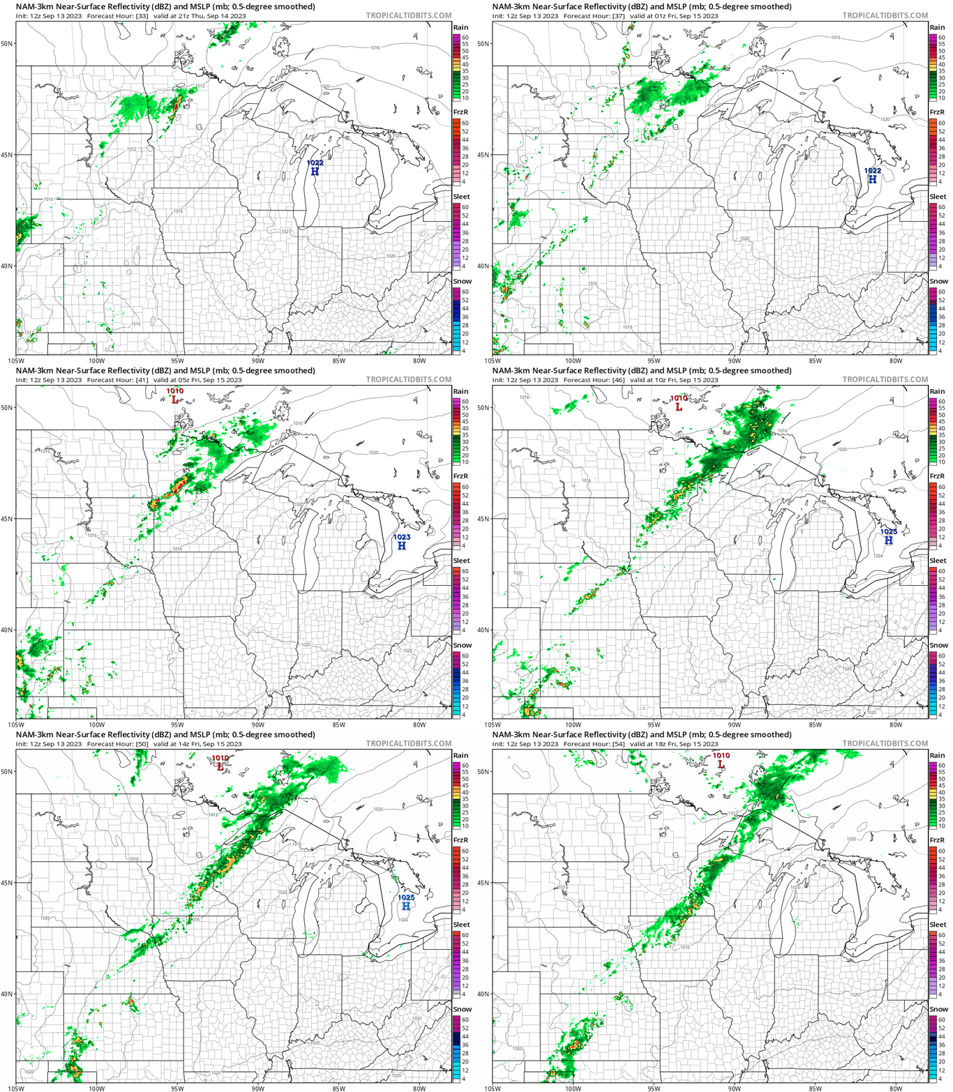
Overall rainfall totals look light with this system. Most of the area will receive less than one-quarter inch of rainfall. A few spots locally could pick up one-half inch.
Here’s the European Centre for Medium-Range Weather Forecasts model rainfall output through Friday:

The weekend looks pleasantly cool and mostly sunny. Highs will reach to low 70s south and 60s north.
There are signs of more significant rainfall developing next week.

