
Wetter pattern emerging late next week?
Forecast models suggest warm, wetter last part of September

Go Deeper.
Create an account or log in to save stories.
Like this?
Thanks for liking this story! We have added it to a list of your favorite stories.


The winds of change may blow across Minnesota by late next week.
We’ve been scanning the weather maps for rainfall now for months. Friday morning’s rain was meager but meaningful in some locations.
Most of the Twin Cities area picked up only a few tenths of an inch of rain. But some locations fared better. Here’s are some select rainfall totals from Friday around Minnesota, in inches:
Victoria, 0.35
Minneapolis-St. Paul International Airport, 0.36
South Minneapolis, 0.45
Duluth, 0.50
North of Redwood Falls, 0.64
Minnetonka, 0.71
Breezy Point, 0.81
West of Montevideo, 0.88
Warmer next week
This weekend looks beautiful with highs in the lower 70s for the Twin Cities and western Minnesota with mostly 60s north.
Turn Up Your Support
MPR News helps you turn down the noise and build shared understanding. Turn up your support for this public resource and keep trusted journalism accessible to all.

But watch for the heat to build back into Minnesota from the southwest next week. Highs by Tuesday will push well into the 80s across southern and western Minnesota.

Wetter pattern late next week?
Forecast models are hinting at more frequent rainfall systems pushing into Minnesota starting late next week.
The Environment Canadian model is one of many that suggest multiple low-pressure waves spinning up occasional rainfall zones. The forecast model loop below runs between 7 p.m. Wednesday, Sept. 21, and 7 a.m. Monday, Sept. 25.
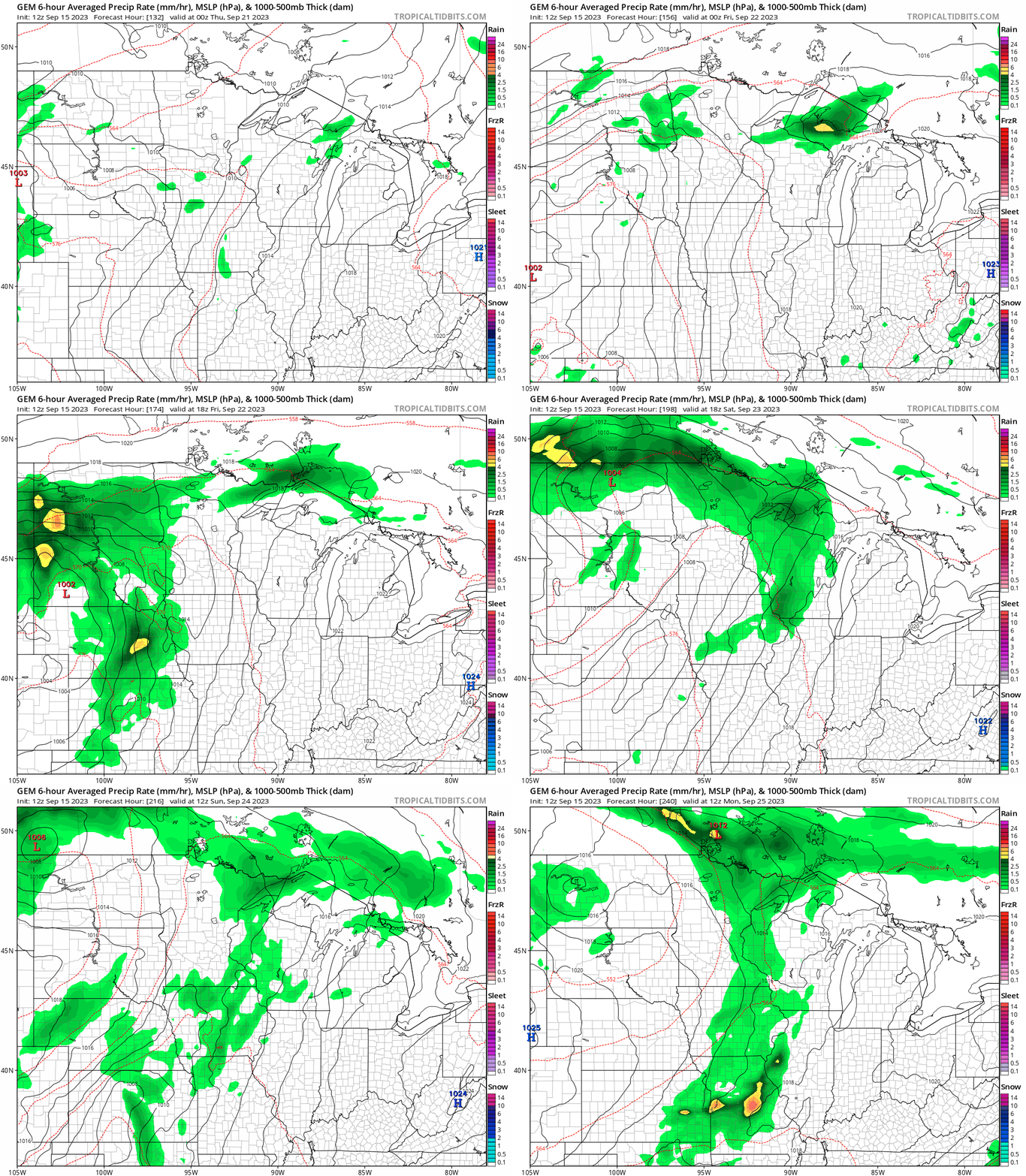
Multiple forecast models suggest we could see widespread areas of between 1 and 3 inches of rain in the next 10 days across parts of Minnesota.

The National Oceanic and Atmospheric Administration outlooks continue to suggest warmer and wetter-than-average weather developing in the next two weeks.
It may not be enough to bust our deep drought. But if we can get back to counting rainfall by the inch instead of by tenths of an inch, it’d be a good start.
Stay tuned.

