
Chilly temps; occasional showers Thursday night, Friday morning
Fall color update for leaf-peepers
Go Deeper.
Create an account or log in to save stories.
Like this?
Thanks for liking this story! We have added it to a list of your favorite stories.


The Thursday high temperature at Minneapolis-St. Paul International Airport was 65 degrees. That’s 1 degree above the average Twin Cities high temperature for this time of year.
We have much chillier temps on tap the next few days.
Temperature trends
Friday highs will be in the upper 40s in parts of far northern Minnesota and in northwestern Wisconsin, with lower 50s elsewhere in Minnesota and western Wisconsin.
Low temperatures late Friday night and early Saturday reach the 30s in many areas:
Turn Up Your Support
MPR News helps you turn down the noise and build shared understanding. Turn up your support for this public resource and keep trusted journalism accessible to all.

A freeze watch runs from 10 p.m. Friday to 10 a.m. Saturday in portions of northwestern Minnesota:

A freeze watch runs from late Friday night through 9 a.m. Saturday for five counties in southwestern Minnesota:

Saturday high temps will be mainly in the 50s, but there will be some 40s in far northern Minnesota:

Sunday highs will be mainly in the 50s, but there will be some 60s in far southwestern Minnesota and a few 40s in the northeast:

Twin Cities metro area highs are projected to reach the lower 50s on Monday, followed by mid-50s Tuesday then upper 50s Wednesday.
Rain chances
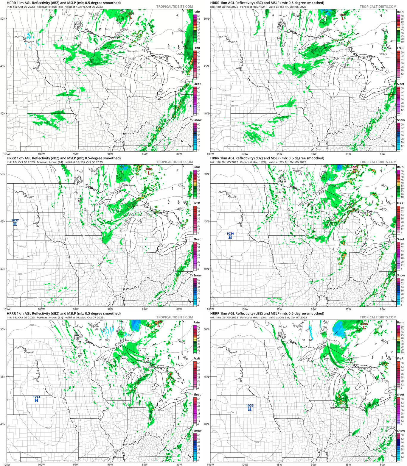
Much of Minnesota and western Wisconsin will see rain showers at times from Thursday evening into Friday morning. Some spots could also see a passing shower or two Friday afternoon.
The National Oceanic and Atmospheric Administration’s High-Resolution Rapid Refresh forecast model shows the potential rain pattern from 7 a.m. Friday to 11 p.m. Friday:
You can hear updated weather information for Minnesota and western Wisconsin on the MPR News network. Also check out the MPR News display of National Weather Service radar.
Drought Update
There was very little change in the U.S. Drought Monitor report that was released Thursday:

Across Minnesota, 82.02 percent of the state is in some category of drought, including 38.41 percent in moderate drought, 36.01 percent in severe drought and 7.60 percent in extreme drought.
Here’s how the map changed from last week:

Portions of Hennepin and Ramsey counties went from severe drought (orange) on last week’s drought report to moderate drought (beige) on this week’s report.
Fall color report
Fall colors are popping across much of Minnesota.
The Minnesota Department of Natural Resources fall color report for Minnesota State Parks and Trails looks like this:

When you look at the fall color map, keep in mind that all deciduous trees are included, not just maples.
The Wisconsin fall color report can be found here.
Programming note
You can hear my live weather updates on MPR News at 7:35 a.m., 9:35 a.m. and 4:39 p.m. each Saturday and Sunday.

