
Drought-easing rains through Friday
Expect 1-3 inches of rain for most of central, southern Minnesota

Go Deeper.
Create an account or log in to save stories.
Like this?
Thanks for liking this story! We have added it to a list of your favorite stories.


This is how you end a drought.
Another slowly moving moisture-rich low-pressure system tracks through the Upper Midwest through Friday.
This system has all the ingredients to produce widespread stratiform (horizontal) rain across our region. These longer-duration soaking rain systems are precisely the type of weather systems we need to crawl our way out of drought.
Drought conditions improve
Thursday’s U.S. Drought Monitor update for Minnesota shows continued gradual improvement.
Turn Up Your Support
MPR News helps you turn down the noise and build shared understanding. Turn up your support for this public resource and keep trusted journalism accessible to all.
Much of northeastern Minnesota was removed from drought this week. Note the area between Duluth, Two Harbors, Silver Bay, and much of St. Louis County to the north. Also, note that Washington County in the eastern Twin Cities is no longer in a drought zone.

Soggy system
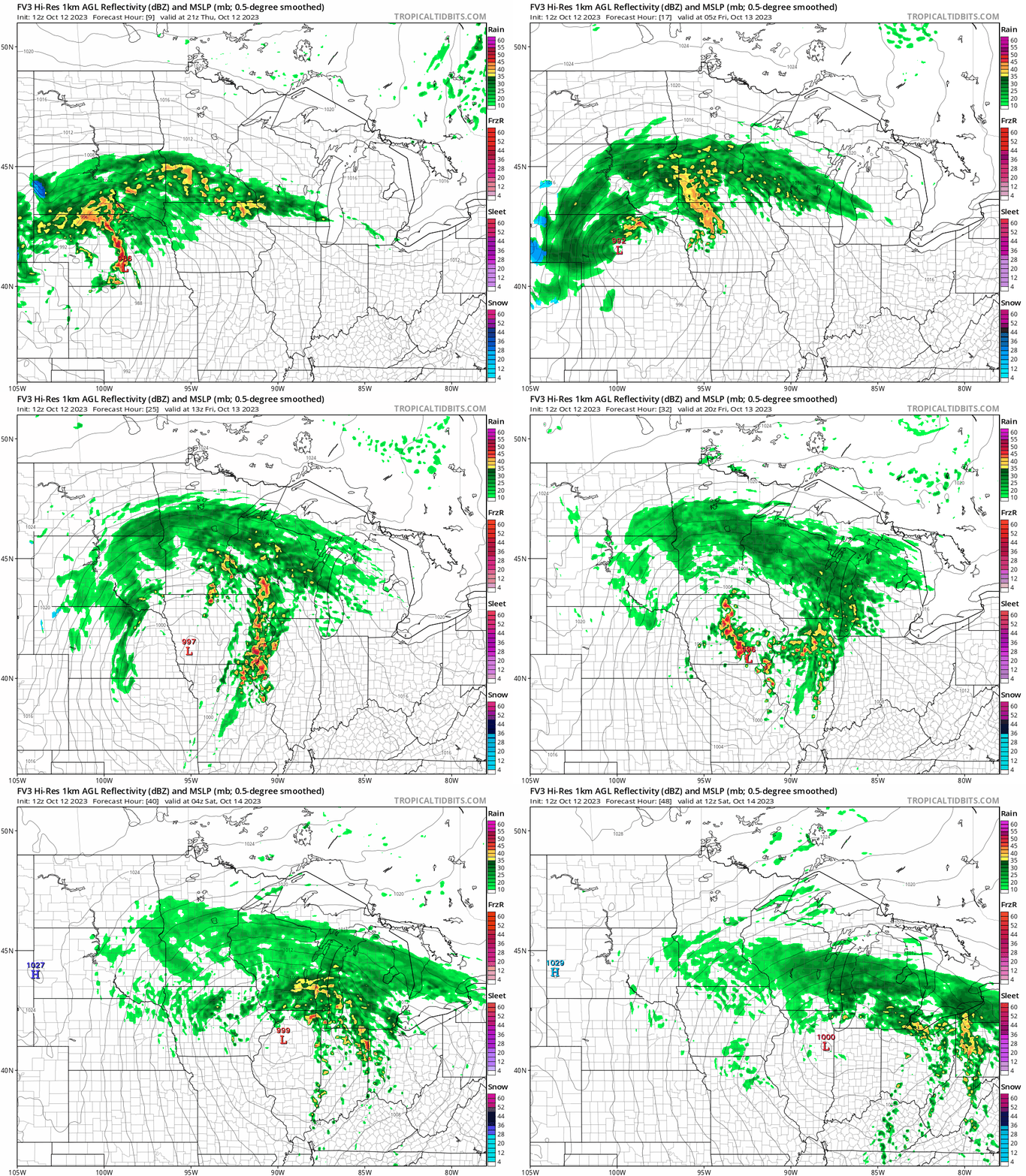
The weather maps continue to track a slowly moving soggy low-pressure system through Iowa Friday. That will pump waves of moderate to heavier rainfall across southern Minnesota. The heaviest rains will fall overnight into Friday midday.
I like the looks of the National Oceanic and Atmospheric Administration’s FV3 model and the way it handles embedded heavier rain cells within the overall rain shield. The forecast model loop below runs between 4 p.m. Thursday and 7 a.m. Saturday.
Multi-inch rainfall
The forecast models I trust the most continue to lay our widespread soaking multi-inch rainfall totals across central and southern Minnesota through Friday.
A widespread area of 1 to 3 inches looks almost certain. Locally some areas could see 3 to 4 inches. The best chance for 4 inches of rain favors southwest Minnesota.
Here’s NOAA’s Global Forecast System model rainfall output through Saturday:

Here’s the Canadian model:

And here’s the European Centre for Medium-Range Weather Forecasts model:

This magnitude and distribution of this rain should help knock back drought another category or so in much of the rain zone for next week’s drought monitor update.
Stay tuned. And stay dry.

