
Rain, thunder, cold, snow for parts of Minnesota this week
Seasonal transition accelerates in the next week

Go Deeper.
Create an account or log in to save stories.
Like this?
Thanks for liking this story! We have added it to a list of your favorite stories.


Get ready for some big weather changes in the next week. A wide variety of weather will visit different parts of Minnesota.
The seasonal transition from mild fall weather into the first stings of winter will accelerate in the next week. The weather maps seem to realize that November begins a week from Wednesday.
Mild fall weather first
Our weather pattern remains pleasantly mild through Tuesday for much of Minnesota. Highs Monday afternoon are soaring well into the 60s once again under sunnier skies and mild southerly breezes.
On the map below, note the late summerlike warmth of the air mass to the south with highs in the 70s and 80s in Nebraska and Iowa.
Turn Up Your Support
MPR News helps you turn down the noise and build shared understanding. Turn up your support for this public resource and keep trusted journalism accessible to all.

Tuesday brings another mild day to southern Minnesota, with cooler air to the north. Highs in the will feel toasty for Rochester and many towns in southeastern Minnesota.

Dew points will reach to 60s across southeast Minnesota on Tuesday, so it will feel humid in late October! This summerlike moisture will also provide the fuel for some bumpy thunderstorms and local downpours.

Rain and thunder Tuesday
An inbound weather system will bring scattered rain and some thunderstorms to parts of southern Minnesota including the greater Twin Cities area.
Most of the short-range mesoscale forecast models suggest two waves of thunderstorms. The first looks likely to pop overnight tonight into early Tuesday morning across southeast Minnesota.
The second wave likely develops later Tuesday afternoon into the evening hours, and that wave is more likely to drift far enough north to clip parts of the greater Twin Cities area.
The National Oceanic and Atmospheric Administration’s FV3 model seems to have a reasonable handle on precipitation timing and coverage through Tuesday. The forecast model loop below runs between 1 a.m. Tuesday and 1 a.m. Wednesday.
Marginal severe risk
Severe weather risk parameters are not overly impressive, but there is a marginal risk for severe cells in southeastern Minnesota. The marginal risk zone clips the Twin Cities area, but the best chance for large hail and high winds favors southeastern Minnesota Tuesday.

Soaking rainfall Thursday
Much of Minnesota may catch a break in precipitation Wednesday. But a more widespread rain event with possible snow in northwestern Minnesota arrives by Thursday.
Forecast models show two low-pressure systems tracking through the Upper Midwest later this week. The Environment Canada model shows widespread rain in southern Minnesota and some snow in northwestern Minnesota.
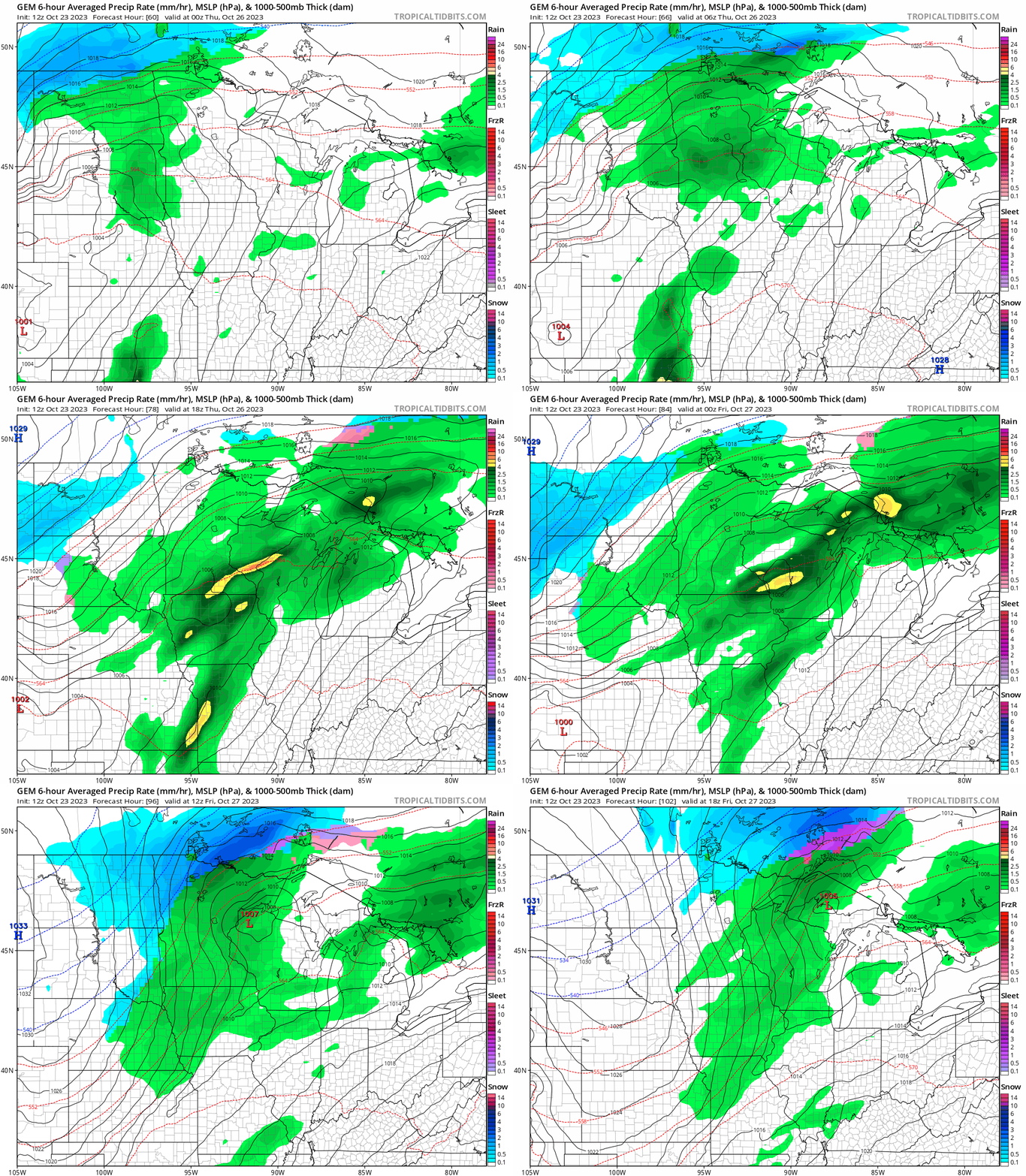
It should be noted that right now all forecast models favor all rain in the Twin Cities and southern Minnesota through the week. The best (only?) chance of accumulating snow is in northern Minnesota.
Soaking rains again
Rainfall this week across southern Minnesota will be significant. The European Centre for Medium-Range Weather Forecasts model cranks out another 1 to 3 inches of rain from the Twin Cities southward into Iowa this week.

A few flakes this weekend?
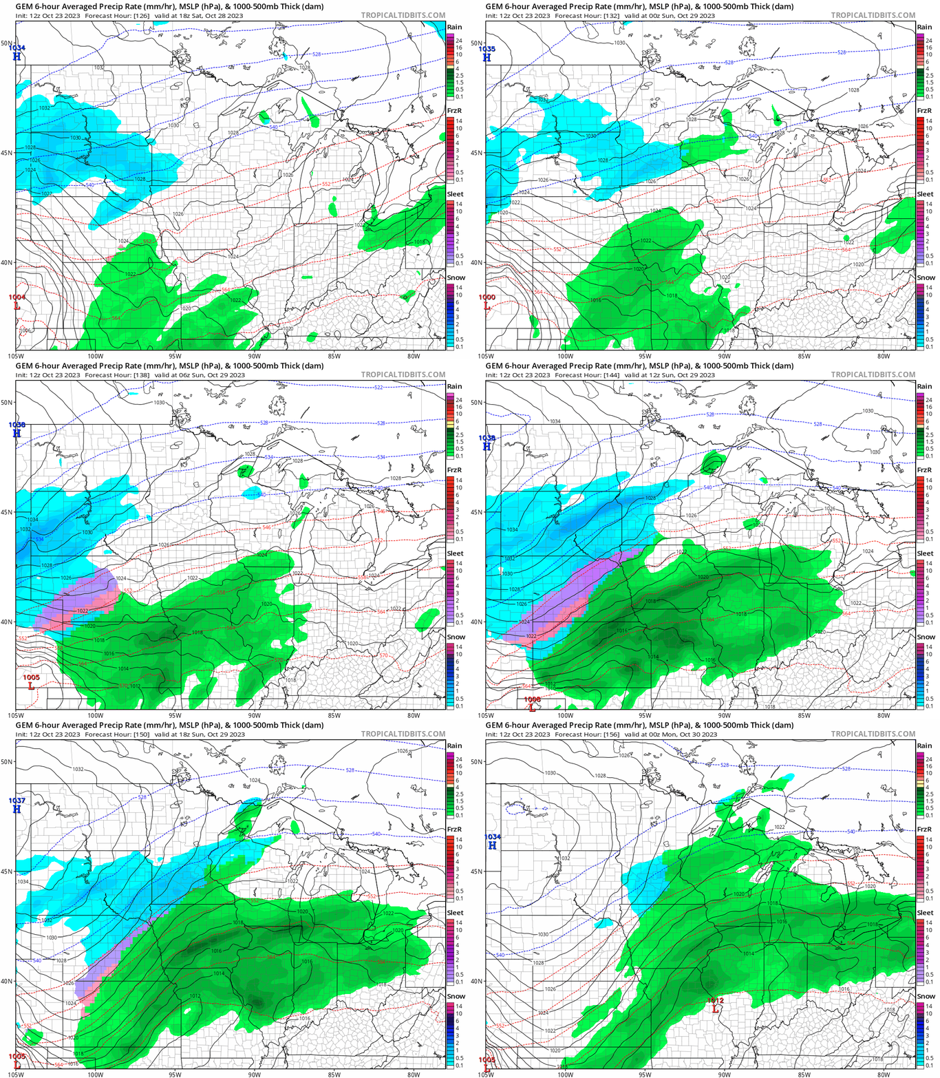
Right now forecast models still don’t suggest any significant snow accumulations for the Twin Cites and southern Minnesota, but a few models suggest a few flurries or snow showers are possible this upcoming weekend.
The Canadian model shows it could be cold enough for a few passing snow showers this weekend. The loop below runs between 1 p.m. Saturday and 7 p.m. Sunday.
Winterlike chill this weekend
The last weekend in October will be the first time it feels like winter is on the way. Highs this weekend will hover in the 30s across most of Minnesota. Overnight lows in the 20s will make for frosty mornings.

The early read on Halloween looks dry but cold. Highs will likely be in the 30s.
Did I mention November arrives next week?

