Late October severe storms drop large hail
Tennis ball-sized hail reported in Sleepy Eye in SW Minnesota
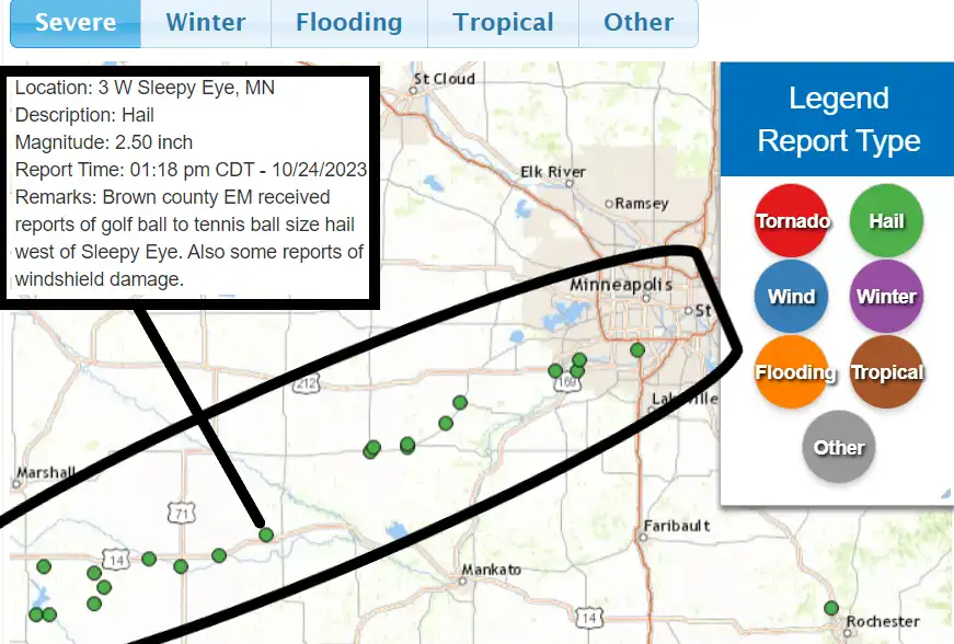
Our severe weather season in Minnesota continues to expand.
Tuesday’s storms produced severe hail in several locations across southern Minnesota, including parts of the southern Twin Cities.
You can see the hail track locations on the map at the top of this post. Here are some select hail reports from Tuesday afternoon.
More rain ahead
We catch a break from rain on Wednesday but the next system brings more rain Wednesday night and Thursday.
The National Oceanic and Atmospheric Administration’s Global Forecast System model shows the next system between 1 a.m. Thursday and 1 p.m. Friday. Note the snow zone in northwest Minnesota:
Snowfall accumulation is likely in northern Minnesota with this system. Models vary on totals. Here’s NOAA’s Global Forecast System model output:
Get ready for a shot of the coldest air so far this fall season this weekend with highs in the 30s.
Create a More Connected Minnesota
MPR News is your trusted resource for the news you need. With your support, MPR News brings accessible, courageous journalism and authentic conversation to everyone - free of paywalls and barriers. Your gift makes a difference.