
Weekend weather: Cold; snowflakes possible Saturday afternoon, evening
Fall color update for leaf-peepers
Go Deeper.
Create an account or log in to save stories.
Like this?
Thanks for liking this story! We have added it to a list of your favorite stories.


I’ll get to the weekend weather details after a quick recap of the snow situation in northwestern Minnesota.

Far northwestern Minnesota and parts of north-central Minnesota saw several inches of snow from Thursday afternoon into Friday morning:

Northwestern Minnesota snowfall reports received Friday morning included 5.6 inches in Karlstad in Kittson County; 5 inches in Warroad in Roseau County; and 3 inches in Crookston in Polk County.
The snow has ended in most of northwestern Minnesota, but the region could still see patchy snow showers there this afternoon, along with gusty winds. Minnesota road conditions can be found here.
Turn Up Your Support
MPR News helps you turn down the noise and build shared understanding. Turn up your support for this public resource and keep trusted journalism accessible to all.
Many locations in eastern North Dakota received more than 6 inches of snow from the storm.
Saturday snow chances
Forecast models show that periods of snow are likely Saturday afternoon and evening in far southern Minnesota. The Twin Cities metro area may ride the northern edge of the snow coverage Saturday afternoon and Saturday evening.
The National Oceanic and Atmospheric Administration’s North American Mesoscale forecast model shows the potential precipitation pattern from 11 a.m. Saturday to 11 p.m. Saturday:
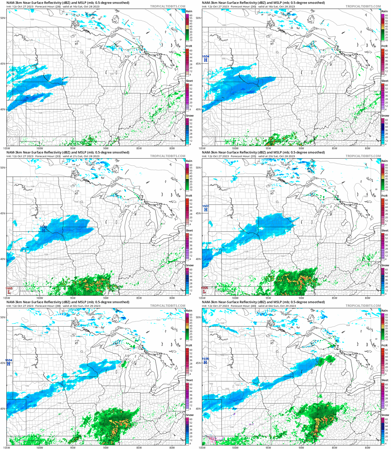
Portions of southwestern and south-central Minnesota could see between 1 and 2 inches of snow Saturday afternoon into Saturday evening, with less than 1 inch in southeastern Minnesota.
A light coating of snow is possible in portions of the Twin Cities metro area Saturday afternoon and evening.
You can hear updated weather information for Minnesota and western Wisconsin on the MPR News network. Also check out the MPR News display of National Weather Service radar.
Cold weekend
Low temperatures Saturday morning will be mainly in the 20s:

Northwestern Minnesota will dip into the teens.
Saturday highs will be in the 30s in most areas, with 20s in far northwestern Minnesota:

For perspective, the average Twin Cities high temperature is 52 degrees on Oct. 28.
Sunday high temps will be mainly in the 30s in southern and central Minnesota, with mainly 20s to the north:

Fall colors

Most of Minnesota is past peak for fall colors, but there are still pockets of good to excellent fall color. The Minnesota Department of Natural Resources fall color report for Minnesota State Parks and Trails looks like this:

Today’s gusty winds will probably take down bunches of brightly colored leaves, but there will still be brilliant fall hues on some trees.
The Wisconsin fall color report can be found here.
Programming note
You can hear my live weather updates on MPR News at 7:35 a.m., 9:35 a.m. and 4:39 p.m. each Saturday and Sunday.

