
No big snow in sight, yet; 50s and 60s Sunday in southern Minnesota
More 50s ahead in mid-November?
Go Deeper.
Create an account or log in to save stories.
Like this?
Thanks for liking this story! We have added it to a list of your favorite stories.


This is the time of year when we’re watching the weather maps for the proverbial other shoe.
Upper atmospheric wave patterns can turn on a dime in November at this latitude. When they do, the forecast can go from reasonably mild, to wild in a hurry.
But for now, the weather maps look fairly benign for the next 1-2 weeks. For now.
Tranquil through Saturday
Overall, our weather pattern looks quiet and seasonably cool for Saturday. Expect a mix of sun and clouds for southern Minnesota, with more clouds to the north. High temperatures Saturday will range from the 30s north to the 50s in southwestern Minnesota.
Turn Up Your Support
MPR News helps you turn down the noise and build shared understanding. Turn up your support for this public resource and keep trusted journalism accessible to all.

Sunday rain or snow north
A low-pressure system will streak across northern Minnesota Sunday. That will bring rain and possibly some snow. Most of the snow will remain north of the Canadian border with this system.
The National Oceanic and Atmospheric Administration’s NAM 3 km model shows the precipitation shield spreading across the northern part of Minnesota Sunday. The forecast model loop below runs between 1 p.m. Saturday and 1 a.m. Monday.
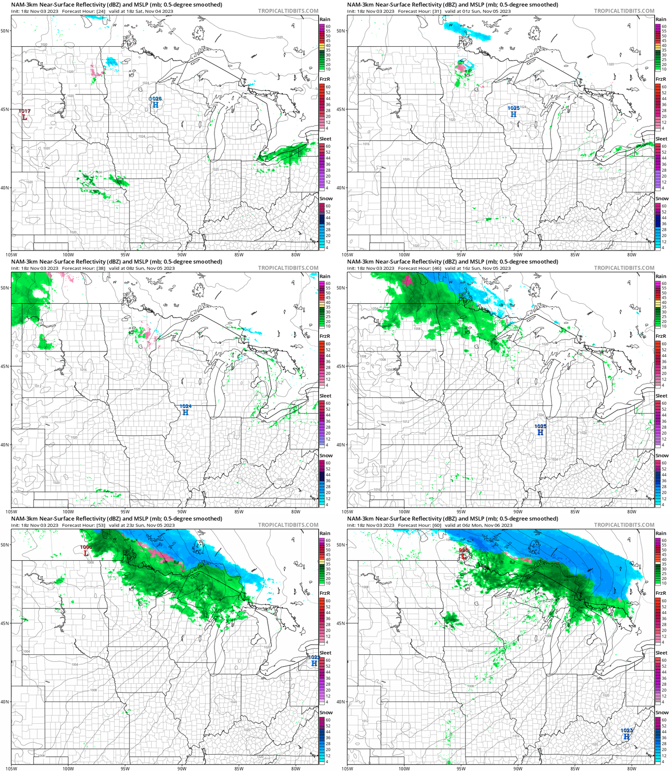
Milder air will be drawn up into southern Minnesota as the system zips through northern Minnesota on Sunday. Highs will reach the 60s in southwestern Minnesota on Sunday afternoon.

We might even see 60 degrees waft into the southwest Twin Cities on Sunday.

Seasonable temperatures next week
Highs next week will run mostly in the 40s to low 50s in southern Minnesota, including the Twin Cities area. The average high for the Twin Cities by next Wednesday is 46 degrees.
Bonus summer the week of Nov. 13?
The medium-range forecast models suggest a milder Pacific flow pattern across the northern U.S. for the week of Nov. 13.

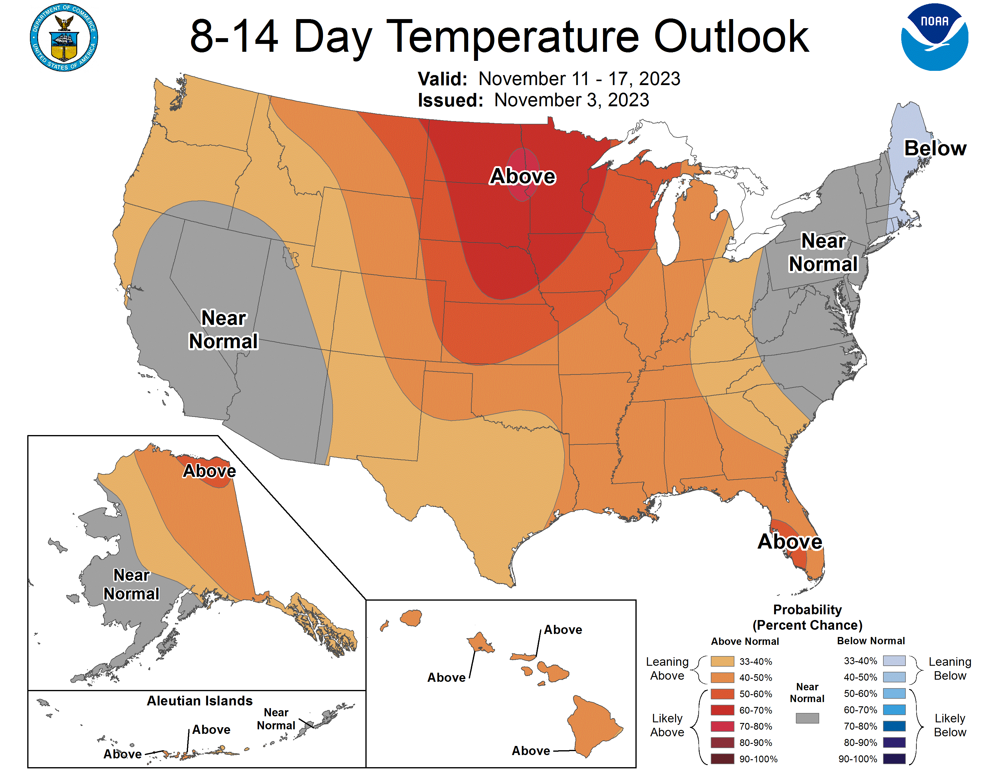
It’s still early, but NOAA’s outlooks strongly favor milder-than-average temperatures in the eight to 14-day range.
That should translate into more days with highs in the 50s, and maybe even one more shot at 60 degrees for southern Minnesota and the Twin Cities.
Stay tuned.

