
Winter weather advisory for northeast Minnesota
Light to moderate snowfall Tuesday into Wednesday up north

Go Deeper.
Create an account or log in to save stories.
Like this?
Thanks for liking this story! We have added it to a list of your favorite stories.


Minnesota’s next weather system will produce snowfall across northeastern Minnesota. The bulk of the system arrives on Tuesday and Wednesday.
The National Oceanic and Atmospheric Administration’s High-Resolution Rapid Refresh model shows the snow zone developing Tuesday afternoon and spreading across northeastern Minnesota Tuesday night into Wednesday.
The forecast model loop below runs between 4 p.m. Tuesday and 7 a.m. Wednesday.
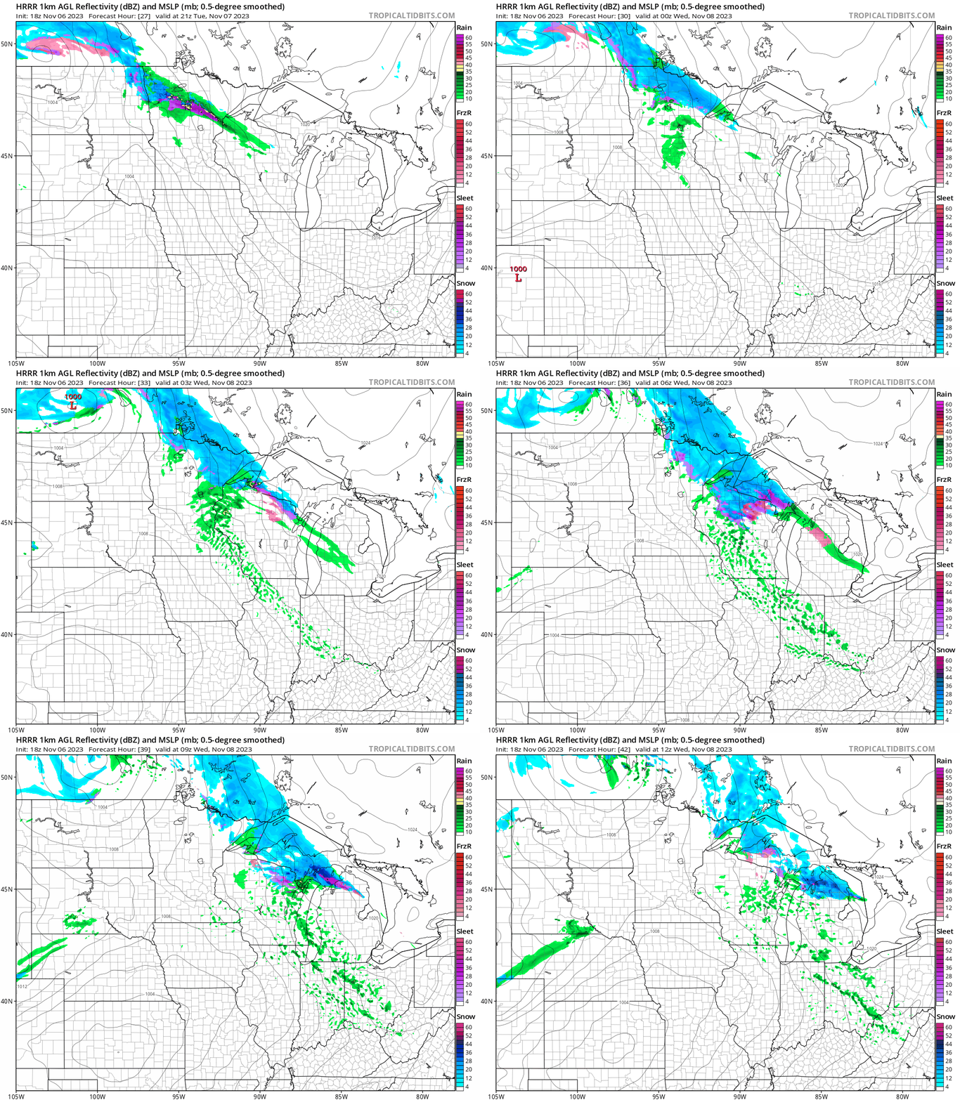
Snowfall will be heaviest along the higher elevations above the North Shore. A winter weather advisory has been issued for the area.
Southern Lake-Southern Cook-
Including the cities of Two Harbors, Silver Bay, and Grand Marais
217 PM CST Mon Nov 6 2023
...WINTER WEATHER ADVISORY IN EFFECT FROM 3 PM TUESDAY TO 9 AM
CST WEDNESDAY...
* WHAT...Snow expected. Total snow accumulations of 3 to 5 inches
in the higher elevations near the North Shore.
* WHERE...Southern Lake and Southern Cook Counties. This
includes the Tribal Lands of the Grand Portage Reservation.
* WHEN...From 3 PM Tuesday to 9 AM CST Wednesday.
* IMPACTS...Plan on slippery road conditions. The hazardous
conditions could impact the morning or evening commute.
* ADDITIONAL DETAILS...Areas immediately near Lake Superior will
see periods of rain mixing in with snow. Expect lesser snow
accumulations near Lake Superior of 3 inches or less.
Temperatures will be near freezing, so expect anything from wet roads to slushy and icy spots into Wednesday.
Turn Up Your Support
MPR News helps you turn down the noise and build shared understanding. Turn up your support for this public resource and keep trusted journalism accessible to all.

