
Balmy air mass returns next week: More 50s and 60s ahead?
Temps likely 10-20 degrees above average next week
Go Deeper.
Create an account or log in to save stories.
Like this?
Thanks for liking this story! We have added it to a list of your favorite stories.


The weather maps are pushing another warm front across Minnesota next week, and this one looks like it could stick around for days.
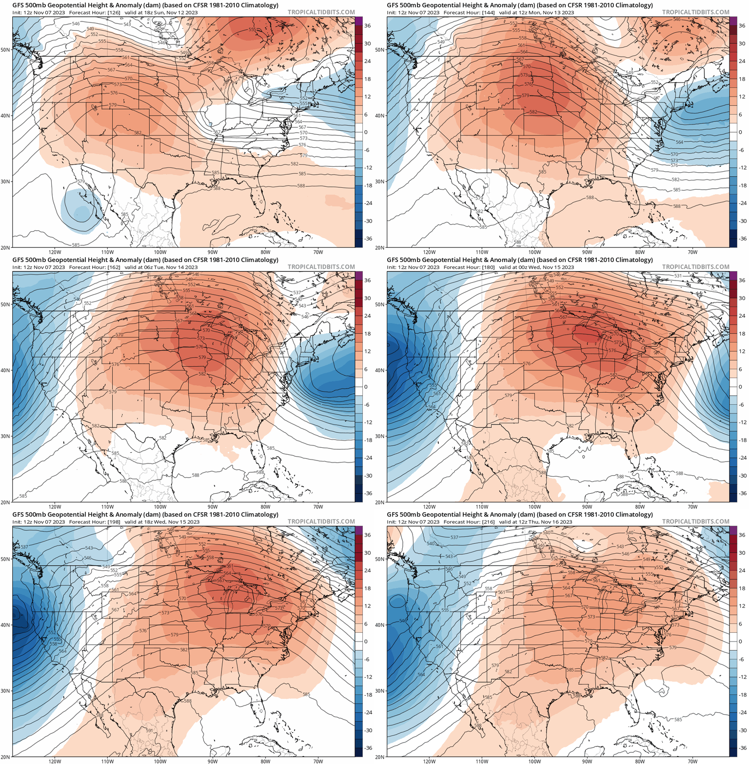
The upper-air pattern across North America next week strongly favors an unseasonably mild air dome building across the central United States.
Check out the upper-air forecast loop at the top of this post. See the warm tones amplifying across the central U.S. with Minnesota near the warmest colors? That means some of the warmest air relative to average will drift across Minnesota next week.
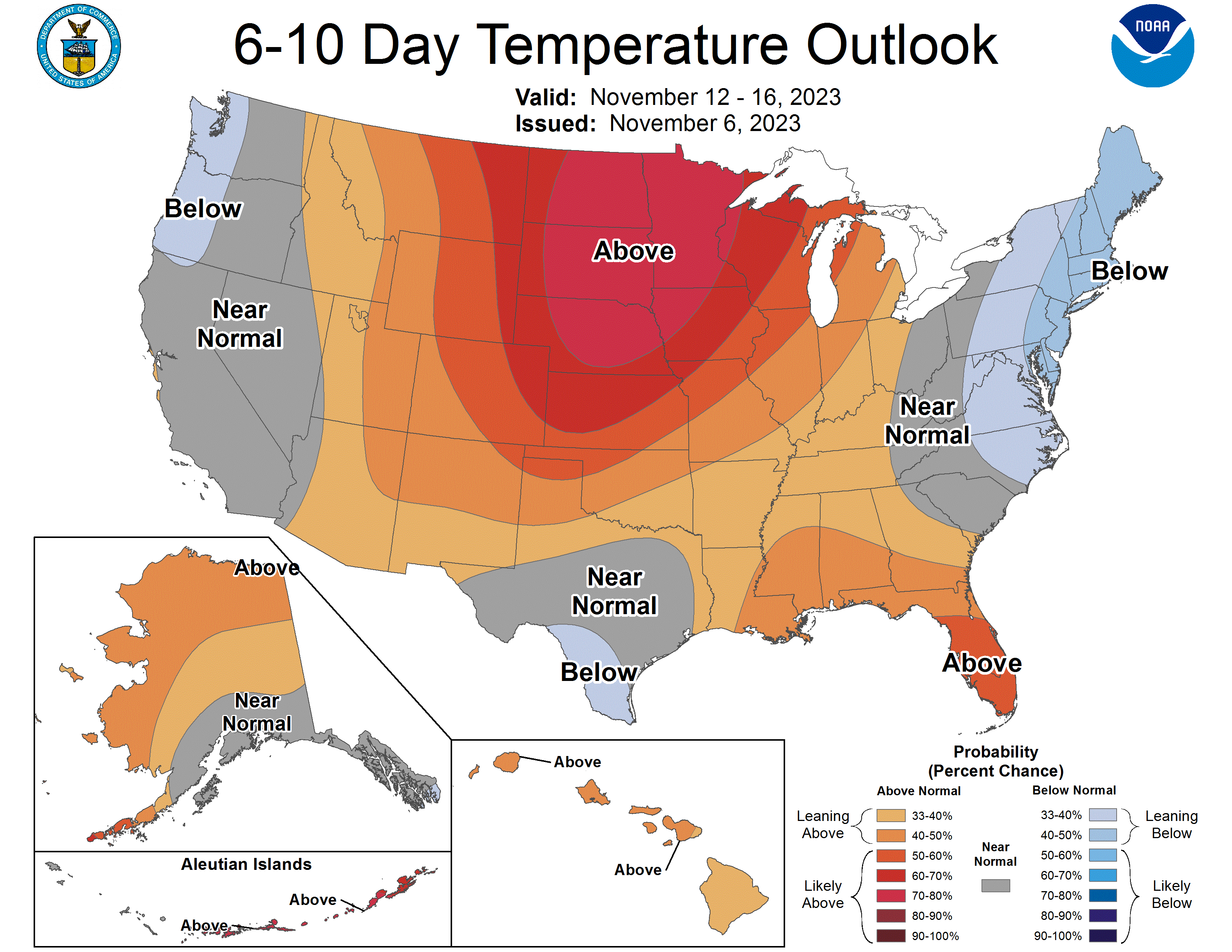
The National Oceanic and Atmospheric Administration’s six to 10-day temperature outlook still stamps the highest probability of warmer-than-average air next week right over Minnesota and the Upper Midwest.
Turn Up Your Support
MPR News helps you turn down the noise and build shared understanding. Turn up your support for this public resource and keep trusted journalism accessible to all.
Forecast models are cranking out highs well into the 50s as early as Monday of next week across southern Minnesota.

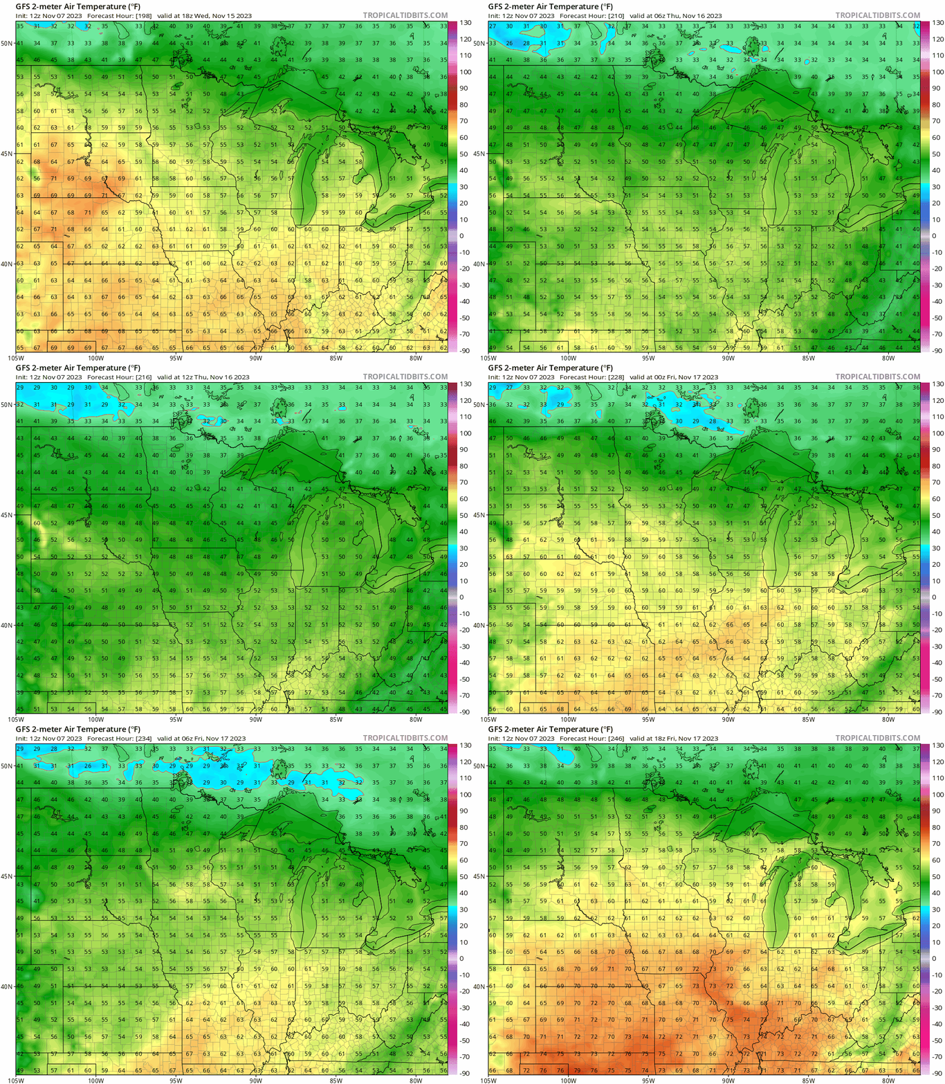
NOAA’s Global Forecast System model suggests the warm air will build in intensity as the week evolves. It pushes highs well into the 50s all the way into northern Minnesota and cranks out temperatures in the 60s for the Twin Cities and southern Minnesota by late next week.
Also, note the forecast overnight lows are in the 40s. That’s above the average high temperatures for late next week.
The average high and low temperatures for next Wednesday in the Twin Cities are 42 and 28. So it looks like temperatures next week will run between 10 and 20 degrees warmer than average.
Record highs next week in the Twin Cities run between 68 and 71 degrees. So we may not break any records next week but this will be a pretty remarkable warm spell for mid-November.
Winter appears to be in no hurry to get established in November this year.
Stay tuned.

